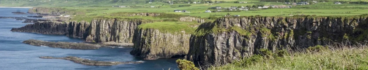

Why visit Tongariro, Taumarunui, and Waitomo?
Is it worth visiting Tongariro, Taumarunui, and Waitomo regions? Tongariro is worthwhile but you need to do a hiking track to see the most spectacular views of turquoise lakes and volcanoes. Taumarunui is Quintessential New Zealand with white sheep on rolling green hills. Seeing glowworms shining like stars in the dark is awe inspiring. We liked Waitomo Caves decades ago before over-tourism struck.
Read on to find out how to make the most of your time —decide which places should you visit, see which photos fascinate you, as well as get links to our custom Google maps and itinerary planning information.
Author & Photographer: George Mitchell
Our recommendations are not influenced by affiliate links – we have none. Our itineraries, photos, and advice are based on having stayed in New Zealand for a total of six months over three trips. We are avid hikers, nature lovers and photographers. NZ is one of our favourite destinations.
Where to Stay

For Waitomo you can day trip from Rotorua or else look for a farm stay in that area. For Tongariro, you stay in huts if you are trekking, Whakapapa village inside the park, or a farm stay in the Taumarunui region.
Waitomo

We stayed with Jean and Brian at the Pitts-Brown Farm in the Waitomo area. They were hosts for SERVAS, an organization founded in 1948 by Displaced Persons having no country as a result of World War II. They wanted to end war and prejudice by getting travellers to meet people of other cultures and countries. SERVAS allows vetted members to stay at a host for free for two nights, longer if the hosts invite you to stay. We served as hosts when we lived in Rome for four years.
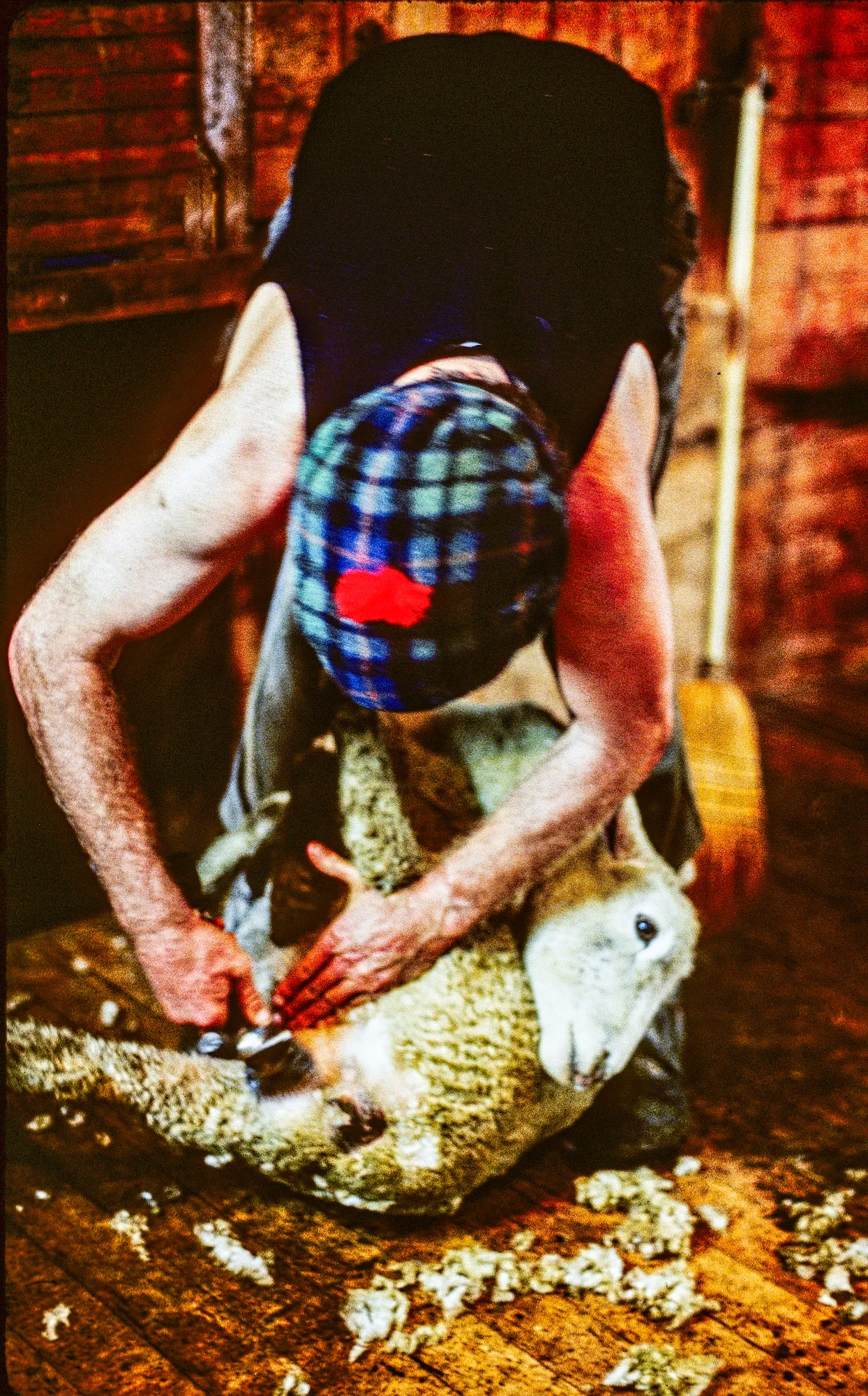
After breakfast, Jean left for her Waitomo Caves school job. Brian walked to the shearing shed to dag sheep — shearing their clotty rumps before bring them to market. Contrary to popular opinion, sheep are not stupid. They detest dagging and all of them stayed as far away on the other side of the barn. Brian decided I should be initiated by shearing two sheep. Trust me, it is not easy. Sheep are quite heavy. You have to lift them by the the neck and put them on their back. Then you have to hold their neck with your feet while you shear their body. The sheep knew I was a newbie and fought to get free. Here Brian showed how easily it is using old technology sheers!

After lunch Brian took us for a drive on the Marakopa and Hauturu Roads with views of limestone outcroppings and lush pastures. Later, we took 4 year-old Allen up the hill to feed the horses some bread. Allen was a very talkative and excitable kid who got over his fear of a huge horse towering over him.
Waitomo Caves
There are many tour options to choose from.
| Tour | Fee | Length |
|---|---|---|
| Glowworm Caves | NZD 75 | 45 minutes |
| Ruakuri Cave | NZD 107 | 1.5 hrs |
| Glowworm & Ruakuri Caves | NZD 158 | 2.5 hrs |
| Ruakuri & Aranui Caves | NZD 158 | 2.5 hrs |
| Glowworm & Aranui Caves | NZD 116 | 2 hrs |
Waitomo Caves Getting There
From Rotorua, you need to head north on Highway 5 then west on Highway 28 to Putāruru and Otorohanga. Then take Highway 3 south to Highway 37 and Waitomo.
Ruakuri Cave
Jean drove us to the Waitomo Caves. We were surprised by the height and width of the Ruakuri Caves. The most interesting formations was the Bridal Chamber. The 40 minute Ruakuri Tour was spoiled by a bored guide. We considered the tour was overpriced way back then.

Aranui Cave
The 40 minute tour of the smaller Aranui Cave was most enjoyable. At the narrow slit entrance we saw the ugly ones, huge but harmless six inch long insects called wetas. Weta (Māori name) is a giant flightless cricket and one of the heaviest insects in the world.

The brownish reds are caused by iron oxide. The straw tubes take 20 to 30 years to grow one inch! We passed the Two Apostles (columns) into the Temple of Peace with two doves above the doorway.
We walked through stalactite-encrusted corridors. Stalactites hang from the ceilings of caves. The most common type of stalactite occurs in limestone caves. Limestone is made from millions of years of compressed sea shells (calcium carbonate). Limestone rock is dissolvable by water! Water drips through the cave ceiling and calcium carbonate precipitates from the mineralized water solution to form rock icicles.

A stalagmite is an upward-growing mound of mineral deposits that have precipitated from water dripping onto the floor and ledges of a cave. One great formation looks like two Maori women, one holding a shawl.
Tiny terraces of water reflect the crystal columns. The largest (18 foot) stalactite hangs from the ceiling. Snow White and the six dwarves appear. The seventh dwarf is a spitting image of Grumpy with a big nose and pot belly. An alabaster column is pure white. Finally there was the delicately lit eastern scene of Rebecca at the well. It is the play of light and shadow that makes the caves special.
Glowworm Cave
The glowworms are in another cave. We passed a red-lit “tomo” or vertical shaft that appeared bottomless. Waitomo is Maori for stream which flows into the hole in the ground.
Every cave has a cathedral, or highest vault. But this one looked like a nave due to the lighting. A stage is placed here at Christmas due to the great acoustics. We hopped into a boat, which was pulled by overhead wires. We didn’t go far but kept going around and around.
The Arachnocampa Luminosa (glowworm) twinkled like stars on a clear night. It was so awe inspiring that everyone was utterly quiet. Actually the glowworms are segmented transparent larvae. The tail provides a reflector of opaque tissue in which four paired organs glow with a green-blue light. This is a by-product of luciferin reacting with oxygen in the presence of luciferase, an enzyme from digesting its prey! Only 1% of the energy is released as heat, the rest as light!
The glowworms use light to attract flying insects: midges are the main food source. Glowworms are found in cave ceilings and stream banks in a hammock of mucus and silk. From this hammock are suspended fine, strong silk threads called fishing lines covered with droplets of mucus. Oxalic acid paralyzes the insect. The glow worm sucks the fishing line up to eat the insects.
In 6 to 8 weeks they develop into pupa. The fungus gnat is rarely seen as it has a very short lifespan. It has no mouth and only exists to propagate. The lights of female pupae attract the males. The fly lays 120 eggs in groups of 20. The first grub that hatches eats the other 19 as its first meal!
Taumarunui

It’s worthwhile to stay on a farm to appreciate how big a business each one entails. We stayed on a farm in the Taumarunui area with Marion and Dave. Normally, SERVAS hosts do not spend their days with their guests. But in NZ, so many times we were included in their family outings and drove us to the places we wanted to see. Note: we were backpacking on our first trip to NZ.

We went to the top of this hilly 580 acre farm with 3000 sheep — lambs (six month olds) and hoggets (one year olds). The land is divided by fences and each day the sheep are shifted (moved) with the help of sheep dogs. There were spectacular views of volcanoes and mountainous King Country.
Lake Taupo

After breakfast, Dave took us to Tokeanu to see a small thermal area. Then he brought us to the Te Ponanga Saddle Viewpoint (G4.6) along Highway 41.
While not hidden, Te Ponanga is a great viewpoint you could easily drive by. It is 68 km (one hour) south of Huka Falls at the beginning of Highway 47, the road to Tongariro NP.
You may not be so impressed with the view until you learn the significance of what you are seeing. Lake Taupo has an area of 616 km² (238 sq mi). This is larger than Phoenix AZ or San Antonio TX and a bit smaller than Edmonton AB.
While Taupo looks like a lake, it is hard to believe this is the flooded caldera of a massive supervolcano. That means it had an eruption with a Volcanic Explosivity Index (VEI) of 8. You would not have wanted to been here ca. 26,500 years ago when it spewed out over 1000 cubic kilometers (240 cubic miles) of debris. This is the world’s most recent VEI-8 eruption.
Tongariro National Park
Tongariro Background

The 1980 commemorative stamp issue featured Maori leaders who made a difference. Te Heu Heu Tukino IV was a paramount chief of central North Island. Before his death, he bequeathed three mountain peaks — Tongariro, Ngauruhoe and Ruapehu — to NZ in 1887. This is very significant because these volcanoes became Tongariro National Park.
However, Ngauruhoe and Ruapehu are not separate mountains – they are all part of the Tongariro volcano complex. Ngauruhoe (see below) was used as Mt. Doom in the Lord of the Rings movie (2001).
These are not extinct volcanoes. They are very active. Some of the major eruptions took place in 1869, 1892, 1896, 1897 and 1926. The most recent eruption was in 2012. It damaged Ketetahi Hut and forced the redesign of the Tongariro Alpine Crossing Track.
Tongariro Getting There
From Rotorua you need to drive south on Highway 5 to Huka Falls and Taupo. Then turn northwest on Highway 41 and left (west) onto Highway 47 to your first stop Te Ponanga Saddle Viewpoint (G4.5). From Huka Falls that is 92 km 1:15h.
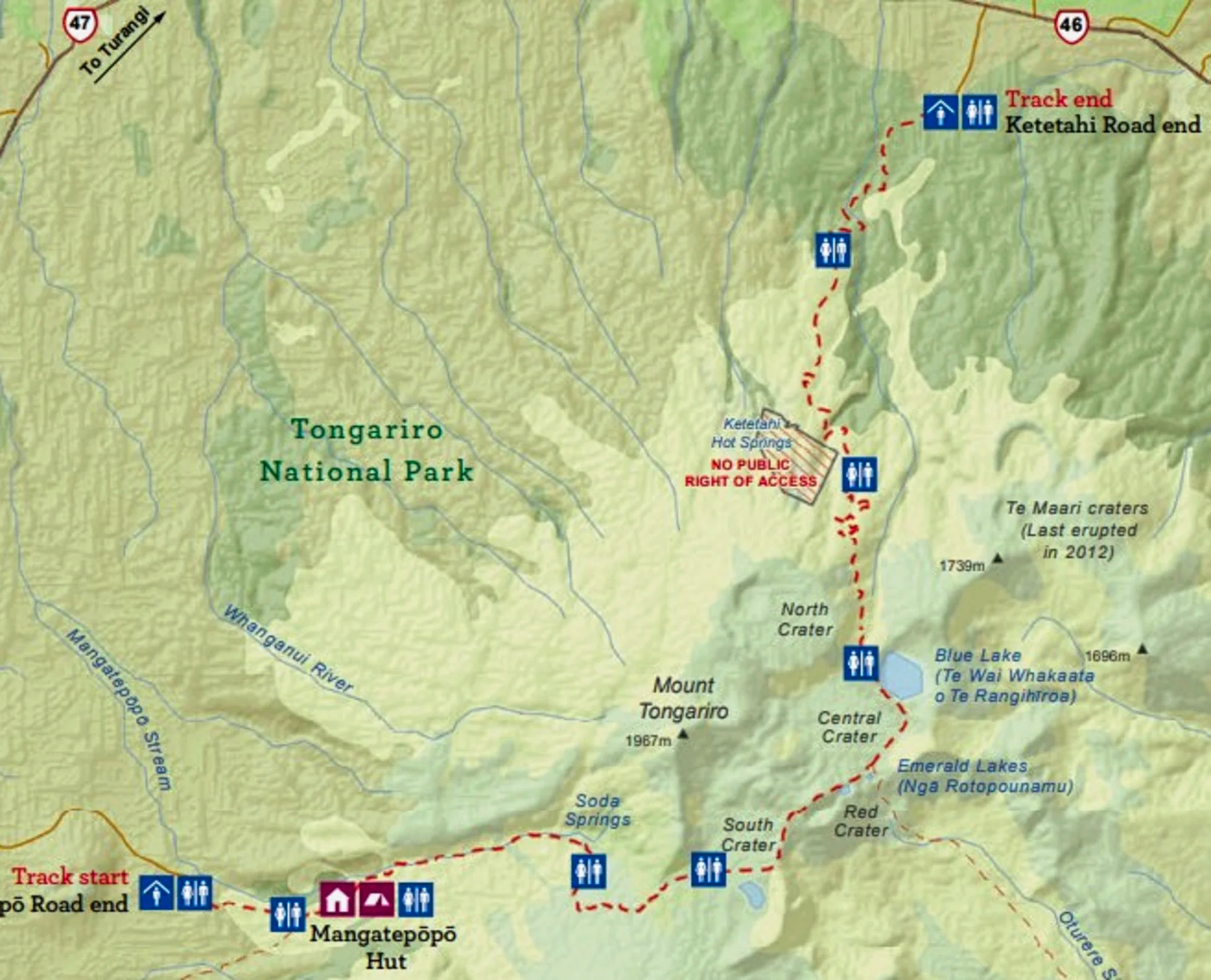
Tongariro Alpine Crossing Track
Elevation: 1,868 m (6,127 ft)
Hut Fees: Oct-Apr NZD 56, May-Oct: NZD 25
Reservations: Required but no fee
This is a challenging Elevation Gain of 748 m (2,454 ft) in 8 km. A high level of fitness is required.
Views from the Start

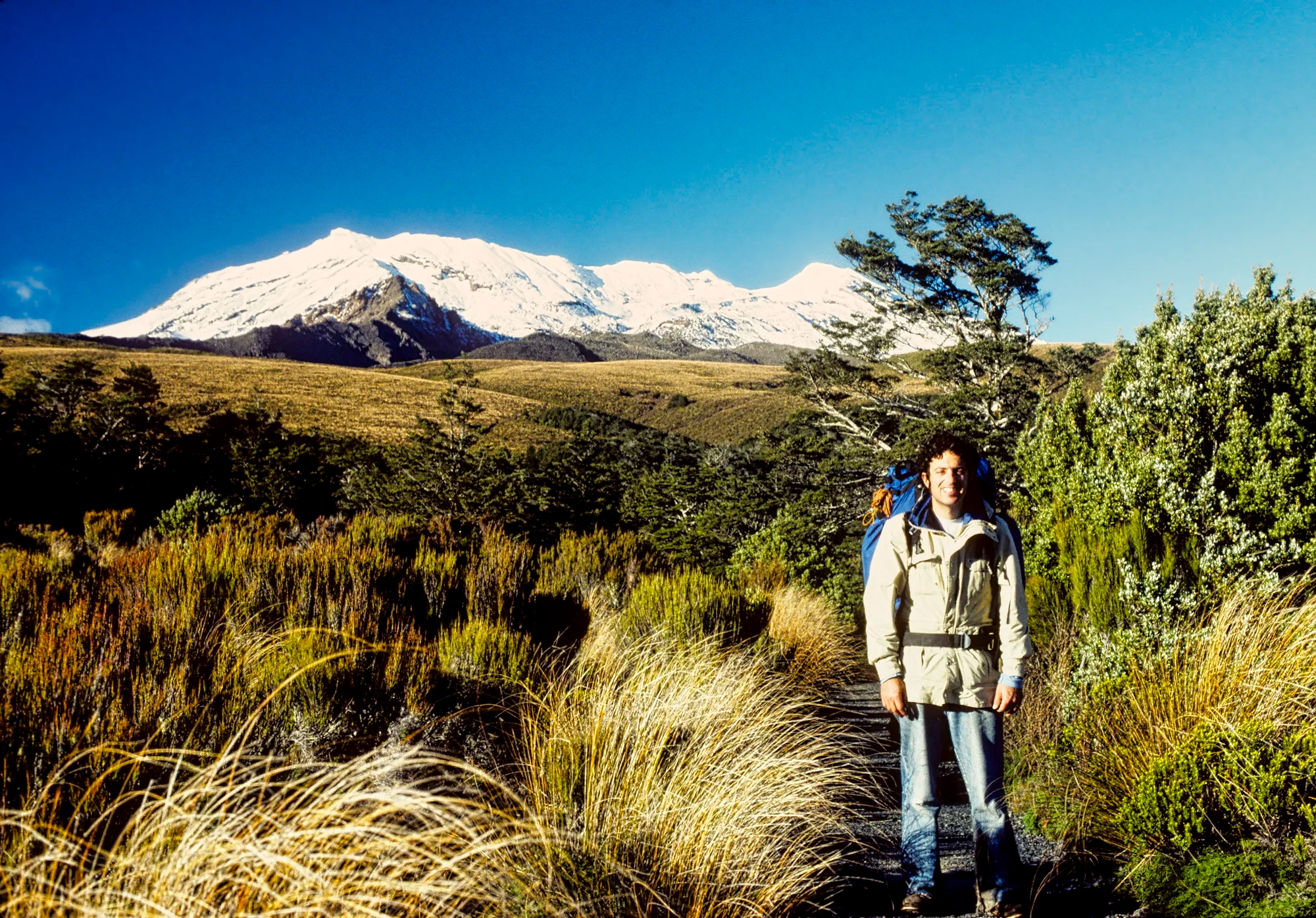
We have been twice to Tongariro. On our third trip to NZ, we did the one-day Mangatepopo Hut to Red Crater hike in the summer with gazillions of not well equipped hikers. Do not go on this hike unless you have proper hiking boots or shoes.
This post mainly describes our first trip to NZ when we did the original Tongariro Alpine Crossing Track as a three-day hut-to-hut trek in April. There was no one else there!
Ketetahi Hut
Elevation: 1,040 m (3,412 ft)
Elev Gain: 280 m (919 ft)
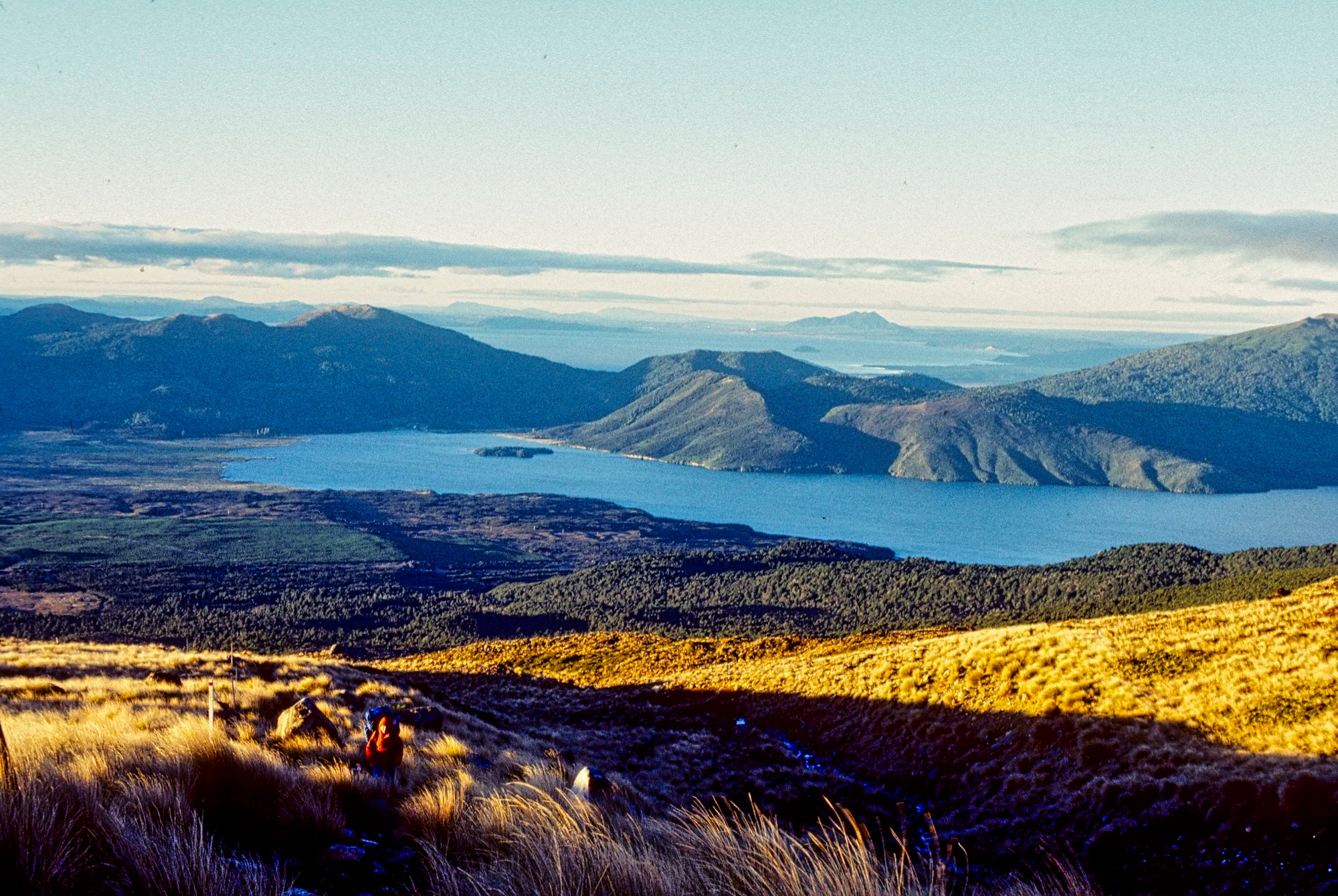
From the highway, the trail was steep and enclosed for the first hour until we reached two plateaus with wide open views of Lake Rotoaira and Taupo. The extensive vista was awesome with the lakes painted violet.

The track opens in tussock and levels out.
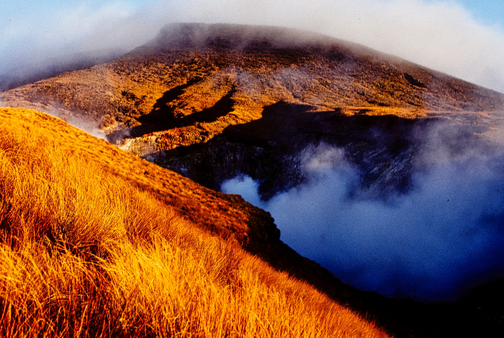
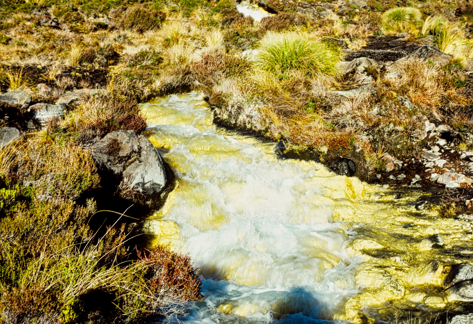
The Ketetahi Springs were steaming ahead. Sulphurous fumes permeated the air. It was dusk so it was too late to explore the area, which is now off limits to hikers. No I did not saturate the reds in these pictures. Our diary stated that the hills were glowing red under the setting sun.

There were only two Kiwis from the Air Force at the hut. The usually well-equipped huts had turned off the gas. We made them supper because we had our portable butane stove. They turned back the next day. We were all alone on this trail for three days!

The next morning was freezing. The track was crunchy with frost. Finally we were having a stretch of clear, crisp weather. We climbed steep switchbacks. The views towards Taupo dominated until we headed into a narrow river valley. Ice crystals were wrapped around green plants. Suddenly Ngauruhoe pierces into view, steam rising from its cone.
Blue Lake

Elevation: 1,725 m (5,659 ft)
Elev Gain: 685 m (2,247 ft)
Two hours into the day came the breathtaking Blue Lake, which fills one of the many former craters.
Emerald Lakes

We descended slightly to three Emerald Lakes, probably the highlight of the track.

A half hour walk on the flat, dry central crater brought us to other turquoise lakes.
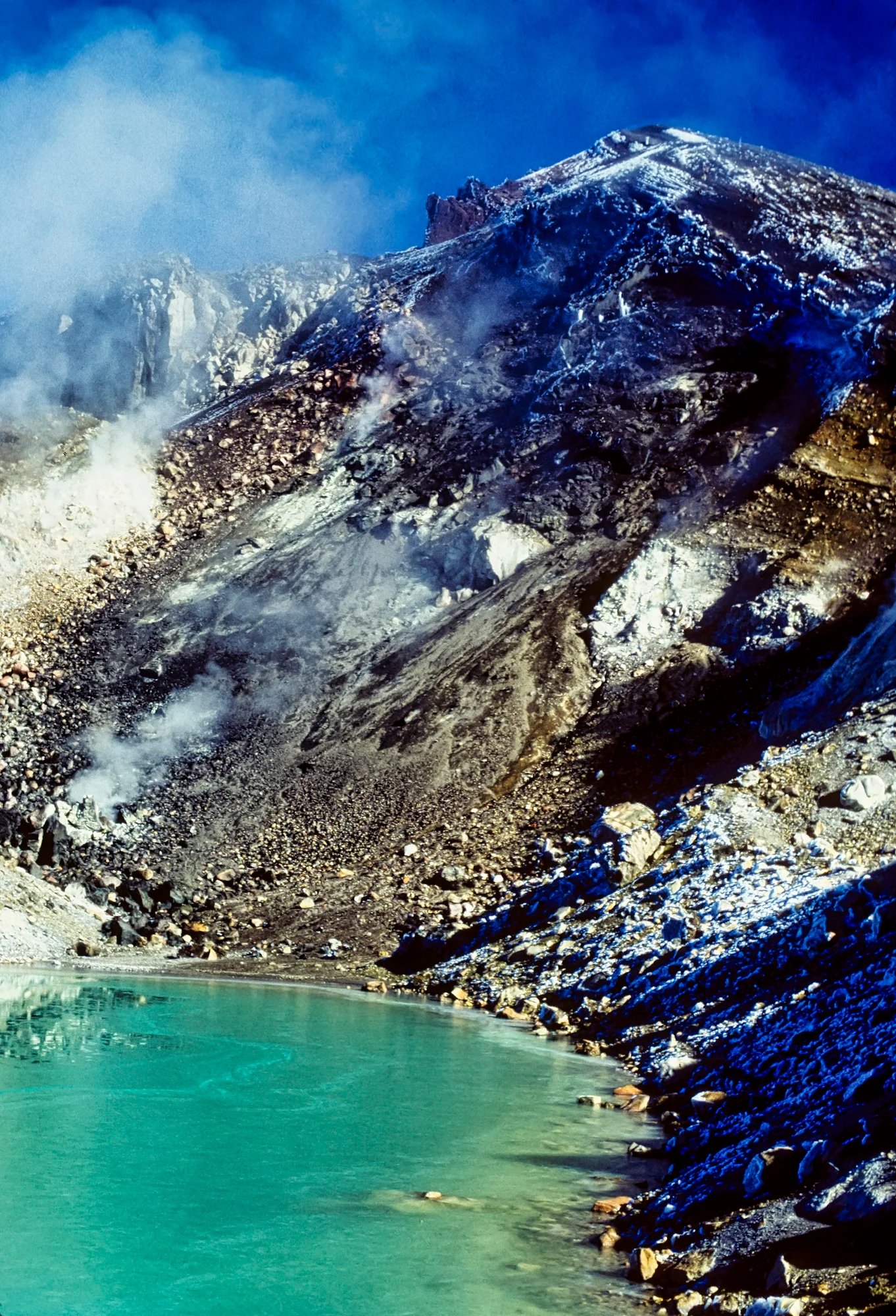
Three states of H2O – steam, snow and water – combine to make any scene photogenic.


From here the track trudges steeply up scoria (loose lava particles) for 47 mins. There were no switchbacks and lots of stops!

Blue and Emerald Craters were still visible from the top of the Red Crater rim. You can see the ribbon pf our trail in the distance.
Red Crater & Ngauruhoe

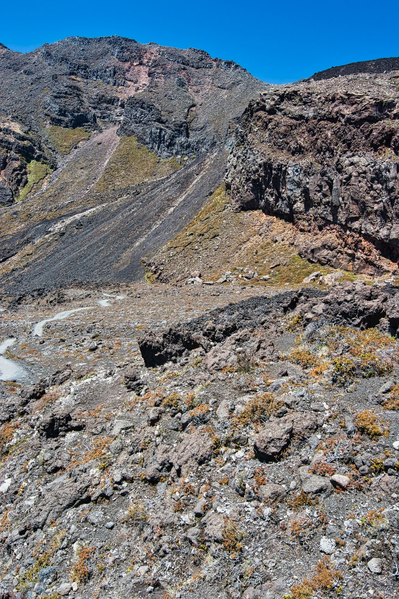
Ngauruhoe, only 2500 years old, dominates the scene. On our first trip, the track traversed the steep incline of the Red Crater. This was the first time we were inside a volcano. This was perilously slippery due to the scoria. If you fell you would roll a long way down! Breathe! The trail now goes on a wide track on the top of the rim.
Red Crater

Elevation: 1,868 m (6,127 ft)
Elev Gain: 143 m (469 ft)
From the top were views of the chasm of Red Crater with its cinder cone partly intact contrasting with the red cliffs.

We ate lunch on the rim of the Red Crater.

This is a wide angle view of the volcanic landscape.

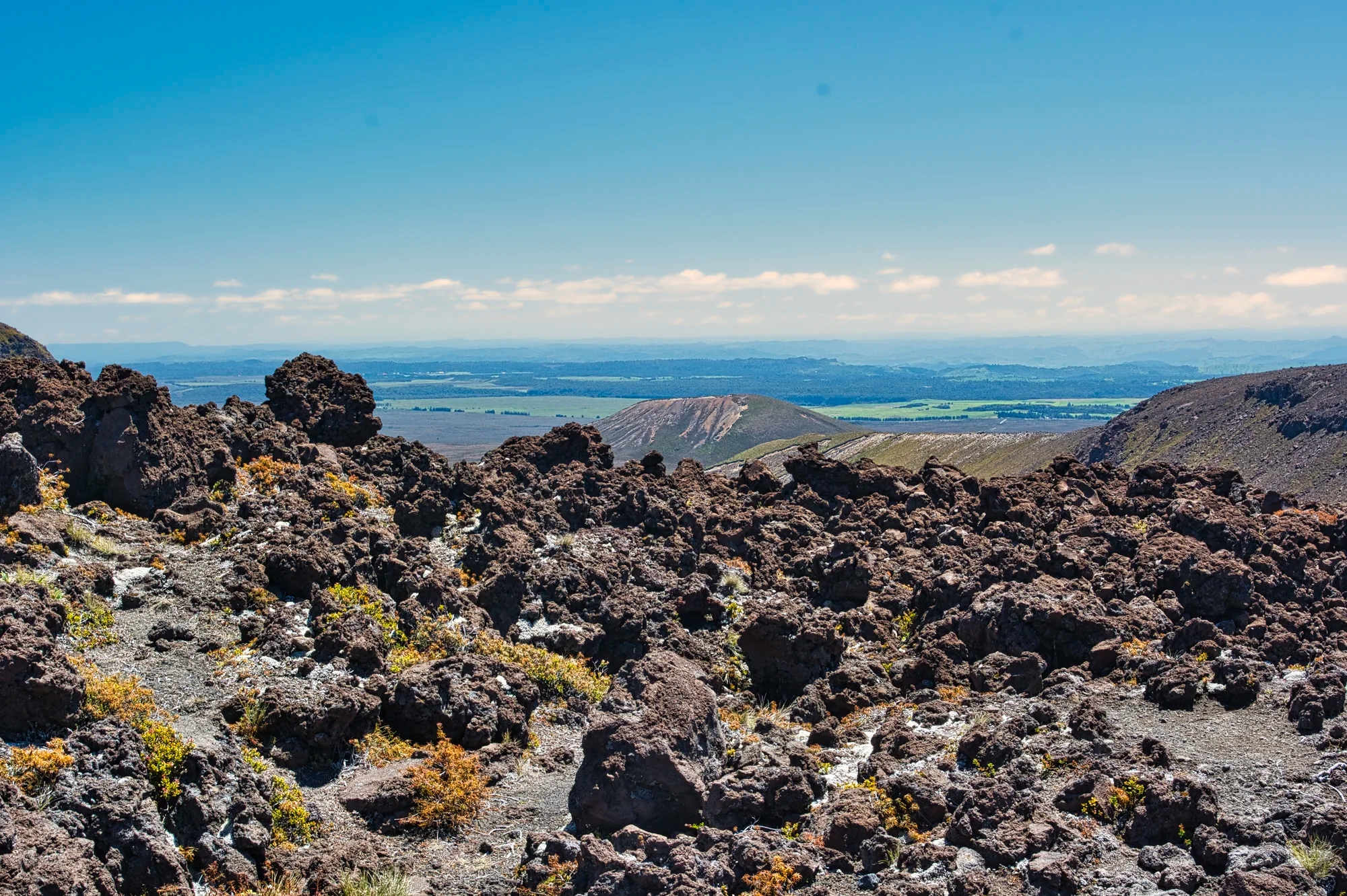
The Rangipo Desert area east of the volcano is not a true desert but it is in the rain shadow of the volcanoes.
Why are there so many volcanoes?

Thanks to a perfectly clear day, we saw Mt. Taranaki (Egmont), about 254 km (158 mi) away!
Why are there so many volcanoes in NZ? Some of the well known volcanoes are Tongariro, Ruapehu, Ngauruhoe, Rangitoto, Taranaki, Tarawera, and the Banks Peninsula.
NZ is on the Pacific Ring of Fire where the Indo-Australian Plate is smashing over (subducting) the Pacific Plate. At this plate juncture, magma rises and volcanoes are formed. Earthquakes are another feature of NZ. The last horrific one registered 6.3 in Christchurch 2011.
South Crater

The best part of the walk was over. The next section is dangerous for all the tourists wearing shoddy footwear like sandals. Tiny balls of scoria act like ball bearings ready to throw you over the edge of the steep descent. There were a few hand rails to help your balance.

The South Crater is a flat caldera with the only easy walking of the track.
If you are heading the other direction, this is where the first steep ascent begins to the South Crater (33 mins).
Soda Spring
Elevation: 1,400 m (4,593 ft)
Elev Loss: 468 m (1,535 ft)
Then we edged over pumice strewn track to Soda Springs (52 mins).

Mangatepopo Hut
Elevation: 1,120 m (3,674 ft)
Elev Loss: 280 m (919 ft)

The going was fairly flat and easy to Mangatepopo Hut (38 mins).

If you are heading in the other direction, you get your first views of Ngauruhoe.
Whakapapa Village and Ruepehu
The next part of the trail was badly eroded and full of holes and gullies. Sunset was at 17:15 h so we were not able to make it to Whakapapa. We had to camp on lumpy tussock. It was too dark to cook supper. It was very cold overnight — but we managed thanks to our down sleeping bags. At daybreak, there was frost on the ground and again it was too cold to eat.

We slogged through another 1:15 hrs through the tussock on the eroded trail to reach Skotel (G4.1) in the Whakapapa Village. We had a humongous brunch.
From Whakapapa we did the 20 min. Ridge Walk with similar views. This is an alternative if you are not hiking the multi day track. We also climbed Bruce Road to the Silica Springs (1:15 hrs).
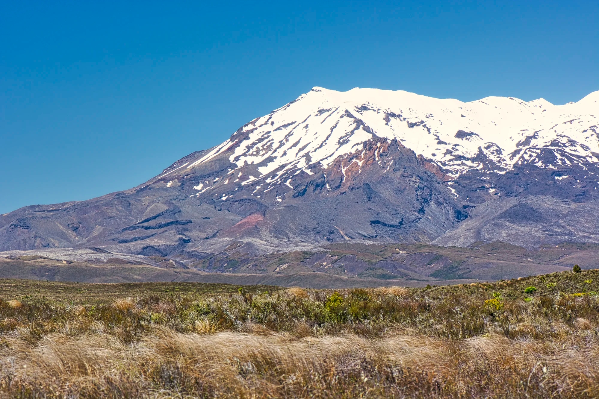
Ruapehu is a ski hill.
Planning a Tongariro Hike Today
Today, DOC NZ (Parks NZ) has implemented a reservation system. You must register to go on any hike. There is no limit in the number of hikers as they test the system. However, you can see where this is going in the future.
Tongariro is one of the most-visited places in all of New Zealand. There are about 1 million visitors visitors per year. It does not feel as overcrowded as national parks in North America. Banff NP and Yosemite NP each have more than 4.5 million visitors per year. The problem is that everyone included inexperienced tourists are hiking the same Mangatepopo Hut to Red Crater track.
Ketetahi Hut is no longer available and Ketetahi Hot Springs are out of limits. There are two treks possible:
- Tongariro Alpine Crossing Track – one day hike from Mangatepopo Hut to Red Crater 8 km one way; or to Ketetahi parking 20.2 km one way.
This is a challenging Elevation Gain of 748 m (2,454 ft) in 8 km. A high level of fitness is required. - Tongariro Northern Circuit – 4 day hike from Whakapapa Village to Mangatepopo Hut, Oturere Hut, Waihohonu Hut, and back to Whakapapa Village.

There is easy road access to Whakapapa Village. If you hike to Ketetahi parking you have to book your pick up ride.
Napier Express

You may have noticed that we discourage fellow travellers from driving to a place and then moving on the next day without spending any time appreciating that place. Here is one example of an express trip to the pleasant town of Napier from Tongariro for a couple of hours and then moving on south to the Otaki area near Wellington. A birding trip is quite different from a tourism trip.

Our 3rd trip to NZ was with our son, an avid bird watcher. The side trip to Napier was for the birds. On the way, we stopped at Waipunga Falls (G4.5) for the birds.

These stops were nice in the early morning light for photography. This is an example of where travelling from A to B is just as nice as the destination.
Andersen Park, Napier

But the real reason for this side trip to Andersen Park was to see the Plumed Whistling Duck. I really like the protruding cream-colored plumes on flanks that contrast with tiger orange feathers. These ducks like ponds and lakes, parks and agricultural land.

Australasian Swamphen is called a Pukeko (Maori) in NZ. It is a conspicuous blue and black waterhen with gigantic red bill and forehead shield. It has large red feet. It is common to wetland habitats and urban parks. They are endemic to NZ, Australia and South Pacific.
The Pukeko have interesting social structure. The live in permanent groups and a shared territory. All eggs are laid in a single nest and the offspring are raised by all group members.
Final Comments on this Itinerary
This is an action-packed itinerary that draws many visitors to NZ. Tongariro is definitely worth visiting and doing one of the hikes. It is busy, and becoming over touristed like North American NPs. Waitomo and Taumarunui are also worth visiting. The places included in the itinerary are all highly rated by the people as shown by their Google Map Ratings.
Do you want more information? Then subscribe for free.
What things fascinate you? How long is your trip? What questions do you have?
Itinerary Planning
Do you want to learn how to plan an itinerary? Use this ready-made itinerary map to plan your trip.
NZ Rotorua-Tongariro Region Map
Our own NZ Planning Maps include all the possible Points of Interest pinned. You can create you own custom maps using the Google My Maps app.
If you have limited time then you should be spending it solely on the best sights. All of our recommendations are appended with the rating from Google Maps, which is based on everyone’s opinions not just tourists. We consider a score of 4 to 4.39 to be Very Good; 4.4 to 5 to be Excellent.
Other Places to Add to Your Itinerary
Fiordland References
Pure New Zealand — NZ Government web site
Tongariro National Park, DOC NZ web site
Volcanic Risk in Tongariro National Park, DOC NZ web post
When is Best Time to Visit Tongariro ?
Tongariro is one of the coldest places in NZ. From our photos above, you can see how gloriously sunny it was in late December (summer) and April (autumn).
Here are the average high temperatures and monthly rainfall at Tongariro by season. Jun-Aug is both cold and rainy/snowy. Sep-Nov is cool and somewhat rainy with November having noticeable better high temperature of 16°C.
| Season | Mean High Temp | Avg Rain per Month |
| Dec-Mar | 19.3°C 66.7°F | 69.3 mm 2.7″ |
| Apr-May | 14.5°C 58.1°F | 74.0 mm 2.9″ |
| Jun-Aug | 10.0°C 50.0°F | 89.0 mm 3.5″ |
| Sep-Nov | 14.0°C 57.2°F | 79.0 mm 3.1″ |
Purpose of Your Trip
What is the purpose of your trip? What are your interests? This itinerary was based on the features that make New Zealand unique…
New Zealand FAQ
The FAQ post answers questions such as:
- Where should I go in NZ?
- What is the best season for travel?
- How much time do I need for NZ?
- How safe is NZ?
Abbreviations
DOC = Department of Conservation = Parks NZ
Kiwi = New Zealander, or a nocturnal flightless bird
NP = National Park
NZ= New Zealand; NZD = New Zealand Dollar;
NI = North Island
SI = South Island

Leave a comment