
Driving south on the Klondike Highway, you traverse the formidable terrain taken during the Klondike Gold Rush. A golden desert awaits you. Visiting Carcross is like travelling back in time to the early Klondike days. The glacial green lakes and waterfalls are spectacular as you cross to Skagway, Alaska. Imagine prospectors climbing and boating this on their way to search for gold.
Emerald Lake
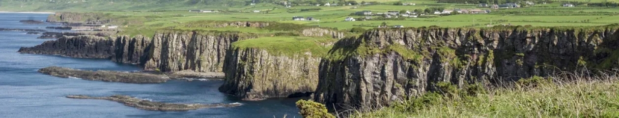
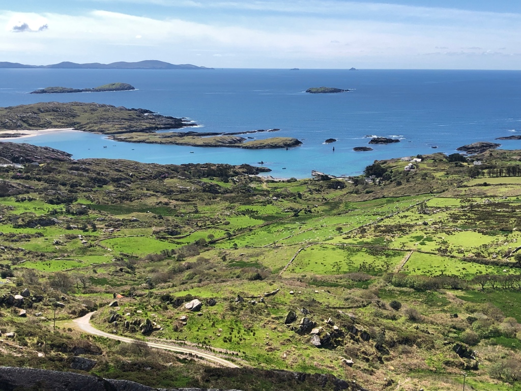
Drive 69 km 48 minutes south of Whitehorse on the Klondike Highway 2 to see gorgeous green lakes and brilliant brown dunes.
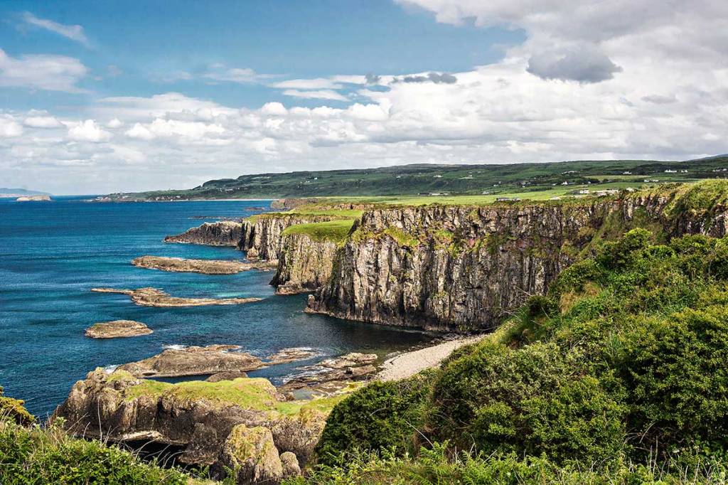
There are several glacier-fed rivers and lakes in Yukon. The “rock flour” ground by the glaciers causes a translucent “glacial green” as seen in the lakes along the Icefield Parkway – Do Not Miss the Best Road Trip in Canada in the Canadian Rockies.

However, Emerald Lake looks more purple-blue than green. This may be due to the cloudy conditions as the purple was toned down by changing the photo’s colour balance.

Unlike glacial lakes, this green color is the result of sunlight reflecting off marl, a white calcium carbonate that settles on the lake floor. Perhaps that is why the colour is most special along the shallow edges of the lake.
The high concentration of calcium carbonate in the water here comes from limestone gravels eroded from the nearby mountains and deposited here 14,000 years ago by the glaciers of the last ice age.
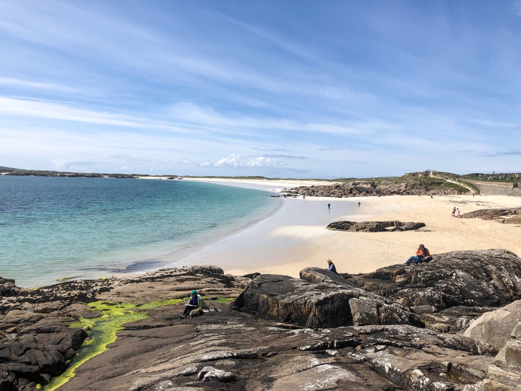
Carcross Desert

There is a desert in the Yukon? Do you notice the trees? That’s a dead giveaway. The climate is not dry enough. Therefore, Carcross Desert is not a desert!

It is actually an undulating series of sand dunes. What is amazing is that the sand was formed during the last ice age. There used to be a large glacial lake that deposited ground up stone, aka sand. It’s not a problem taking a short walk on the dunes since you can use the mountain back drop to orient yourself.

Unfortunately, locals like to criss-cross the dunes with tire marks spoiling the effect of utter wilderness. It would be nice if these ATVs were banned or, at the least, a totally separate area not near the walk-in entrance, is set aside for dune buggies so they are not visible in the touristy and scenic areas. The dunes contain a wide variety of unusual plants that are not being protected. This is not a good example of conservation of natural areas.
Caribou Crossing Trading Post
A short distance south on the Klondike Highway, the Caribou Crossing Trading Post is full of tourist shops, but you can also get a coffee or snack at Carcross Commons. The piazza is beautifully decorated with Indigenous designs and totem poles.
In many ways, Caribou Crossing was significant to the Klondike Gold Rush. It was used as the staging point for the Klondikers after they scaled Chilkoot Pass. But it was also home to three of the discoverers of gold in Bonanza Creek that started the Klondike Gold Rush.

Information panels in the piazza describe Skookum Jim Mason, Tagish Charlie, and Kate Carmack, who are all buried in the Carcross cemetery. Kate was Skookum Jim’s sister and, at the time of the gold strike, the wife of another co-discoverer, American George Carmack. In 1900, Carmack deserted Kate for a white woman and refused her any part of the fortune amassed from the gold strike, as well as access to their daughter. In 1920, she died penniless.
The small visitor centre is a replica of Skookum Jim’s house, which had collapsed. The building is beautifully decorated with Indigenous designs and is owned by the band council.
Carcross

Just south of the Trading Post is the gold rush village of Caribou Crossing on the shores of Bennett Lake. It got its name for the herds of caribou that used to cross the narrows between the lakes.
But mail for its 410 residents often ended up at one of the other towns called Caribou Crossing across Canada. Thus in 1994, Caribou Crossing Yukon was renamed Carcross.
At the time of the gold rush, the town was a stopover point for thousands of gold-seeking stampeders, making their way to the rivers and creeks in the post Is Dawson City Worth Visiting? The Klondike Highway of that era was the network of rivers and lakes.
Touring Carcross You will feel like you have just time travelled back to the early 1900s. Even the cars are old. If you like photographing old buildings then definitely meander through the town. Pick up the Carcross Walking Tour brochure at the Visitor Information Centre for a history of 34 buildings. I am only including the places I found most photogenic.

Matthew Watson General Store is one of the oldest still operating businesses in the Yukon. It was a major supplier during the Gold Rush. Only three families have run the store in its 122-year history!
Note that the wood façade covers what seems to be a tin shed. After the 1909 fire that destroyed Carcross, the store was restored using two buildings from the mining ghost towns of Conrad and Bennett.
Matthew Watson was a prospector who climbed the Chilkoot Pass in 1899. Matthew bought the store in 1911. In addition to foodstuffs, he also provided mining and hunting supplies, clothing, and medical cures.

This is one of the buildings owned by Matthew Watson. It is rumoured to have once been a brothel. The 1950s Chevy pickup belonged to one of the owner’s grandfather.

The log cabin was constructed in 1921 by Johnny Williams, a foreman in the WP & YR Railway. Because long trees could not be found, the short, thin logs were assembled vertically.
The building later became an RCMP Barracks and holding cell. Unfortunately, the Chilkoot Trail Sourdough Bakery was closed when we visited. In addition to bread, they provide meals and pastries.

Arne Ormen was a Scandinavian-Canadian woodcutter who lived in nearby 12 Mile. He would travel to Carcross to buy supplies and go to the beer parlour. In winter he would ski and in summer he would bicycle. When he got older he decided to live in Carcross and built this little cabin in 1950s. He was very tall and could not stand up in his cabin! Unfortunately, Arne did not live long after he built this cabin. Walk on the sandy path to the beach for the unobstructed view of Bennett Lake shown above.
Klondike Highway
You should drive the spectacular White Pass south to Skagway, Alaska — even if you don’t plan on going to Alaska.

Stop at the km 95 viewpoint for a wide vista of Bove Island surrounded by glacial green water. Tagish Lake is more than 100 km (62 mi) long and about 2 km (1 mi) wide. Notice the sunny weather.

Unfortunately for us, as we travelled into the coastal mountains, it was raining profusely with low flying cloud. The dismal weather helps us picture the prospectors climbing Chilkoot Pass into this rugged landscape. Now imagine, prospectors transversing through snow!

I have edited the second photo to improve the lighting and make the lake colour darker. It is spectacular because glacial green Tutshi Lake is sprinkled with islets and rocks.

The spectacular Pitchfork Falls is located in Alaska but just before the Customs building. So you can see it and turn back! It may look sunny thanks to photo editing but it was still a very dreary day.
Because it was raining profusely, we decided to not go to Skagway. Our son had highly recommended taking the ferry from Skagway to Haines AK then by road to Haines Junction YT and returning to Whitehorse.
Haines Junction, Kluane NP

Haines Junction is a pleasant small town. Near the Alcan Motor Inn was a municipal park with the view above of Kluane National Park. We were very disappointed with Kluane. Because it is very mountainous and glaciated, there are no roads within the park. The “foothills” block any views of the scenery behind.
This is the closest view of the mountains. Because the weather was cloudy most of the time, this was also the only good photo that we have.

The Haines Junction view does not compare to the famous Kaskawulsh Glacier in the tourist literature. There are only two ways to see the spectacular Kluane glaciers and lakes – a long hike or a helicopter ride.
Teslin
Our last stop in Yukon was the town of Teslin, along the Alaska Highway 1, heading south towards the Stewart Cassiar Highway 37 and Terrace BC. Teslin has two First Nation museums that exceeded our expectations.
Tlingit Cultural Centre
The Tlingit Cultural Centre has superb art and is well worth a visit.

The upper left hand bead work resembles the dual Kaskawulsh Glaciers. But the two lateral glaciers look like two hands joining.

The mural also includes merging glaciers separated by medial moraines, again representing the dual Kaskawulsh Glaciers.

The centre also runs a program of cultural demonstrations in this purpose-built hall. When we visited, top carver Tom Johnson was demonstrating his craft. We had a long chat with him. Speaking of carvings, enjoy the open air park outside the main entrance with five clan posts.
George Johnston Museum
Then we went to the George Johnston Museum, open June to September. George was an indigenous trapper and entrepreneur.

George Johnston became the first person in Teslin to own a car. This is his 1928 Chevrolet! I wonder what the roads were like then.
George photographed the changes to the Tlingit people as a result of the building of the Alaska Highway in 1942.
Did you know that the Americans paid $41 million to build it and claimed the area as their territory until the war ended. It was to supply airfields such as Teslin YT to defend Alaska from attack. The Canadians insisted that these would be Royal Canadian Air Force (RCAF) bases. The bases were in Yukon so the Japanese could not attack them.
The museum also displays George Johnston’s collection of Tlingit ceremonial regalia and photographs recording the changes to the Inland Tlingit.
Yukon Itineraries and Posts
Here are the posts describing our road trip from Northern BC to the Yukon, as well as two of our customized itineraries (Google Maps).
Stewart-Cassiar Highway 37: Bear Glacier, Stewart, Cassiar Jade, Boya Lake
Yukon Green – Miles Canyon, Yukon River, Whitehorse
One Thing You Must Do in the Yukon – Whitehorse
Is Dawson City Yukon Worth Visiting? – Gold Rush


You must be logged in to post a comment.