Tag Archives: waterfalls

Explore Wild British Columbia — the Solitary Stewart-Cassiar Highway

Our recommendations are not influenced by affiliate links – we have none. Our content and advice is derived from our personal expertise, experience, and knowledge based on living in Western Canada as well as travelling and living for 23 years around the world.

Bear Glacier, Stewart-Cassiar Highway, BC
Bear Glacier, Stewart-Cassiar Highway

Do you want to feel like one of the ancient explorers? So few people live here, you will be all alone as you discover gleaming glaciers, wispy waterfalls, green jade, brown bears, and utter wilderness

We have crossed North America at least eight times but this was our first road trip to the Yukon. On our 19,000 km odyssey, we skipped the busy Alaska Highway route. Instead, we drove the isolated highway between Fort St. James (FSJ) and Stewart-Cassiar. See the Mt Robson to Furs and Jade Map.

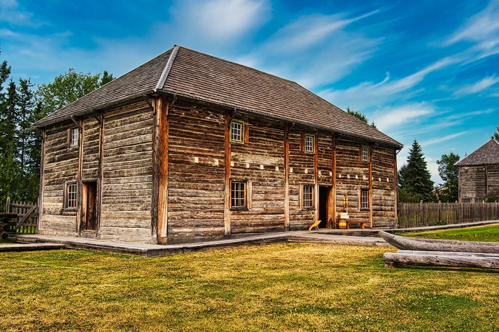
The Last Fur Trade Post, Fort St. James, BC
The Last Fur Trade Post, Fort St. James

We spent the morning in an authentic Hudson’s Bay fur trade post, Fort St. James (FSJ) National Historic Park, as described in the post The Last Fur Trade Post.  The FSJ interpreters are from the town of the same name, which is a First Nations area.  There are no “reservation” signs as this is a self-governing area and reservation has a negative connotation.  The Indigenous call themselves First Nations as they were here first.  Instead of a town hall there is a band office and the band owns many of the businesses here.

One women only works in FSJ during the summer then goes to Victoria BC for the winter. She’s an artist and sells her artwork in Victoria, which apparently is an artist hangout.  That beats living in the typical -40°C winter in FSJ!!  Usually, the temperature is in the low 20s °C in the summer.  It was 31°C when we were there.  So much for no global warming.

Smithers

From FSJ it is 54 km, 36 minutes to Highway 16, better known as the Yellowhead.  The highway is named after fur trader and explorer, Pierre Bostonais.  He was nicknamed “Tête Jaune” (Yellowhead) because of the yellow streaks in his hair.  The scenery was not exciting and eventually we arrived at Smithers.  We stopped for coffee and had a chat with a Dutch Canadian who runs Paul’s Bakery.  Her family emigrated in 1952 after the war.  Smithers looks like it has very dramatic backdrop of mountains.

Moricetown Canyon
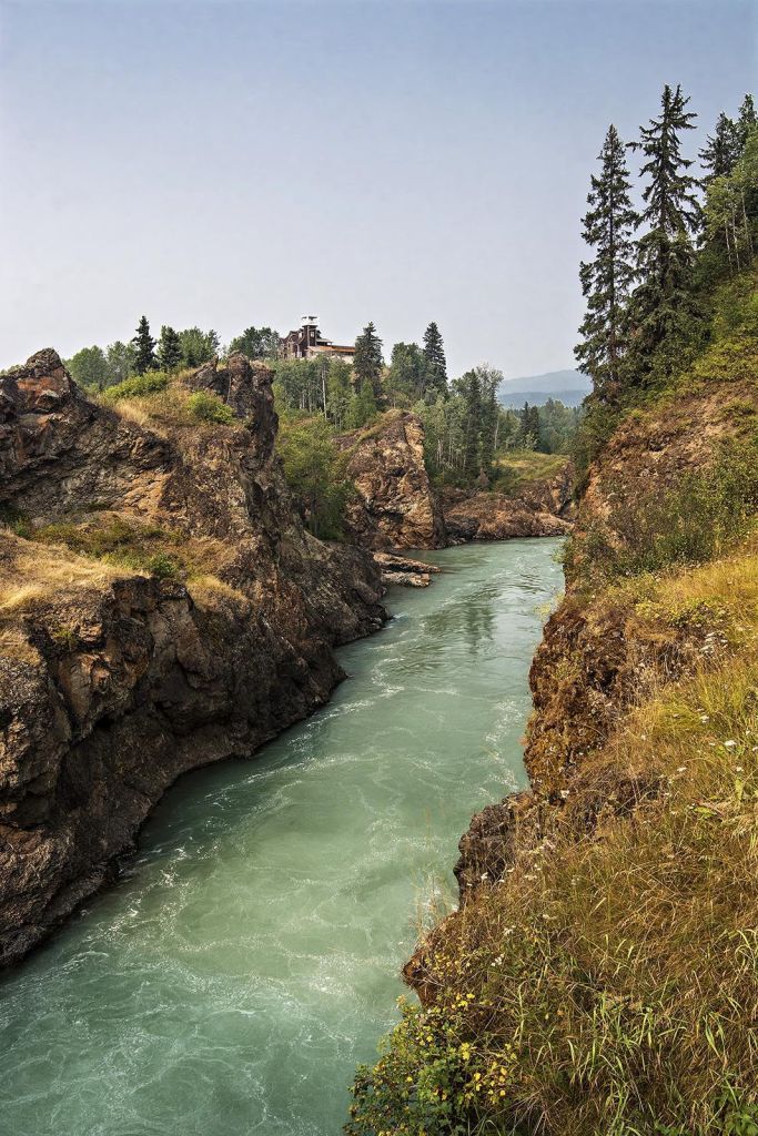
Glacial-Green Moricetown Canyon, British Columbia
Glacial-Green Moricetown Canyon

The scenery picked up north of town when we stopped to see Moricetown Canyon.  Definitely cross the bridge over the gorgeous green river and walk back on the bridge for dramatic views of the canyon.

New Hazelton

Due to our late arrival, we had to stopover in the village of New Hazelton. Many hotels were already full. One was closed because they had no air conditioning and it was over 30°C. We stayed at the very good 28 Inn Hotel, right on the main highway.

The smoke from the forest fires has followed us all the way north.  There was a new fire right here in the Seven Sisters Park!  We can see the mountains but faintly.
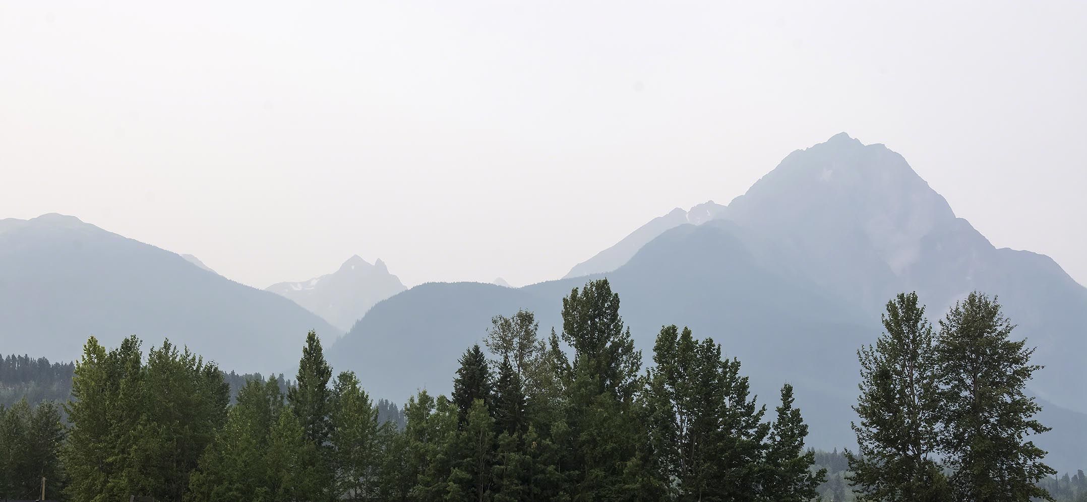
Forest Fires create the Smokey Seven Sisters, British Columbia
Forest Fires create the Smokey Seven Sisters

There were 182 forest fires in central British Columbia (BC) in 2017.  It was caused by the extremely high temperatures, dry lightening and lack of rainfall.  It was the largest set of fires in BC history burning 12,140 sq km (3 million acres)!!!  That is equivalent to burning down all of Montenegro or Jamaica.  Firefighters came from Australia, New Zealand and Mexico! The main north-south highway was closed.

Bulkley River Canyon
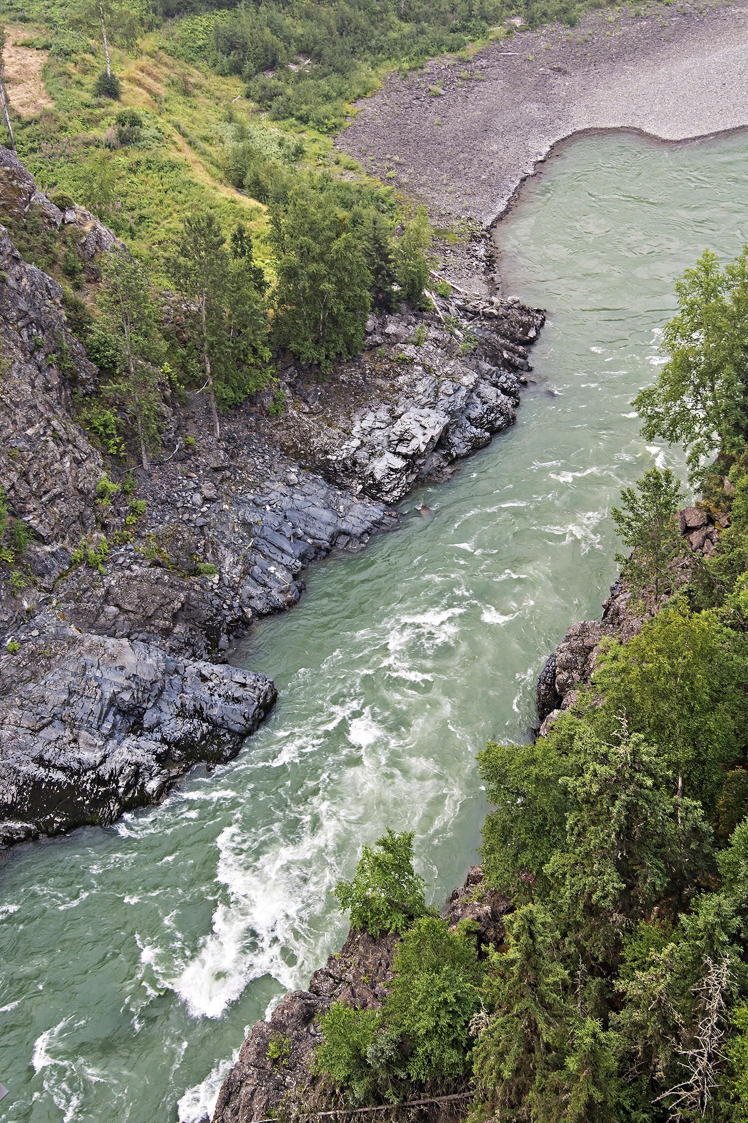
Bridge View of Bulkley River Canyon, British Columbia
Bridge View of Bulkley River Canyon

We drove to Hagwilget to see the very deep Bulkley River Canyon.  Crossing the steel bridge is not for those afraid of heights. Imagine crossing the river on a cedar rope bridge used by the Carrier Indians centuries ago!

One sight of interest we missed was the Ksan Historical Village at the end of the road.  We had heard of many other First Nation visitor centres that were excellent (and free) that we planned to see in the Yukon and near Terrace, BC.

The Stewart Cassiar or Highway 37 starts at Kitwanga junction on Highway 16 and ends 725 km later at the Alaska Highway.  Extreme Northern BC has only 106,442 people live in an area 425,626 sq km nearly 4% bigger than Sweden!! There are very few hotels and even fewer gas stations. Gas and food are more expensive along this route so that’s why we restocked in Prince George.
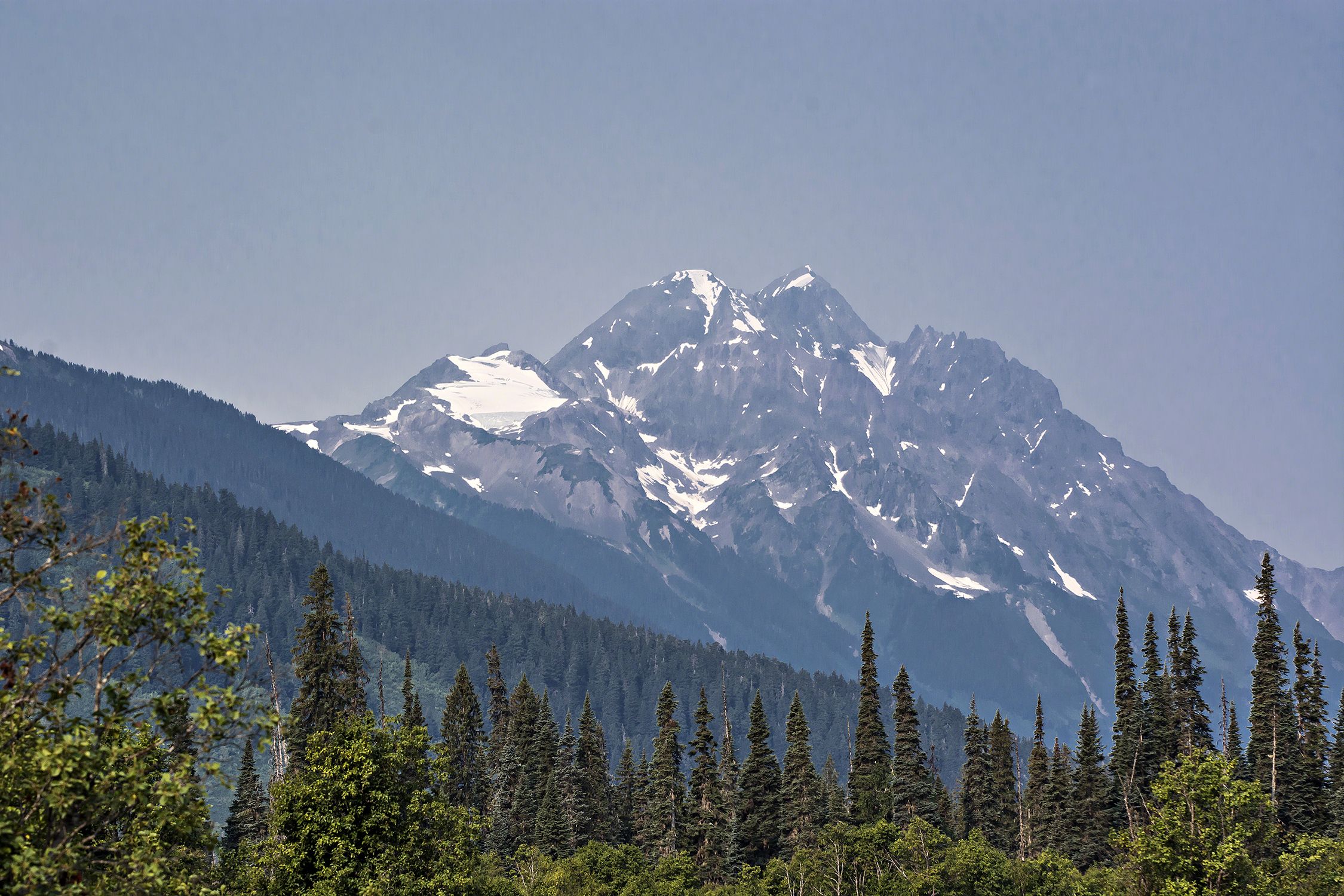
Mountains along Stewart-Cassiar Highway, British Columbia
Mountains along Stewart-Cassiar Highway

The views for the first 200 km were obscured by smoke from the Seven Sisters fire.  I removed the haze from this photo. We also may have seen an eagle (we were too surprised to get a photograph) right on the highway.
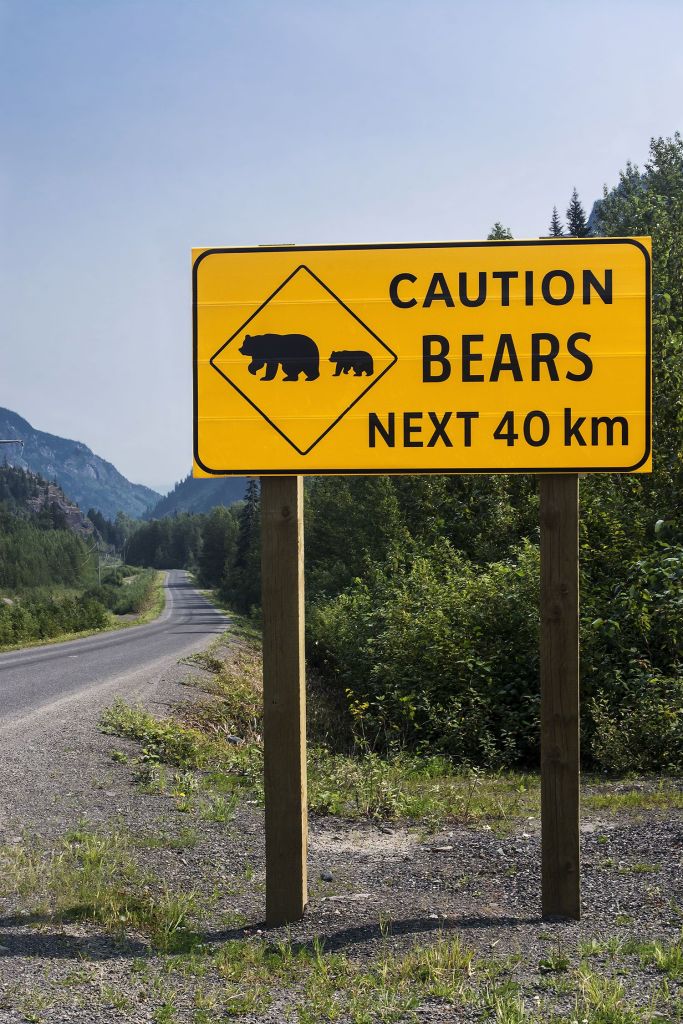
The Caution Bears sign was so true.  This was followed by five sightings of bears!!!  
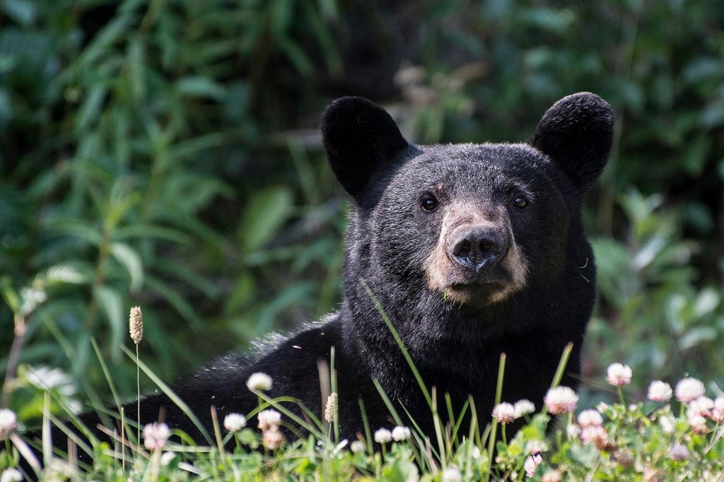
Bear Stare, Stewart-Cassiar Highway, British Columbia
Bear Stare, Stewart-Cassiar Highway

I opened the window to get a picture and the bear immediately stopped and stared at us.  I wonder if it could smell the food in the car?  No, I definitely did not get out of the car!  There are 135,000 brown bears and 15,000 grizzly bears in all of BC.

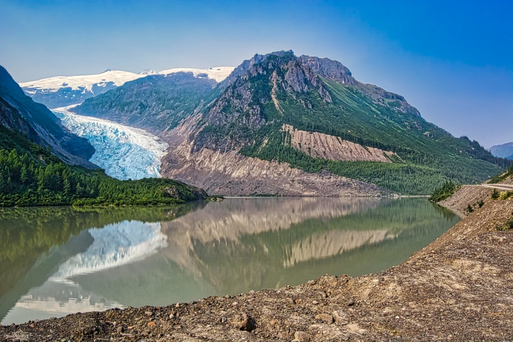
Bear Glacier

Then we did a side road 37A to Stewart. The scenery was sensational as soon as we drove through the coastal mountains.  This road is definitely the most scenic of the whole trip to Cassiar.

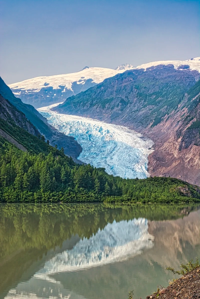
Bear Glacier, Stewart-Cassiar Highway, BC
Bear Glacier, Stewart-Cassiar Highway

The highlight was equivalent to taking the Inside Passage cruise to Alaska without paying $1000.  Right at road level stretched the dramatic Bear Glacier.  So that’s what the cruise to Glacier Bay Alaska is like.  Wow, we cannot wait to go to there.  We are at same latitude as southern Alaska, so the climate is cold enough to still have glaciers down at sea level.

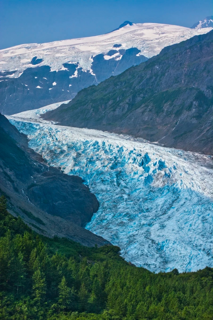
Bear Glacier, Stewart-Cassiar Highway, BC
Bear Glacier, Stewart-Cassiar Highway

But why are glaciers blue?  It’s the same reason why a thin amount of water (running faucet) appears white but a large amount of water (ocean) appears blue.  The thicker, older ice is compressed by the weight of the glacier so the red light (long wavelength) is absorbed but the blue light (short wavelength) is transmitted.  The longer the path that the light travels in ice, the more blue it appears.

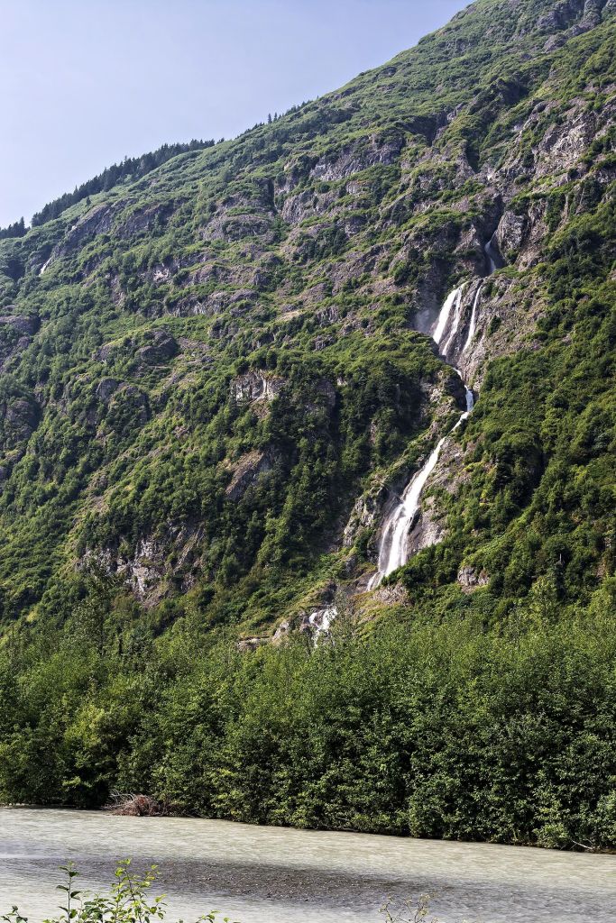
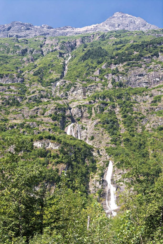
Waterfalls near Stewart, , British Columbia
Waterfalls near Stewart

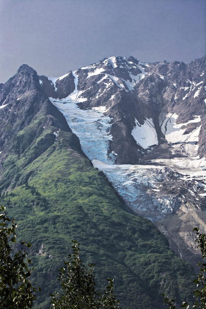
The scenery along the rest of the highway to Stewart was sensational with waterfalls and tall mountains capped with snow and 20 glaciers. 

Waterfalls near Stewart, , British Columbia
Waterfalls near Stewart

However, I wish that Destination BC would install pull-offs near the best views.  You will have to park and walk to take photos.  Be careful as this is a very busy road with no shoulders. 

Glaciers near Stewart, British Columbia
Glaciers near Stewart

The markers for these waterfalls and glaciers on the Mt Robson to Furs and Jade Map are just an approximation but you cannot miss them.

Stewart
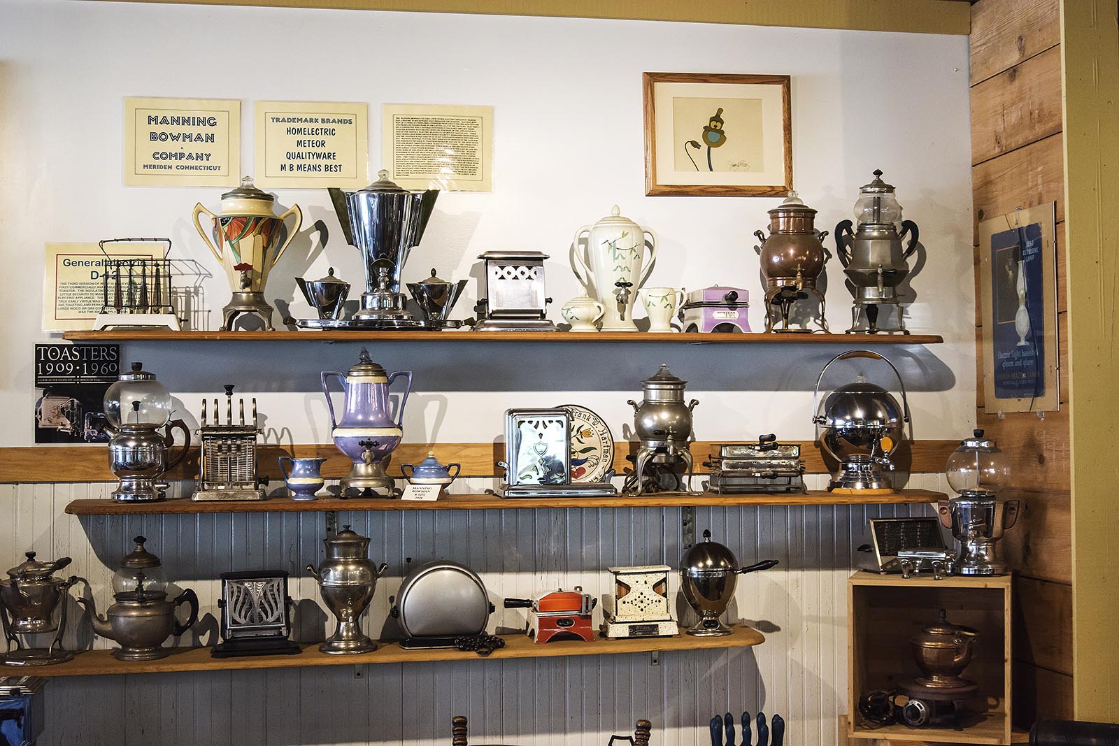
Ripley Inn Café, Stewart, British Columbia
Ripley Inn Café, Stewart

At first glance there is nothing much to see in the village of Stewart.  Only about 500 people live here.  So tourist trade workers are imported from BC universities. We stopped for coffee at the Ripley Creek Inn.  The café had a huge collection of memorabilia.  Rooms start at $150. Then I took a photo and noticed that the Kate Ryan building dates from 1920.  So who is Kate Ryan?

Klondike Kate
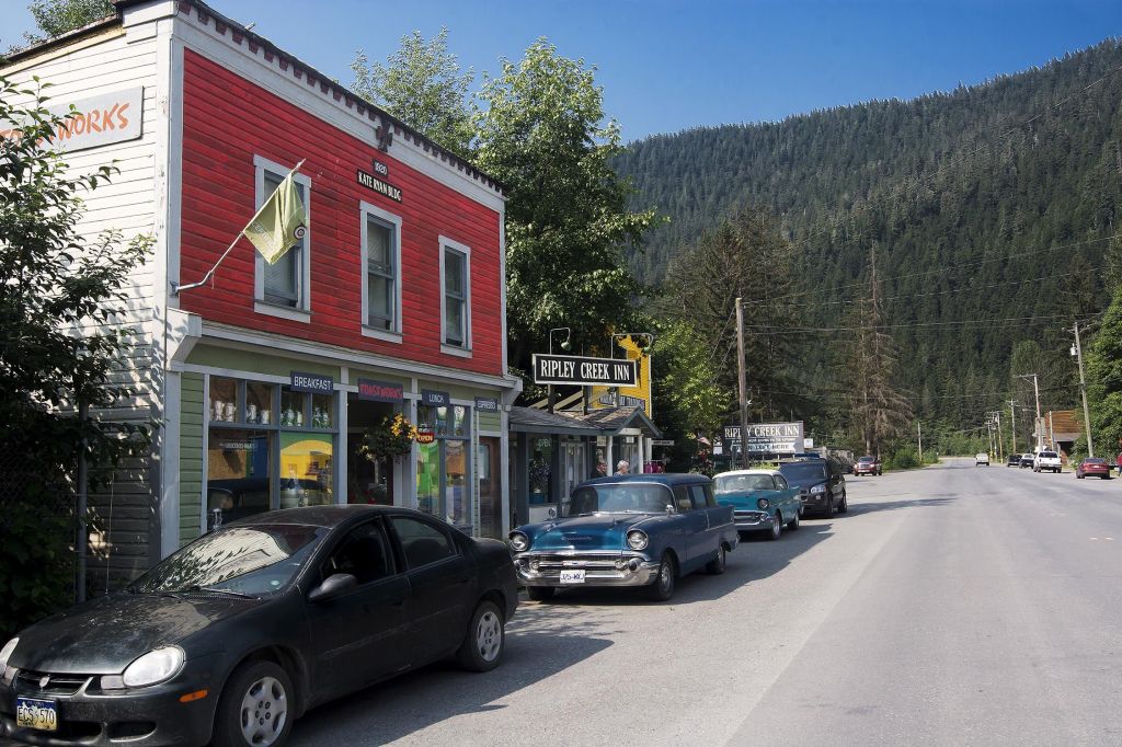
Kate Ryan Building 1920, Stewart, British Columbia
Kate Ryan Building 1920, Stewart

Katherine Ryan was born in a poor family in Johnville, New Brunswick.  She had been courting Simon Gallagher of the local gentry.  His mother opposed any marriage. Kate not only left but moved to the west coast in 1893.  Then the Klondike Gold Rush began in 1896. Two years later, the 28-year-old Kate decided to become a Klondiker, the first woman to do so.  To earn money, Kate opened up Kate’s Café in Whitehorse.

She was also the first woman special constable hired by the Northwest Mounted Police (now known and still operating as the RCMP). They wanted her to take care of women who broke the law, including prostitutes in Dawson City. She became famous by the nickname Klondike Kate in honour of her legendary exploits.  Kitty Rockwell was a singer, a dancer and a thief.  She was also one of her prisoners.  To get revenge on Kate Kitty took on the moniker Klondike Kate and associated it with all the immoral things Kitty did to damage Kate’s reputation.

In 1903 Kate became the first female gold commissioner.  She retired in Stewart, renting out this store-front to businesses.

Salmon Glacier

Salmon Glacier is one of our regrets as we had not heard about it until some Americans mentioned it during our trip.  The majestic Salmon Glacier can be viewed from the Summit Viewpoint via a 37.4 km (23 mile) gravel road only from early July to late September.  The road travels from Stewart BC into the USA and back into Canada.  The fifth largest glacier in Canada is 14,000 years old. Download the self-guided sightseeing tour, Salmon Glacier Auto Brochure.

Mount Edziza

Mount Edziza is an example of a dormant volcano covered by a glacier.  Because it’s in an unpopulated region, it is not as well monitored.  Mount Edziza Provincial Park was created to preserve the volcanic and culture treasures unique to the northern British Columbia area.

After seeing photos and reading about the incredible hiking, we were getting really excited to go there.  We saw pictures of the Spectrum Range hike.  Who knew such a spectacular site existed in Canada?
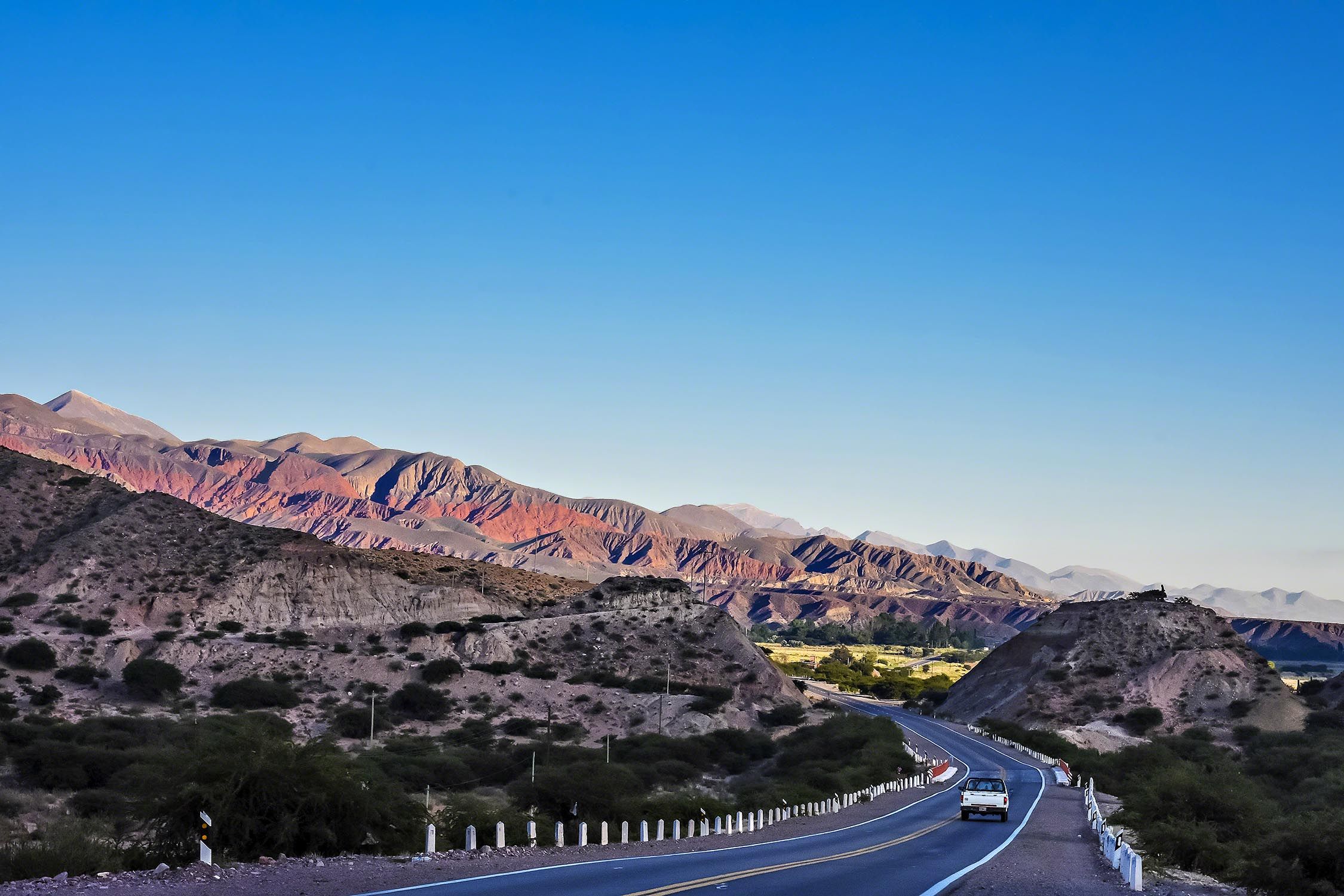
Quebrada de Humahuaca (Rainbow Mountains) near Purmamarca, Argentina
Quebrada de Humahuaca, Purmamarca, Argentina

We had seen a similar colourful landscape in our son’s pictures above of Quebrada de Humahuaca (Rainbow Mountains) near Purmamarca, Argentina.   Daniele Mitchell was one of the top ten birders in British Columbia and has just started to blog about his birding trips.

Then we found out that there is no vehicle access to the park.  You had to go on a group tour by seaplane then trek 9 days at a cost of over $3000 per person.  Major disappointment!  Message to Destination BC, if you build a road ending about a day hike away from the Spectrum Range or at least to a high up viewpoint of it, they will come.  This would increase tourism to Northern BC.

Volcanoes of BC

Who knew that there are hundreds of volcanoes in BC?  Well, BC is part of the Pacific Ring of Fire In fact, many famous mountains are actually dormant volcanoes; such as, Stawamus Chief (Squamish), Mt Garibaldi and Black Tusk (Garibaldi PP).  But the biggest danger of eruption is a volcano only 72 km by air and 100 km by road from Vancouver.  It is called Mt Baker (Washington).  Borders are no barrier to the force of nature.

The majority of the eruptions happened in the Miocene Era (6–10 million years ago), the Pliocene Era (2–3 million years ago), and most recently in the Pleistocene Era (10,000 years ago).  Deep layers of ash and microscopic glass shards have been found as far away as Newfoundland, Ireland and Northern Europe!

The stone obsidian is highly valued for its cutting qualities and was used by local First Nations to make tools and weapons.  It was traded for other goods as far away as Alaska and northern Alberta.

Mount Edziza is the main source of this naturally occurring glass since it requires the heat and high pressure of a volcanic area. Obsidian ranks 5.0 on the Mohs scale of hardness with a high of ten (diamond).  Steel rates a 4.0 score!

Dease Lake
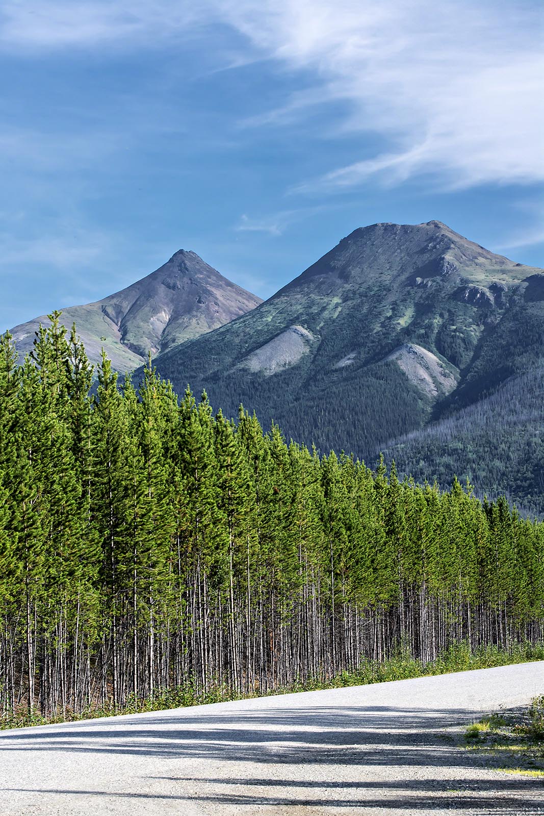
Cassiar Mountains, BC
Cassiar Mountains

As a result of our Stewart side trip we did not get as far as planned.  So instead of camping at Boya Lake Prov. Park, we stayed at a hotel in Dease Lake.  Northway Motor Inn was highly rated by Google (#4.3) and was very nice with lots of tourist info in the shared kitchen, which provides a microwave and coffee maker.   NB: you need wifi in your hotel as there is no cell service along the Stewart Cassiar Hwy.  The next part of the highway we saw the Cassiar Mountains above.  Do they look like volcanoes?

Cassiar
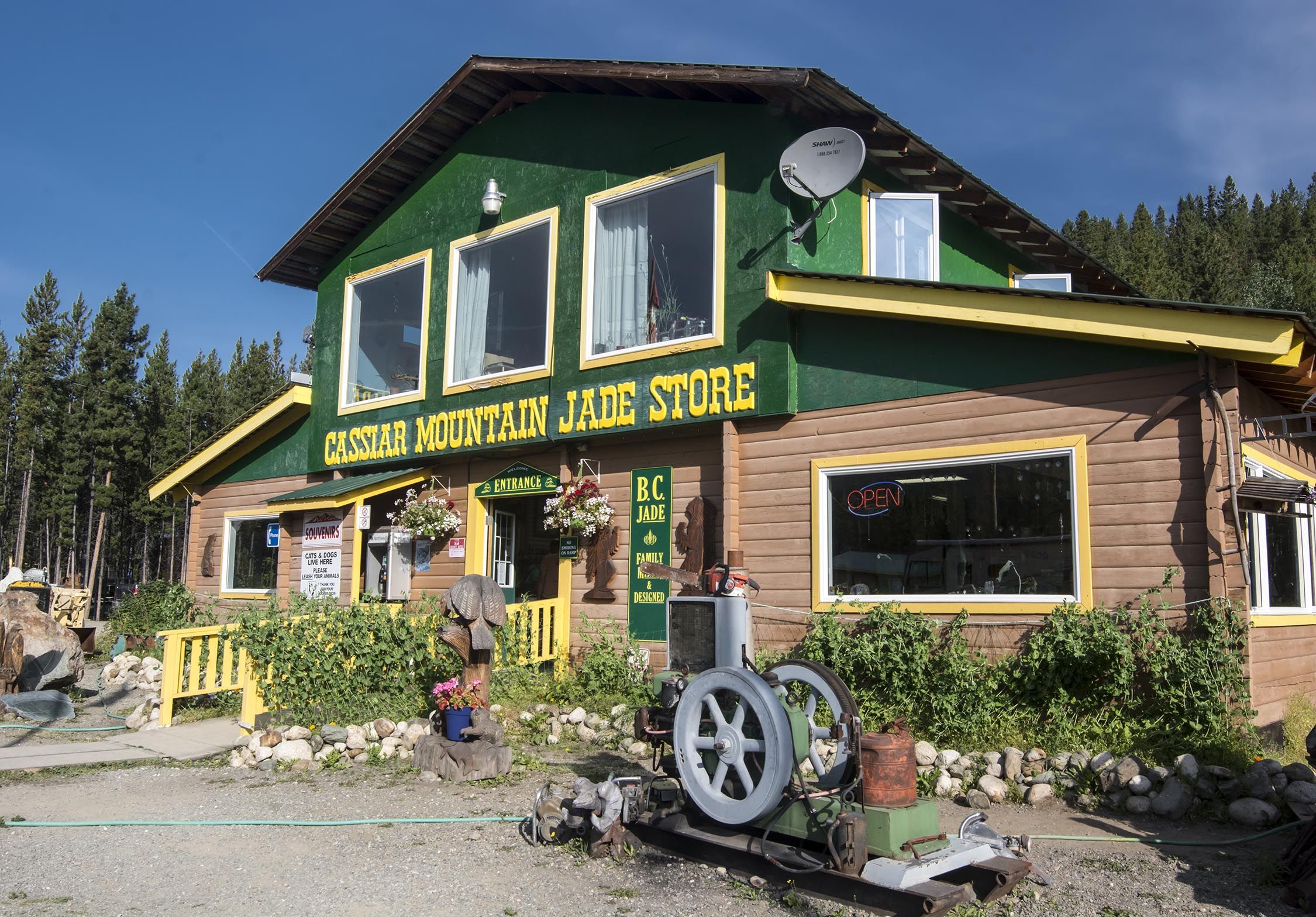
Cassiar Mountain Jade Store, BC
Cassiar Mountain Jade Store

It takes 60 million years of high heat and pressure to form jade. So it is found in volcanic subduction zones where two geological plates collide. BC jade can be found in rock deposits or alluvial boulders that have been moved by glaciers over time.  Jade comes in many colours.  Deese Lake to Cassiar BC is the world’s largest producer of nephrite jade.
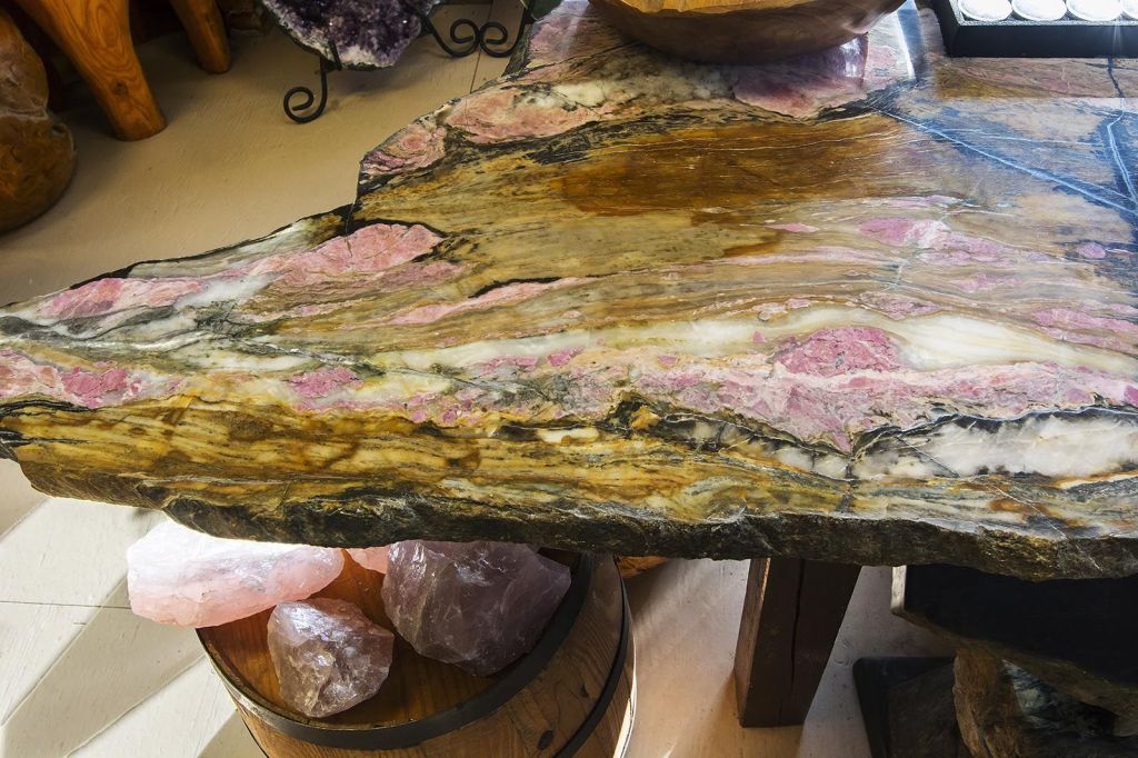
Multi-coloured Jade table, Cassiar Mountain Jade Store, BC
Multi-coloured Jade, Cassiar Mountain Jade Store

The BC jade market is booming as the demand for “emperor green” color nephrite is highly sought after in the Chinese market.  The deposits of green nephrite are found only in three locations in the world: China, Siberia and British Columbia.  Jade was initially prized for its hardness and resilience.  Canadian jade has a Mohs hardness of 6.5 to 7.0. However, it became more prized due to its beauty and use for ornaments and jewellery. Thanks to Chinese demand, rare imperial green jade is the most expensive gem in the world, worth more than diamonds. So don’t expect to be able to buy artefacts at the Cassiar store.  This is the green gold rush.

Boya Lake
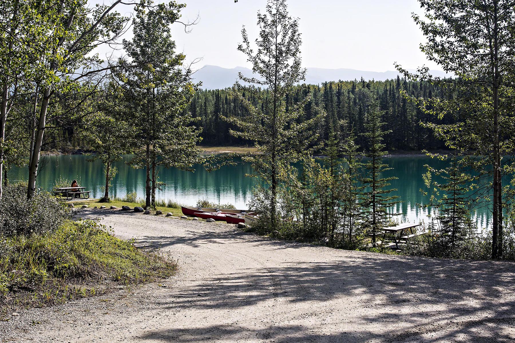
Boya Lake Provincial Park, BC

The Boya Lake Provincial Park (PP) has a very nice campground along a pretty green lake. However, there are only low level mountains as a backdrop. So it was disappointing. It would have been a great stopover as the last stop before entering the Yukon, the subject of our next post.

We met a couple from Quebec City that came to Yukon a couple of years ago. They fell in love with Yukon and found out that it was easy to move there. Lawyers were in high demand so it was easy to find a job. You never know how travelling can affect your life!

Here are the posts describing our road trip from Northern BC to the Yukon, as well as two of our customized itineraries (Google Maps) with all of the points of interest pinned for you. Heading south do not miss Fort St. James:

Heading north do not miss Miles Canyon, Whitehorse, Dawson City and the Klondike Highway:

Mt Robson to Furs and Jade Map

Yukon Itinerary Map

Masada to Sinai

Our recommendations are not influenced by affiliate links – we have none. Our content and advice is derived from our personal expertise, experience, and knowledge based on travelling and living 23 years around the world.

Pyramid Parking

After two years of travelling in tropical Asia-Pacific, our Round The World (RTW) trip took us to an amazing couple of months in the deserts and oases of Ancient Egypt and Israel. From Egypt we took the ferry to Haifa and buses to Jerusalem and a side trip from Jericho to Sinai. The places we describe in our blog can be seen in our Israel-Palestine Map.

Jericho

Jericho, located in Palestine, is only 25.6 km east of Jerusalem. It is one of the oldest cities in the world, dating to ca. 9600 BC. Unfortunately, the ancient walls were brought down by the Israelites led by Joshua.

Hisham’s Palace was the most interesting place to see, although there are only remnants of its former glory. The decorative, arched wall of the Ornamental Pool was a taste of what it once looked like. The palace dates back to the later half of the Umayyad Dynasty (661-750 CE). The Umayyad Caliphate conquered all of the Middle East, Northern Africa as well as southern Spain. They built the spectacular Dome of the Rock described in the next post, Jewels of Jerusalem.

The Umayyad capital was Damascus until 744 when the Abbasids defeated them. The Abbasids promised amnesty to the Umayyad family. They invited them to a pardon ceremony then killed them all. Never trust your enemy!

One grandson of Hisham escaped and ruled in exile in beautiful Córdoba, Spain. We can thank him for most of the magnificent sights in Southern Spain. This was an enlightened kingdom since they allowed and protected non-Moslems such as Jews, Christians and Zoroastrians.

The most special sights of the palace were the lace stone semi-circular frieze in the top photo and the Tree of Life mosaic in the audience room of the bath house in both photos.

Ein Gedi

Ein Gedi, “the spring of the young goat”, is an oasis rising above the eastern edge of the Judean Desert. It is a beautiful and very popular nature reserve (entry fee NIS 28).

We walked the trail to the Nahal David spring-fed waterfalls. This is named after the David who killed Goliath. King Saul made him the army chief and insisted he live in the palace. But when the army returns from fighting the Philistines, the people praised David more than Saul. In a jealous fit, King Saul throws a spear at David, who ducked and fled to a cave near this spring. King Saul found him but could not see him in the dark cave. David took a slice of the king’s cloak and showed him he could have killed him but did not.

There were good but hazy views of the arid land and the Dead Sea. It is amazing that anyone could live here. The famous Dead Sea scrolls were found by a shepherd in a cave in this area. Ancient temples were built here as well.

Dead Sea

It may have been December but it was warm enough to float in the Dead Sea. No wonder this was the site of one of the world’s first health resorts built for Herod the Great. The Dead Sea is actually 430.5 metres (1,412 ft) below sea level!!

Salt crystals crown many of the rocks near the shore. The Dead Sea is 9.6 times saltier than an ocean. Another dramatic fact is that the Dead Sea has receded 58% over the last century! Jordan has initiated a project to carry brine from the Red Sea by 2021.

Masada

View from Water Gate

It was Hanukkah (December 8th) when we travelled to one of the most symbolic monuments of Jewish history. This is where a small group of rebels held off the Roman army. Today, the Israeli Defense Force (IDF) holds its swearing in ceremony on top of Masada.

We walked under the cable car then began the very steep 400 m ascent up the ancient Snake Path to the cliff top of Masada. We were surprised that we made it to the top in 36 minutes non-stop. It took 26 minutes to descend the path.

Herod the Great was the infamous Jewish vassal king under Roman rule at the time of the birth of Jesus. The despotic ruler built two palaces on Masada ca. 31 BC as a refuge for himself in the event of a revolt. He was very unpopular with his own people. The revolt eventually came after the destruction of Jerusalem in 70 CE.

The rebels held off the Romans for three years. The Romans built a huge rectangular campsite for a legion of 9000 soldiers and is still visible below. The final siege of Masada by the Romans took place in 73 CE at the end of the first Jewish-Roman war. The Romans were only able to capture Masada by building a steep ramp below and slowly pulling up a siege tower.

Roman Siege Ramp from Room #7

The rebel leader Eliezer ordered his men to destroy everything except their food to show the Romans that they voluntarily chose to die rather than submit to slavery. But when the Romans reached the top, the buildings had been burned and all the remaining 960 rebels had committed mass suicide!

South to Sinai

Saint Catherine, Egypt, is located at the foot of Mount Sinai above. The monastery is named after martyr Catherine of Alexandria, who actively converted people to Christianity. In AD 305, at the age of 18, she was sentenced to die on a breaking wheel but incredibly she survived. She was then beheaded.

Only a few years later in AD 313, Emperor Constantine issued the Edict of Milan making Christianity the official religion of the Roman Empire. The capital of the Roman Empire was moved to Constantinople in AD 330 before the fall of Rome the city. There was no such thing as the Byzantine Empire — see Ancient Rome — Ancient Hidden Gems Walk 3. The Empire was now Christian, Greek Orthodox to be specific, and the official language was now Greek not Latin.

Why was one of the oldest Greek Orthodox monasteries (AD 565) built here? Helena, mother of Emperor Constantine, came to the Holy Land to locate and preserve the sites of significant events in Christianity. Emperor Justinian I ordered the building of the church because this was the site of the the Burning Bush where Moses received the Ten Commandments. The site is sacred to Christianity, Islam, and Judaism.

We really enjoyed the hike to the summit of Mt. Sinai.

Travelling to Trim

Enjoy the dramatic architecture of Sligo Abbey. Where did those pointed arches and stone tracery come from? Appreciate the tranquil views of Glencar Lough viewpoint and waterfalls. See Quintessential Ireland – white sheep on green hills – at the Gortmaconnell trail head. The best part was how few tourist were here.

Read on to find out how to make the most of your time —decide which places should you visit, see which photos fascinate you, as well as get links to our custom Google maps and itinerary planning information.

Author & Photographer: George Mitchell

Our recommendations are not influenced by affiliate links – we have none. Our content and advice is derived from our personal experience and knowledge based on living in Europe for seven years.

So what do you do when it rains in Ireland? You could visit a castle or other Heritage Ireland (OPW) site, You could visit a museum or go shopping if you are in a city. You can eat or drink at a pub.

On rainy Day 27, we continued to tour scenic sights but focused on things that were not hidden by low flying clouds.

Sligo Abbey

Sligo Abbey

It was a rainy day, so we started by visiting the ruins of an abbey in downtown Sligo. This Dominican Friary was originally built in 1253 destroyed in 1414 and again in 1595 and 1641. It follows a Norman architectural style based on Romanesque with Saracenic influences. Really?

The Normand dynasty also ruled Sicily from1070 to 1200, where it was influenced by Byzantine and Saracenic architecture. The term Normans means Norsemen! In 911, the Vikings invaded Normandy and stayed. William the Conqueror of Normandy later invaded Great Britain. in 1066 and changed the course of history as well as the English language!

The central nave still remains without a roof. But the majesty of the stone arches and walls still remains.

The best part was the evocative cloister. Parts of the abbey still remain to provide rain cover.

Here is what the abbey looked like in the sun the day before.

The Glencar Lough Viewpoint (G4.5) provides a broad view of the steep sided valley. By our luck, the sun came out to brighten up the grassy views.

The short walk up from the parking lot brought two views. The lower Glencar Falls (G4.7) tumble between flowering rhododendron trees. The upper falls soared down in one powerful spout.

The parking lot had a beautiful setting along Glencar Lough (lake G4.8) between two mountain ranges.

Gortmaconnell Walk

The hike was cancelled due to rain. Instead, we ate lunch at the trail head. By the end of lunch the sun had come out.

Trim

Finally we arrived in Trim as the sun set and the rain stopped. Out came a full arch rainbow. Well that’s a first. So where are the leprechauns when you need them?

If you want to read about what we did in Trim the see:

This is a very tranquil day trip very far away from the crowds of tourists who head to sites that are famous because of name recognition. The main purpose of this route would be to quit the longer North Ireland itinerary to get to Trim and the Dublin Airport.

What things fascinate you? How long is your trip? What questions do you have? Do you want more information? Then subscribe for free.

Itinerary Planning

Do you want to learn how to plan an itinerary? Is your trip less than two weeks? If you have less time simply quit the itinerary at Ramelton, Donegal or Sligo and return to Trim, departure point for the Dublin airport. Use this ready-made itinerary map to plan your trip.

Ireland North’s Best Sights Map

This day trip is not part of our preplanned two week North of Ireland itinerary. Instead it could be used by travellers with less than two weeks to take the “off ramp” from the itinerary to return to Dublin Airport.

Purpose of Your Trip

What is the purpose of your trip? What are your interests? This itinerary was based on the features that make Ireland unique…

The FAQ post answers questions such as:

  • Where should I go in Ireland?
  • What is the best season for travel?
  • What is the best clothing?
  • Where should I go? What are the must-sees?
  • How much time do I need for Ireland?
  • Can I see everything in a week?
  • How safe is Ireland?
  • How much cash should you take to Ireland?
  • Should I pay in Euros or my own currency? 
  • What apps are useful for travel?
  • Should I rent a car? Take a Taxi?

Krazy Killarney

Our recommendations are not influenced by affiliate links – we have none. Our content and advice is derived from our personal expertise, experience, and knowledge based on living and travelling around the world for 23 years. 

Killarney NP is a pleasant drive through forest, lakes, and mountains rather than what we think of as quintessential Ireland. Now mix in castles, estates and gardens and you have a diverse set of things to do.

Moll’s Gap

We drove from calm Kenmare to visit the NP. A mere six km brought us to a pass through the mountains, Moll’s Gap, with a major parking area. This provided wide open views of a heath landscape of rock strewn fields and mountains. While the main road to the NP turns right, the left road travels through this landscape to Sneem.

Ladies’ View

There are about three pull offs for Ladies’ View. It’s worth stopping at each one.

But the major and last viewpoint at the restaurant provides the closest view of the distant lakes. It was given its name because the Ladies in Waiting exclaimed about the view on Queen Victoria’s visit in 1861. It is supposed to be the most photographed spot in Ireland.

We heard some of our fellow B&B guests state how Killarney has glacial lakes. The area may have been scoured by glaciers. But glacial lakes originate from existing glaciers and thus have a very beautiful turquoise-green colour. See why they are green in my post Icefield Parkway – Do Not Miss the Best Road Trip in Canada. So these are not glacial lakes.

There is also a pull off right off the Upper Lake. Very few people stopped here but it is a good photo opp. A friendly Irish man started a conversation with us. He then introduced his three American cousins he was guiding around. He explained that all national (N999) roads are rated as 100 km per hour whether it was deserved or not. Indeed, this part of the road is narrow and curvy and includes one-lane rock arch tunnels!

Torc Waterfall

This is a pleasant ten minute hike to an average height waterfall. What was most special were the ferns and moss-covered trees and boulders with light and shade filtering through the canopy.

Muckross House

This furnished Victorian house can be visited for a fee or via the OPW Heritage Card. The exterior can be views for free.

However, this was such a beautiful sunny day that we stayed outdoors and toured the extensive gardens. These were completed in time for a visit by Queen Victoria in 1861.

One plus of travelling in May are the many pink and red rhododendrons. It’s a great place for a picnic as well with many benches and lawn. The Gardens are free.

Ross Castle

This wedding photo site can be viewed for free but the interior is an OPW site. Visit the boat cruise side for better afternoon lighting.

Killarney had a vibrant downtown but very busy roads. The main streets had some nice store fronts.

We had our first and last taste of Murphy’s famous ice cream. We would highly not recommend this overrated, watered-down ice cream. Even store-bought speciality ice cream has much more flavour and way better value.

It is amazing that Killarney is considered the tourism capital of Ireland with over a million visitors per annum. While the population is only ca. 14,000, it has the feel of a city, especially in terms of traffic.

However the lack of a decent highway system means all traffic going elsewhere must go through park and town roads that should be geared solely to low-speed tourist travel. It’s time to build a proper high speed highway outside of the park. In general, there is a need for more highways to bypass the towns and relieve the traffic for the benefit of the residents.

Ireland South Map

The FAQ post answers questions such as:

  • When should I go?
  • What is the best season for travel?
  • What is the best clothing to Wear?
  • Where should I go?
  • How much time do I need for Ireland?
  • Can I see everything in a week?
  • How much cash should you take to Ireland?
  • Should I pay in Euros or my own currency? 
  • How safe is Ireland?
  • Should I rent a car? Take a Taxi?

From Cascades to Kids

From Charming Chemainus make you way north towards Tofino. On the route you can make some astonishing stops as well as do some short hikes.

Englishman River Falls PP

Not long after Nanaimo, exit the Inland Island expressway (Hwy 19) for the Englishman River Falls Provincial Park (PP). From the day use parking lot you want to take the trail that parallels bot sides of the river crossing two bridges and loops back to the parking lot. It’s a short, easy trail. See the Englishman River Falls Provincial Park map.

Colourful Coombs

Goat Village, Coombs BC

We always look out for the kids. But this is ridiculous. These kids have been climbing the roofs for over 40 years! We seen them many times when we lived in Western Canada. The Graaten family emigrated from Norway in the 1950s. Following Norwegian tradition, they built a sod roof over their market, which has an amazing selection of products. The goats were picked up on waivers as lawn mowers. They became a marketing gimmick for the Old Country Market. It works ‒ one million tourists visit each year! The biggest change has been all the shops and cafes that have opened along this side street.

Goat Closeup, Coombs BC

Directions: leave the Inland Island Highway 19 at the exit for Highway 4 to Tofino. A short distance southwest turn left onto old Highway 4A to the village of Coombs. You can get there from Parksville via the same Hwy 4A in the opposite direction. Return to Hwy 4 to continue on to the rest of this itinerary.

Little Qualicum Falls PP

This was a very pleasant hike that was more like a walk. The trail head is at the day use parking lot and parallels the river from the lower to the upper waterfall. See the Little Qualicum Falls Provincial Park map.
You can camp here or drive on towards Tofino.

MacMillan Provincial Park

Cathedral Grove had some gigantic douglas fir trees but a severe windstorm in 1997 toppled many huge trees. This tree is one of the few older trees that could be photographed from the trail. Also enjoy the hanging ferns as you walk.

But the park was most disappointing as there are way too many tourists. We remember this park when we were the only visitors on the trail. Moreover, Hwy 4 has much more traffic and noise today. There is so little parking, that everyone parks along the non-existing shoulders. The province cannot even widen the road to provide properly graded and sized shoulders. Be careful crossing the busy road!

This is a serious safety hazard. It is time that the province of BC constructs an expressway to end just after passing Port Alberni. The important thing is that the new road totally bypass MacMillan Park and Cameron Lake. This section of Highway 4 should solely be used by tourists.

Sproat Lake to Kennedy Lake

After Port Alberni, the two-lane Highway 4 is a twisty mountain road. It takes significant driving time to get to the coast. There are some wide open views thanks to the large lakes but there are minimal places to pull over to enjoy the views.

The weather was misty on the way over the mountains. We had forgotten how mountainous it was to get to Long Beach NP.

Last Post Charming Chemainus

Next Post Rugged Tofino