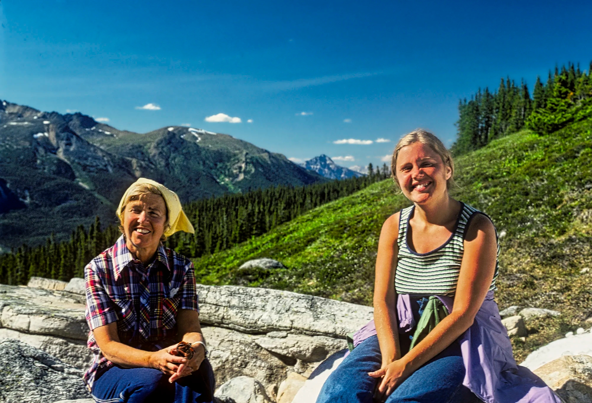
Tag Archives: wildlife

Explore Wild British Columbia — the Solitary Stewart-Cassiar Highway

Our recommendations are not influenced by affiliate links – we have none. Our content and advice is derived from our personal expertise, experience, and knowledge based on living in Western Canada as well as travelling and living for 23 years around the world.

Bear Glacier, Stewart-Cassiar Highway, BC
Bear Glacier, Stewart-Cassiar Highway

Do you want to feel like one of the ancient explorers? So few people live here, you will be all alone as you discover gleaming glaciers, wispy waterfalls, green jade, brown bears, and utter wilderness

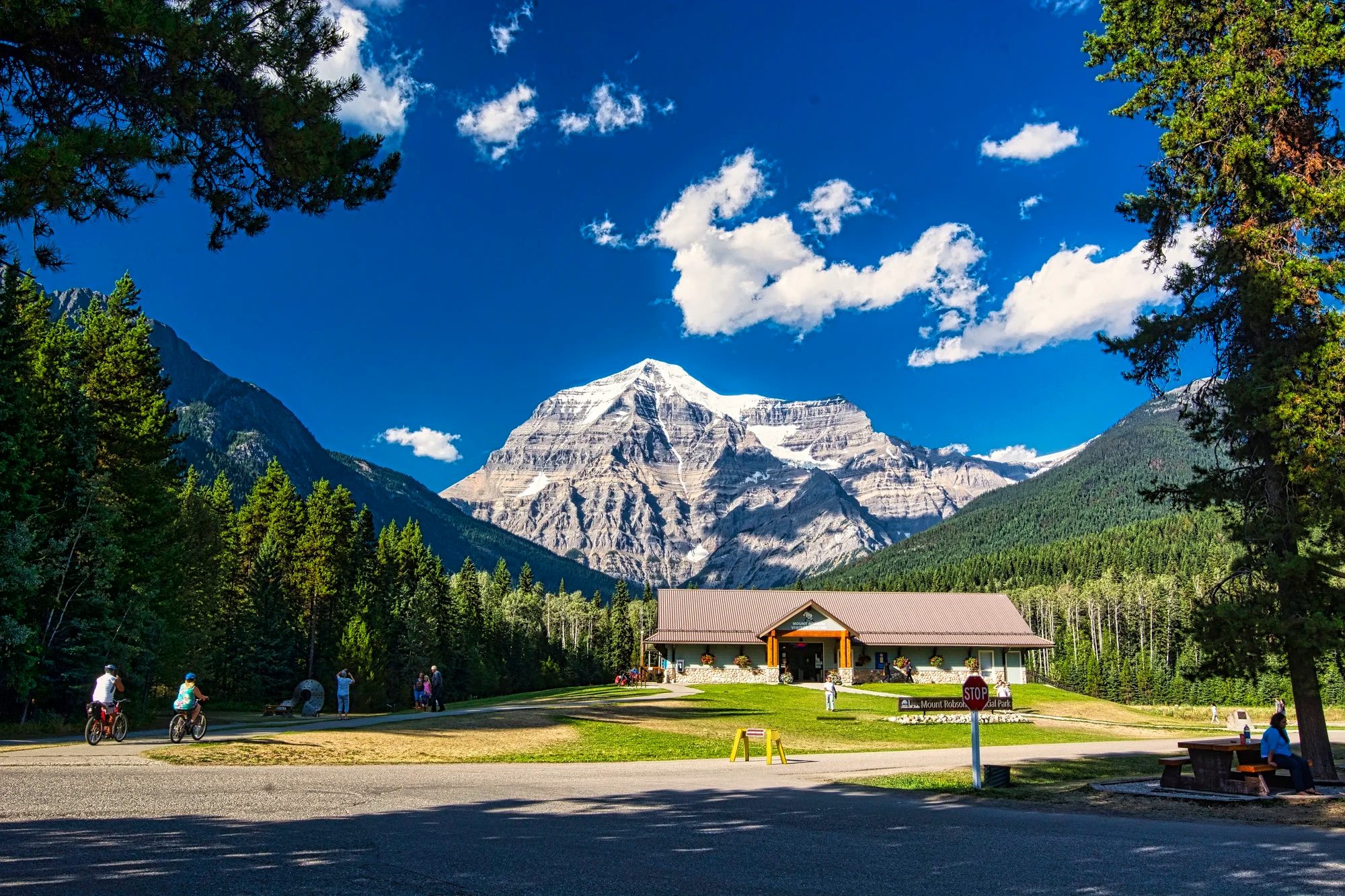
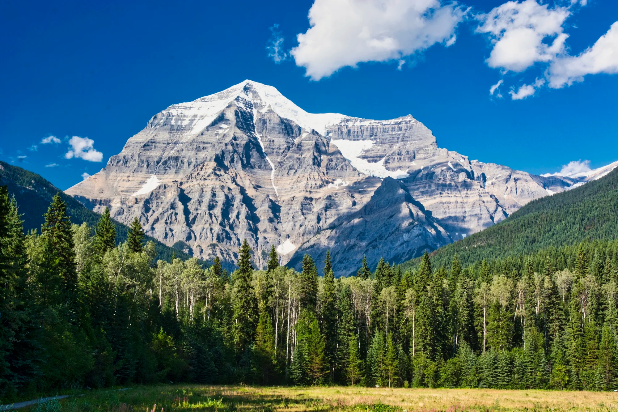
We have crossed North America at least eight times but this was our first road trip to the Yukon. On our 19,000 km odyssey, we skipped the busy Alaska Highway route. Instead, we drove the isolated highway between Fort St. James (FSJ) and Stewart-Cassiar. See the Mt Robson to Furs and Jade Map.

The Last Fur Trade Post, Fort St. James, BC
The Last Fur Trade Post, Fort St. James

We spent the morning in an authentic Hudson’s Bay fur trade post, Fort St. James (FSJ) National Historic Park, as described in the post The Last Fur Trade Post.  The FSJ interpreters are from the town of the same name, which is a First Nations area.  There are no “reservation” signs as this is a self-governing area and reservation has a negative connotation.  The Indigenous call themselves First Nations as they were here first.  Instead of a town hall there is a band office and the band owns many of the businesses here.

One women only works in FSJ during the summer then goes to Victoria BC for the winter. She’s an artist and sells her artwork in Victoria, which apparently is an artist hangout.  That beats living in the typical -40°C winter in FSJ!!  Usually, the temperature is in the low 20s °C in the summer.  It was 31°C when we were there.  So much for no global warming.

Smithers

From FSJ it is 54 km, 36 minutes to Highway 16, better known as the Yellowhead.  The highway is named after fur trader and explorer, Pierre Bostonais.  He was nicknamed “Tête Jaune” (Yellowhead) because of the yellow streaks in his hair.  The scenery was not exciting and eventually we arrived at Smithers.  We stopped for coffee and had a chat with a Dutch Canadian who runs Paul’s Bakery.  Her family emigrated in 1952 after the war.  Smithers looks like it has very dramatic backdrop of mountains.
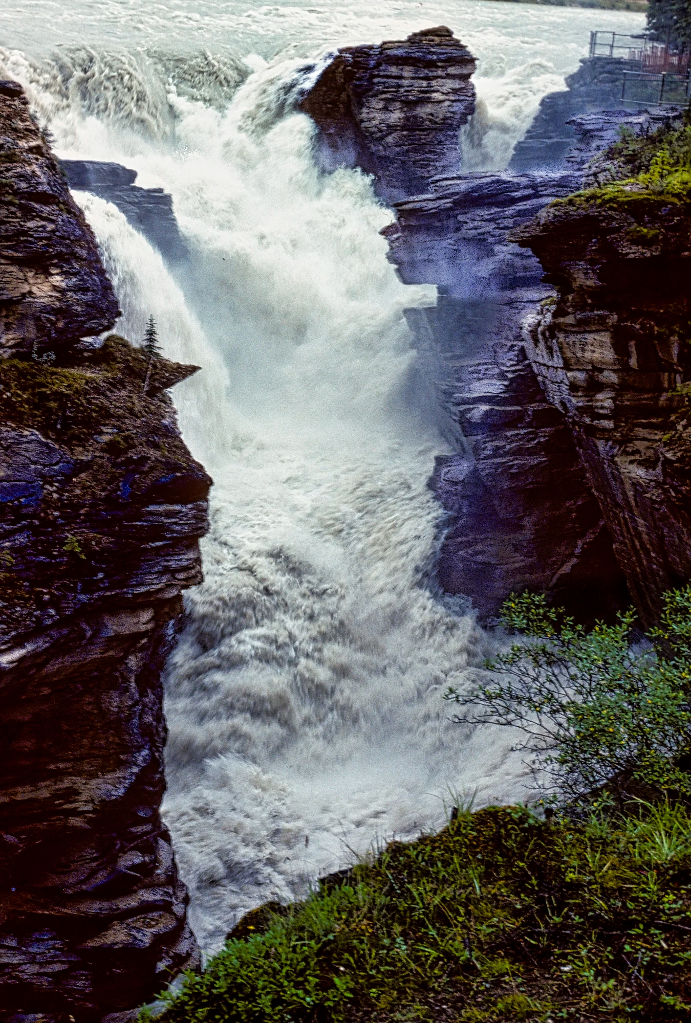
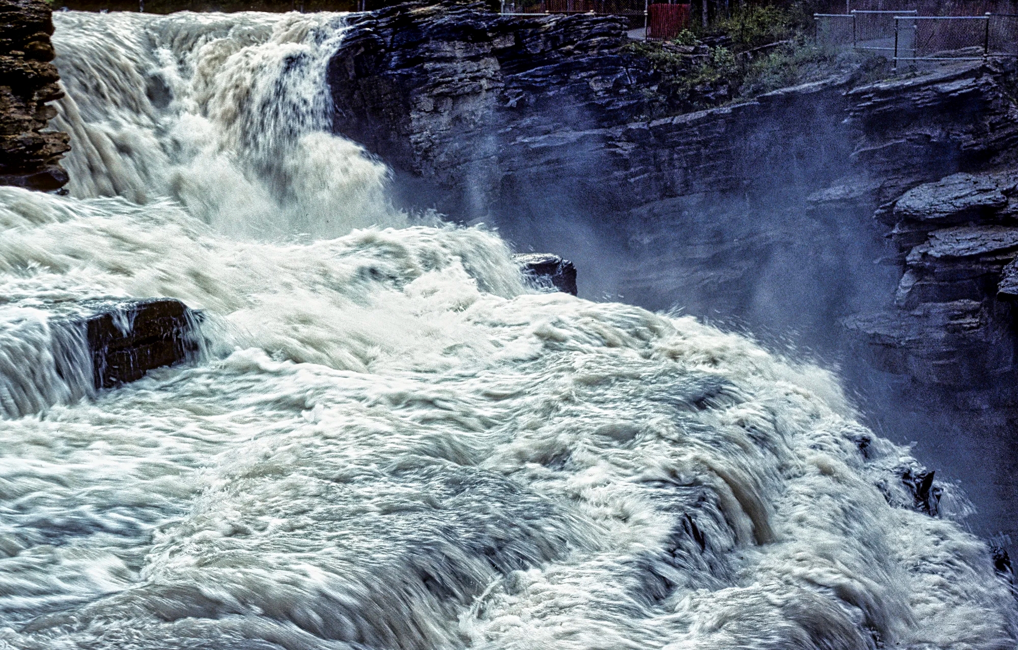
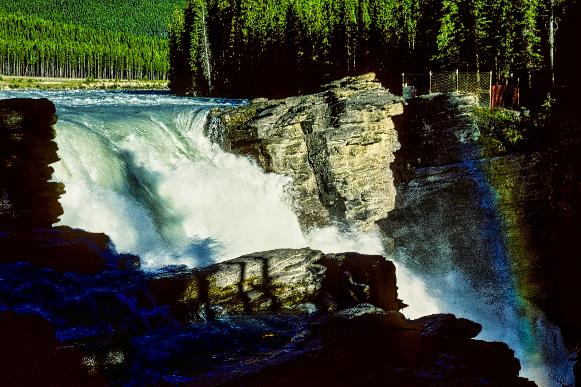
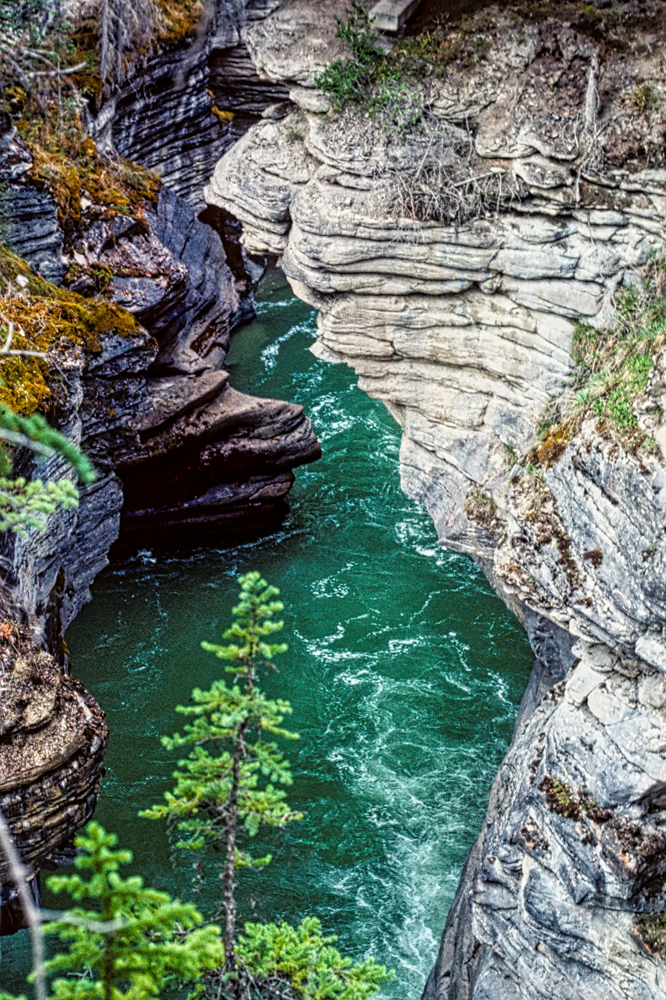
Moricetown Canyon

Glacial-Green Moricetown Canyon, British Columbia
Glacial-Green Moricetown Canyon

The scenery picked up north of town when we stopped to see Moricetown Canyon.  Definitely cross the bridge over the gorgeous green river and walk back on the bridge for dramatic views of the canyon.

New Hazelton

Due to our late arrival, we had to stopover in the village of New Hazelton. Many hotels were already full. One was closed because they had no air conditioning and it was over 30°C. We stayed at the very good 28 Inn Hotel, right on the main highway.

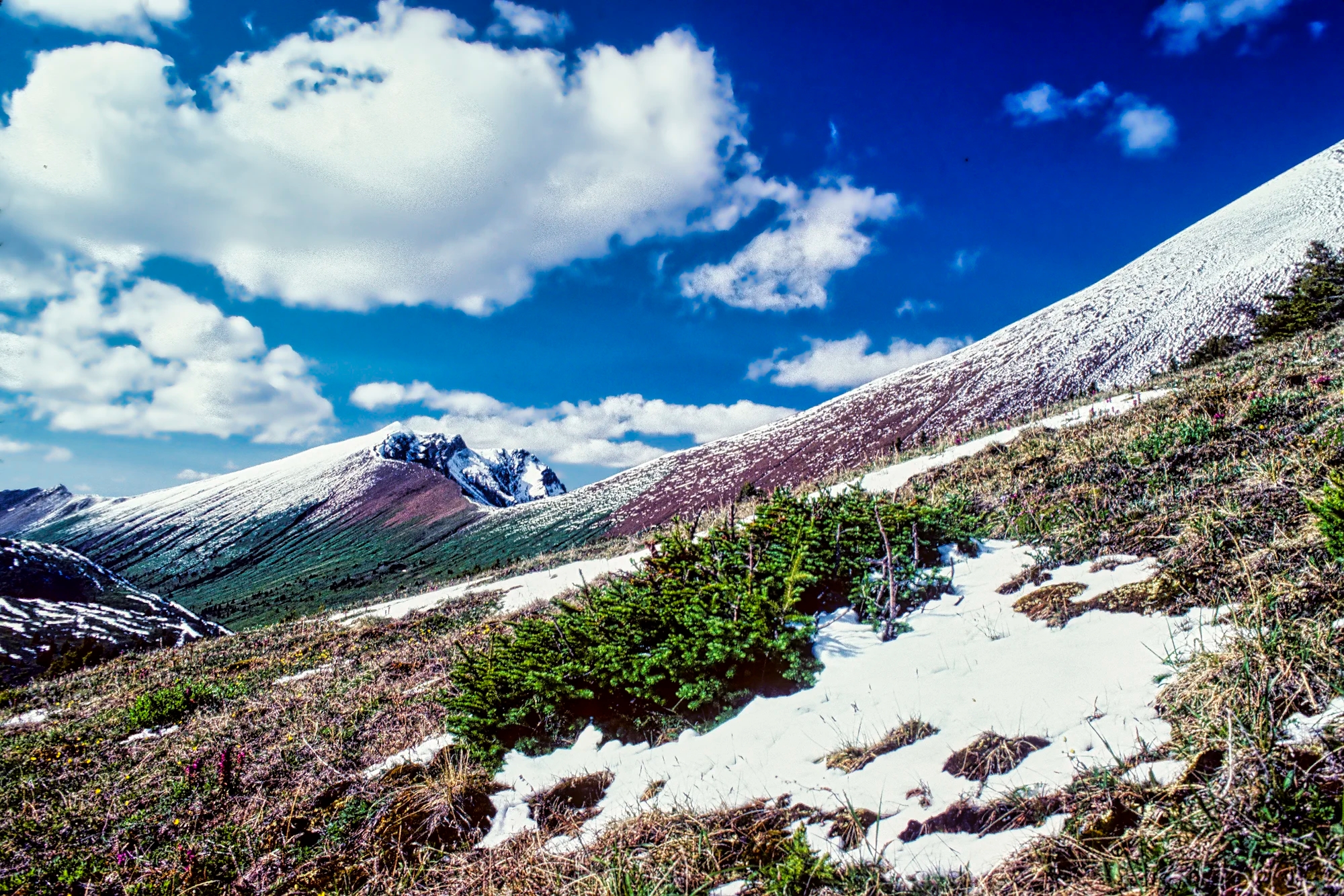
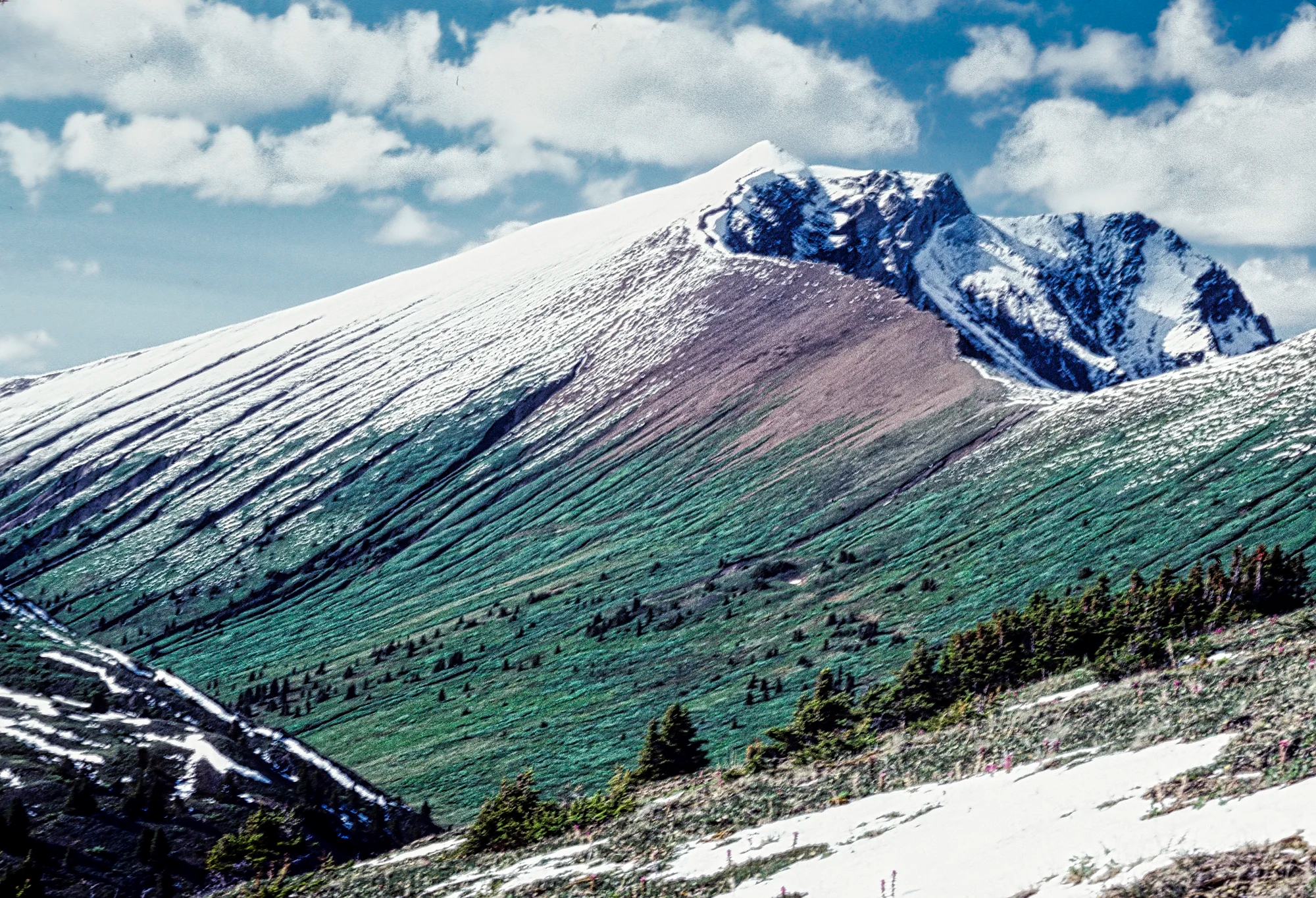
The smoke from the forest fires has followed us all the way north.  There was a new fire right here in the Seven Sisters Park!  We can see the mountains but faintly.

Forest Fires create the Smokey Seven Sisters, British Columbia
Forest Fires create the Smokey Seven Sisters

There were 182 forest fires in central British Columbia (BC) in 2017.  It was caused by the extremely high temperatures, dry lightening and lack of rainfall.  It was the largest set of fires in BC history burning 12,140 sq km (3 million acres)!!!  That is equivalent to burning down all of Montenegro or Jamaica.  Firefighters came from Australia, New Zealand and Mexico! The main north-south highway was closed.

Bulkley River Canyon

Bridge View of Bulkley River Canyon, British Columbia
Bridge View of Bulkley River Canyon

We drove to Hagwilget to see the very deep Bulkley River Canyon.  Crossing the steel bridge is not for those afraid of heights. Imagine crossing the river on a cedar rope bridge used by the Carrier Indians centuries ago!

One sight of interest we missed was the Ksan Historical Village at the end of the road.  We had heard of many other First Nation visitor centres that were excellent (and free) that we planned to see in the Yukon and near Terrace, BC.

The Stewart Cassiar or Highway 37 starts at Kitwanga junction on Highway 16 and ends 725 km later at the Alaska Highway.  Extreme Northern BC has only 106,442 people live in an area 425,626 sq km nearly 4% bigger than Sweden!! There are very few hotels and even fewer gas stations. Gas and food are more expensive along this route so that’s why we restocked in Prince George.

Mountains along Stewart-Cassiar Highway, British Columbia
Mountains along Stewart-Cassiar Highway

The views for the first 200 km were obscured by smoke from the Seven Sisters fire.  I removed the haze from this photo. We also may have seen an eagle (we were too surprised to get a photograph) right on the highway.

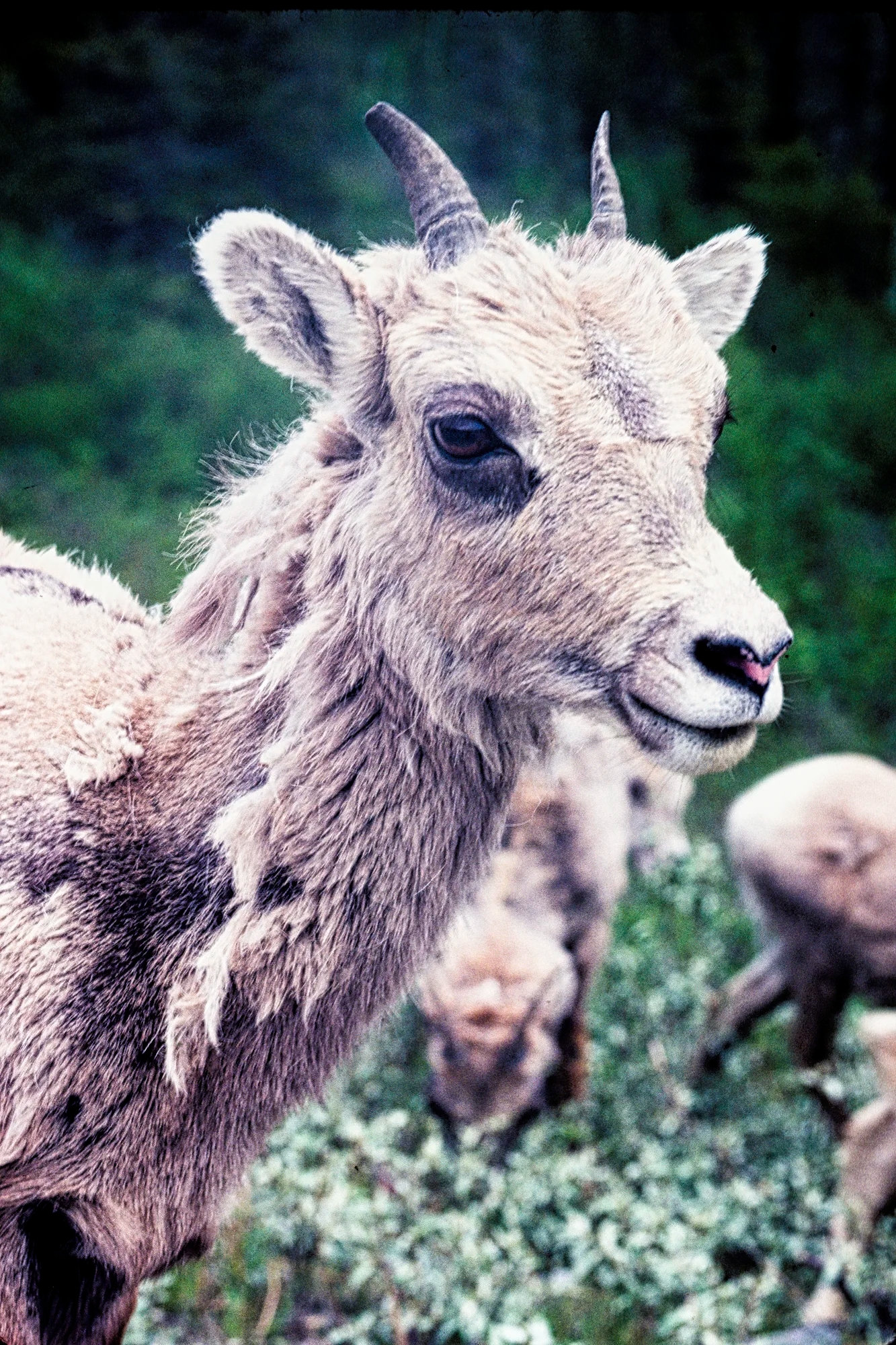
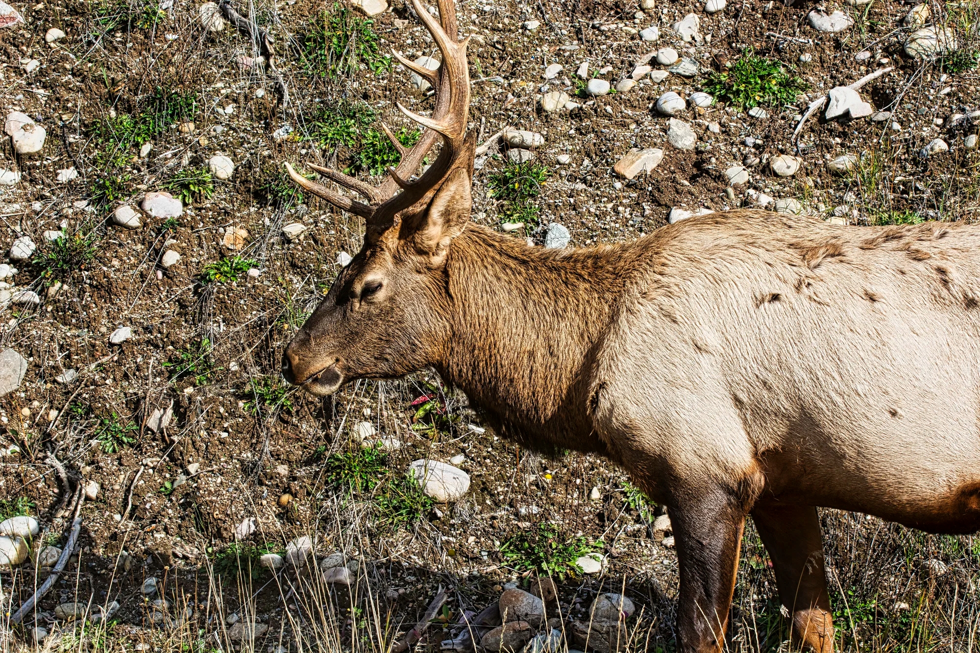
The Caution Bears sign was so true.  This was followed by five sightings of bears!!!  

Bear Stare, Stewart-Cassiar Highway, British Columbia
Bear Stare, Stewart-Cassiar Highway

I opened the window to get a picture and the bear immediately stopped and stared at us.  I wonder if it could smell the food in the car?  No, I definitely did not get out of the car!  There are 135,000 brown bears and 15,000 grizzly bears in all of BC.
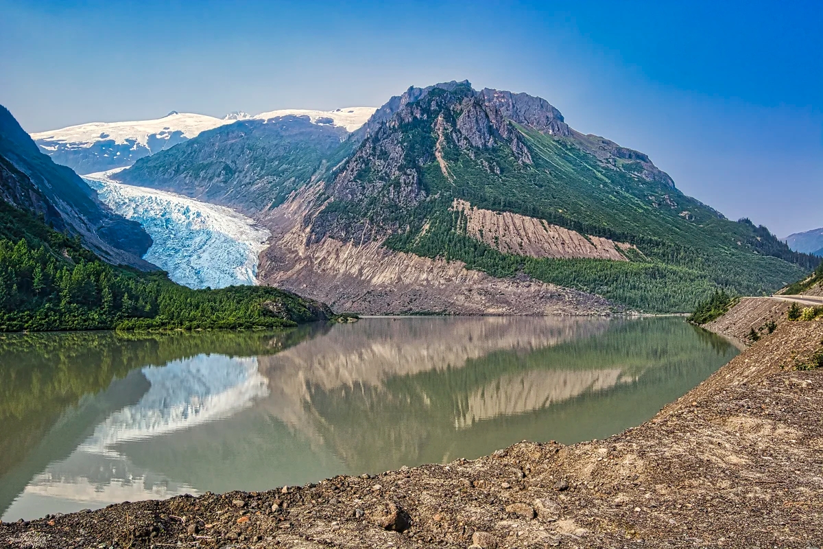
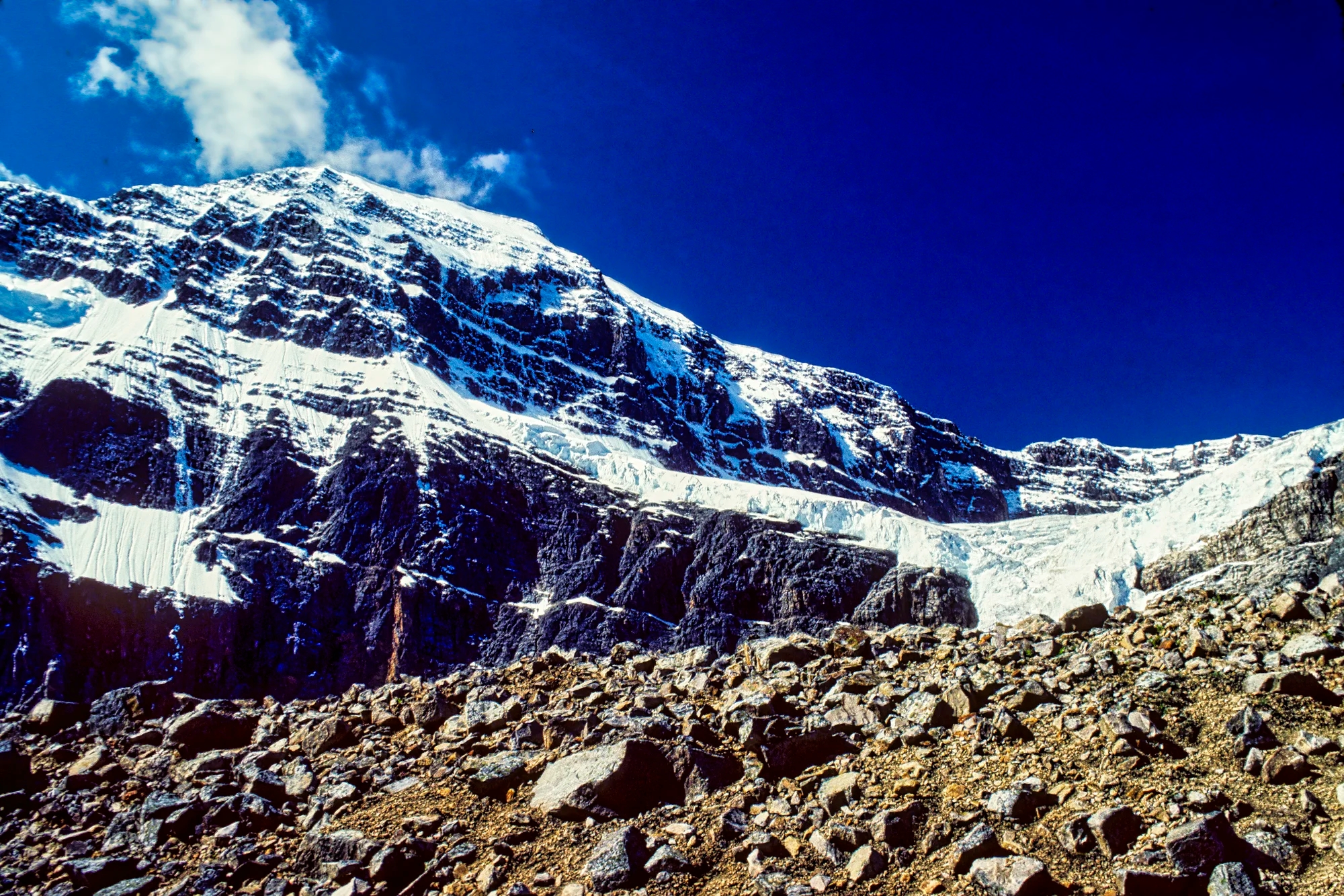
Bear Glacier

Then we did a side road 37A to Stewart. The scenery was sensational as soon as we drove through the coastal mountains.  This road is definitely the most scenic of the whole trip to Cassiar.

Bear Glacier, Stewart-Cassiar Highway, BC
Bear Glacier, Stewart-Cassiar Highway

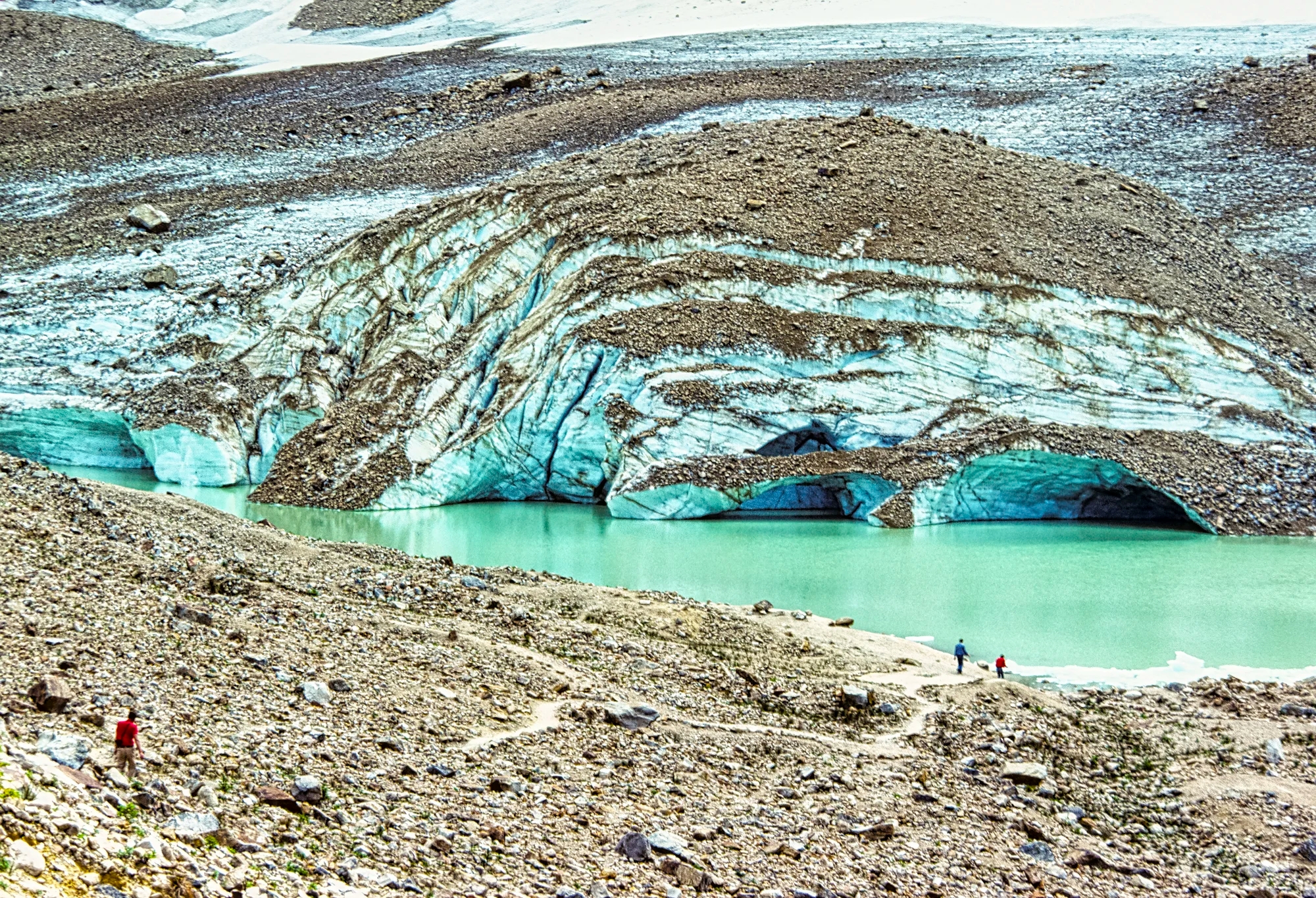
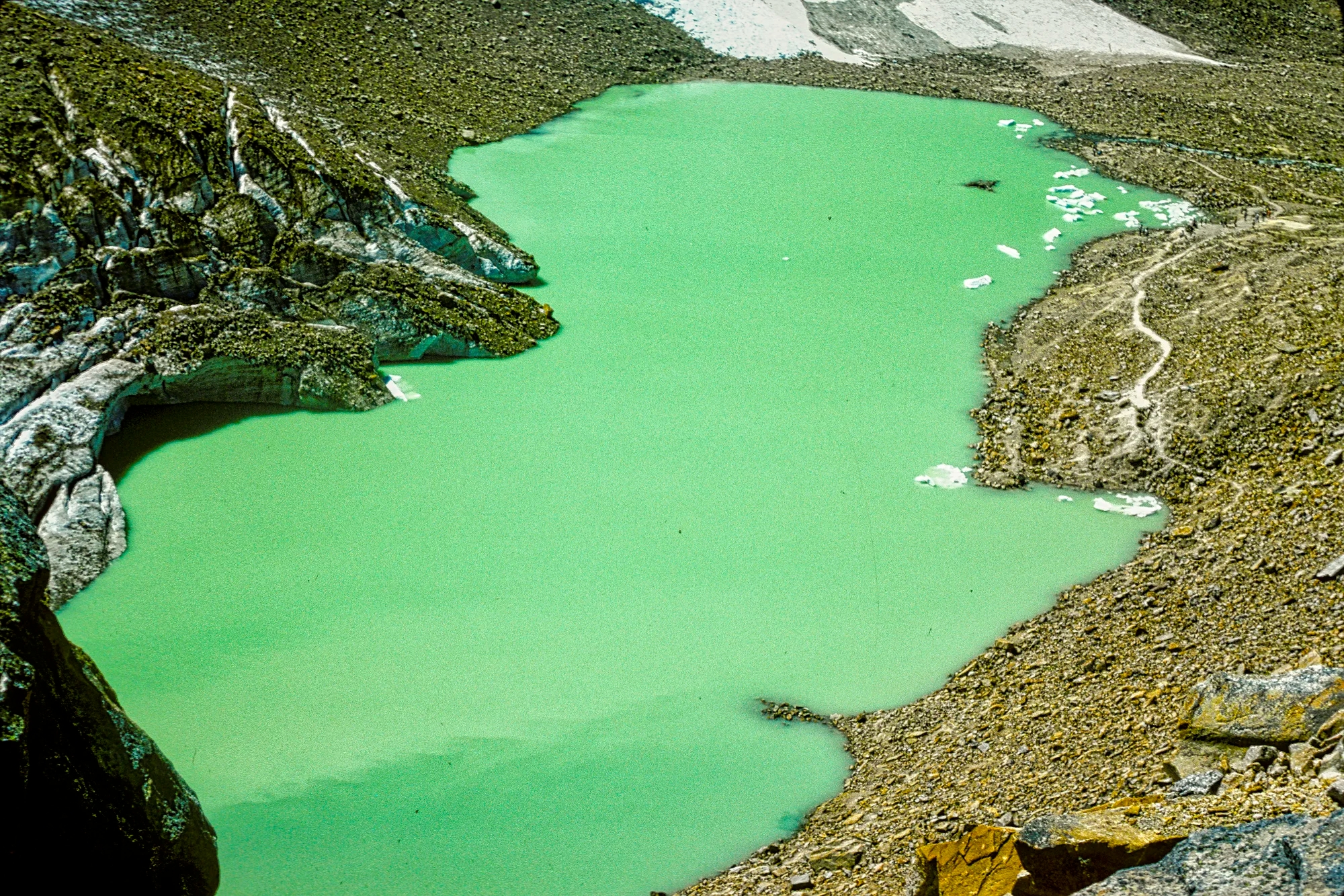
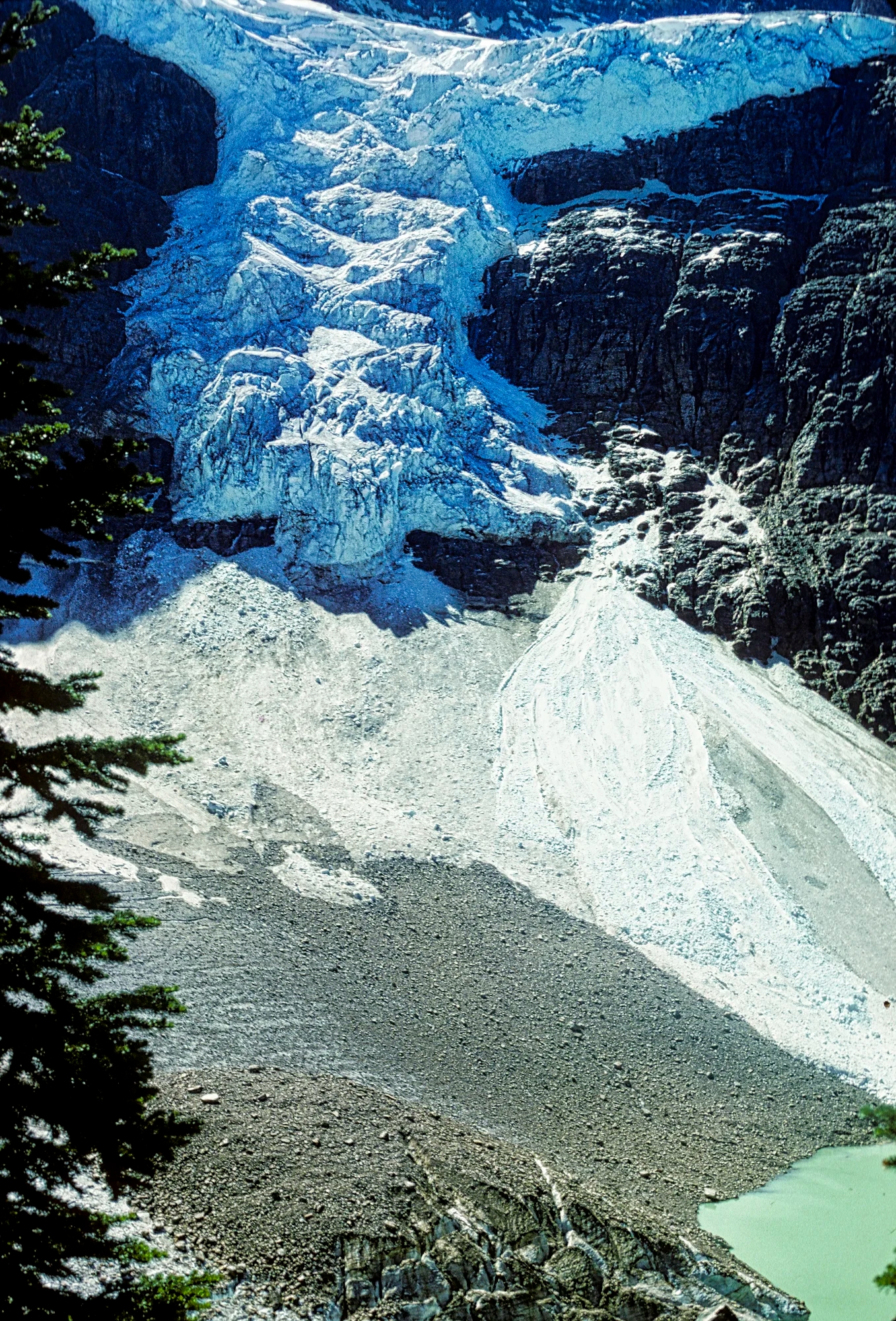
The highlight was equivalent to taking the Inside Passage cruise to Alaska without paying $1000.  Right at road level stretched the dramatic Bear Glacier.  So that’s what the cruise to Glacier Bay Alaska is like.  Wow, we cannot wait to go to there.  We are at same latitude as southern Alaska, so the climate is cold enough to still have glaciers down at sea level.

Bear Glacier, Stewart-Cassiar Highway, BC
Bear Glacier, Stewart-Cassiar Highway

But why are glaciers blue?  It’s the same reason why a thin amount of water (running faucet) appears white but a large amount of water (ocean) appears blue.  The thicker, older ice is compressed by the weight of the glacier so the red light (long wavelength) is absorbed but the blue light (short wavelength) is transmitted.  The longer the path that the light travels in ice, the more blue it appears.

Waterfalls near Stewart, , British Columbia
Waterfalls near Stewart

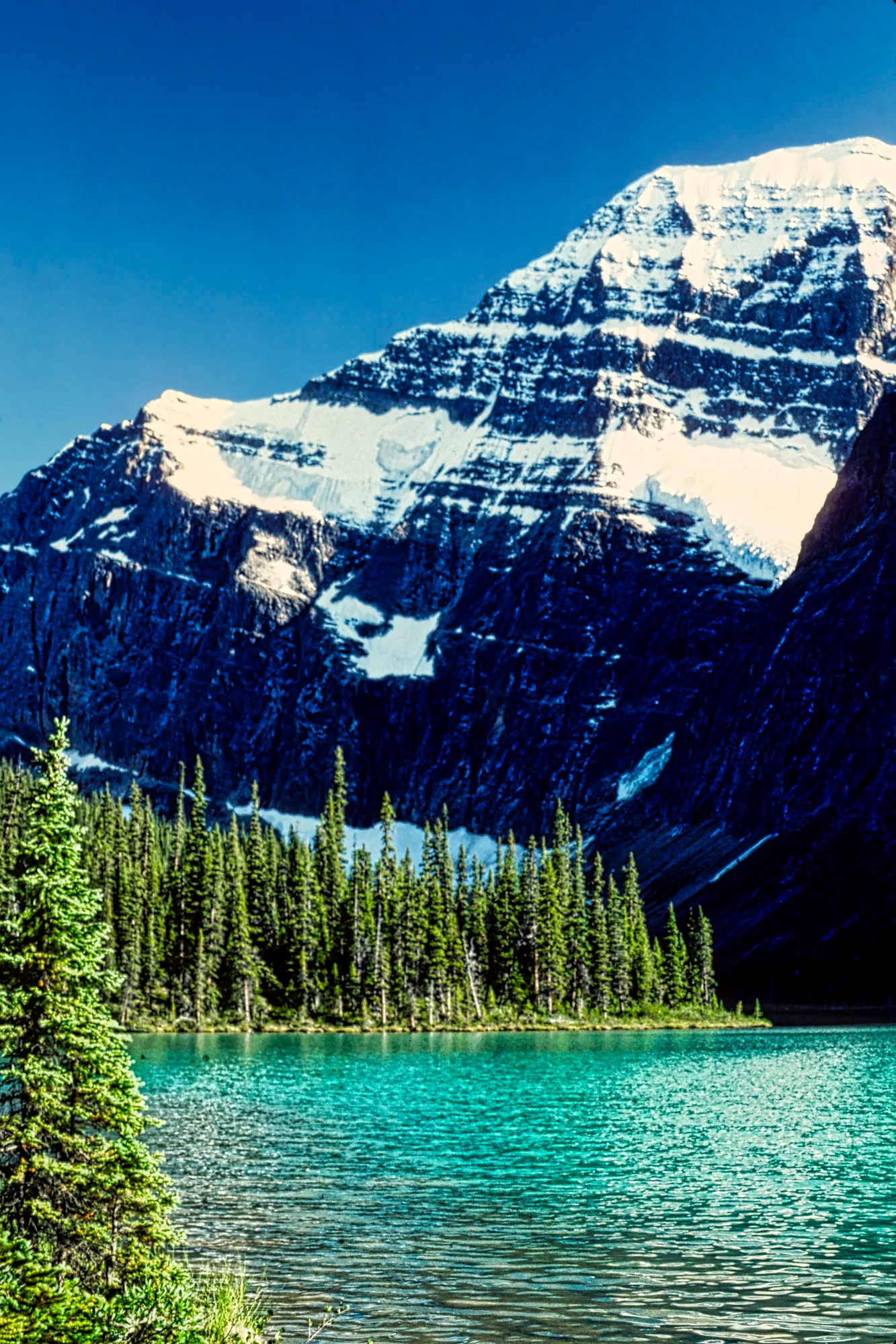
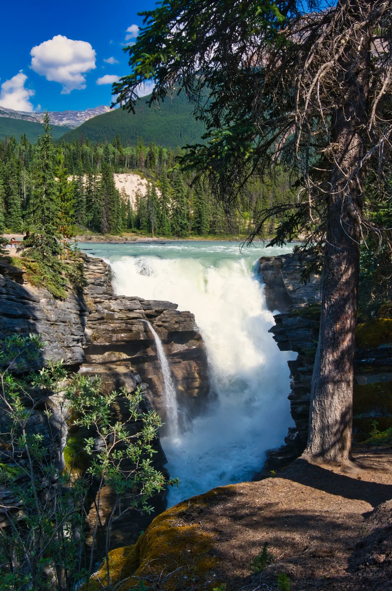
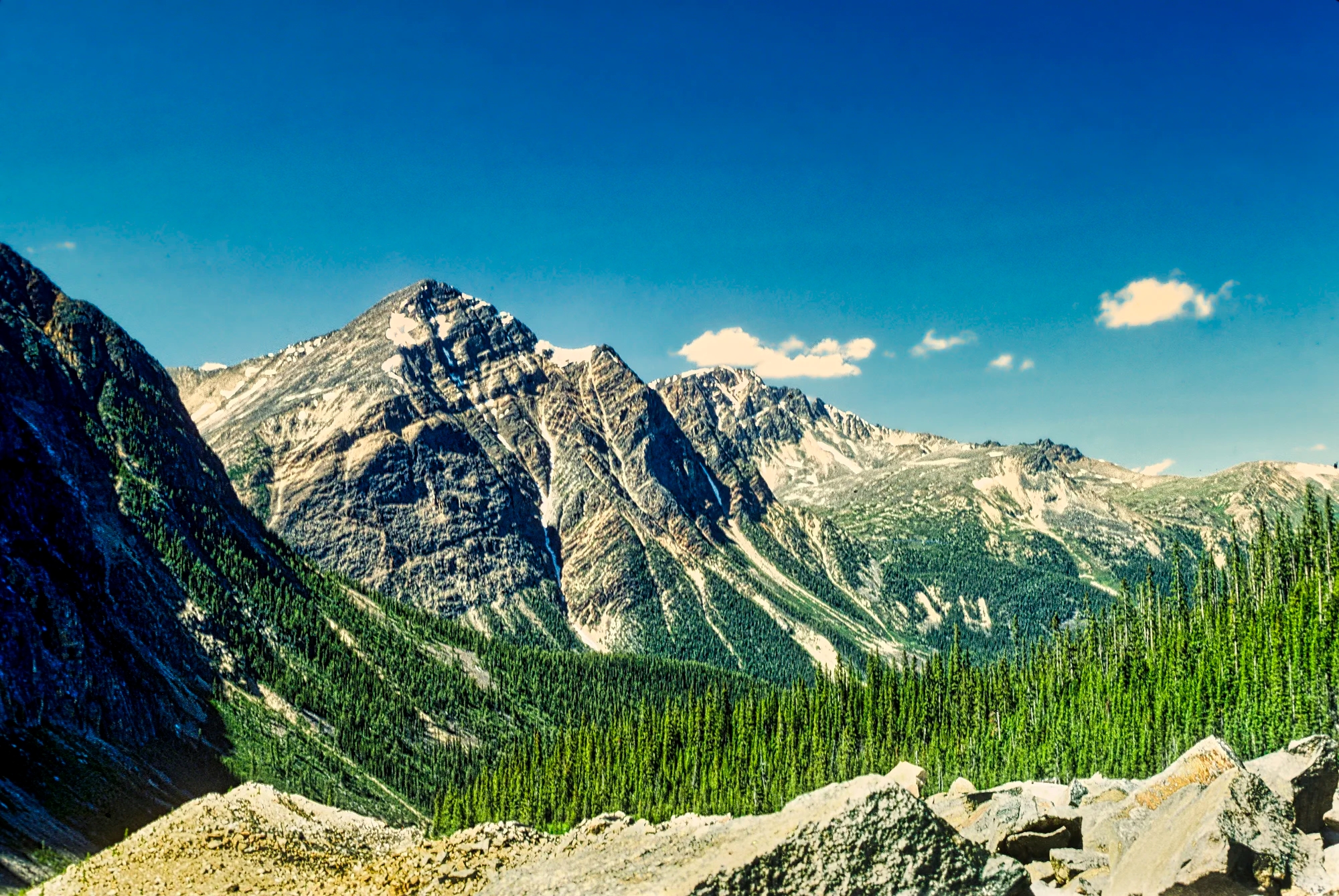
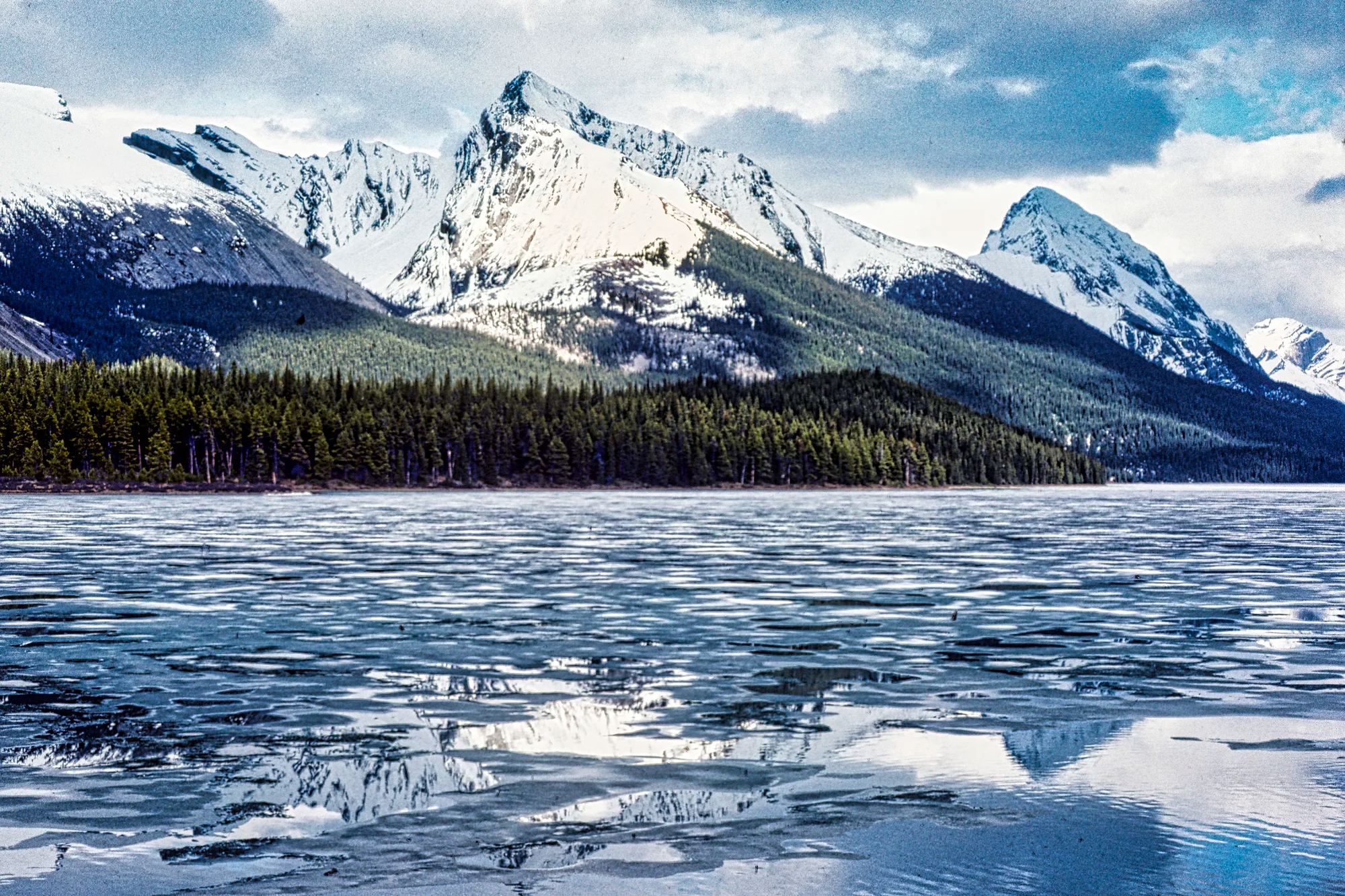
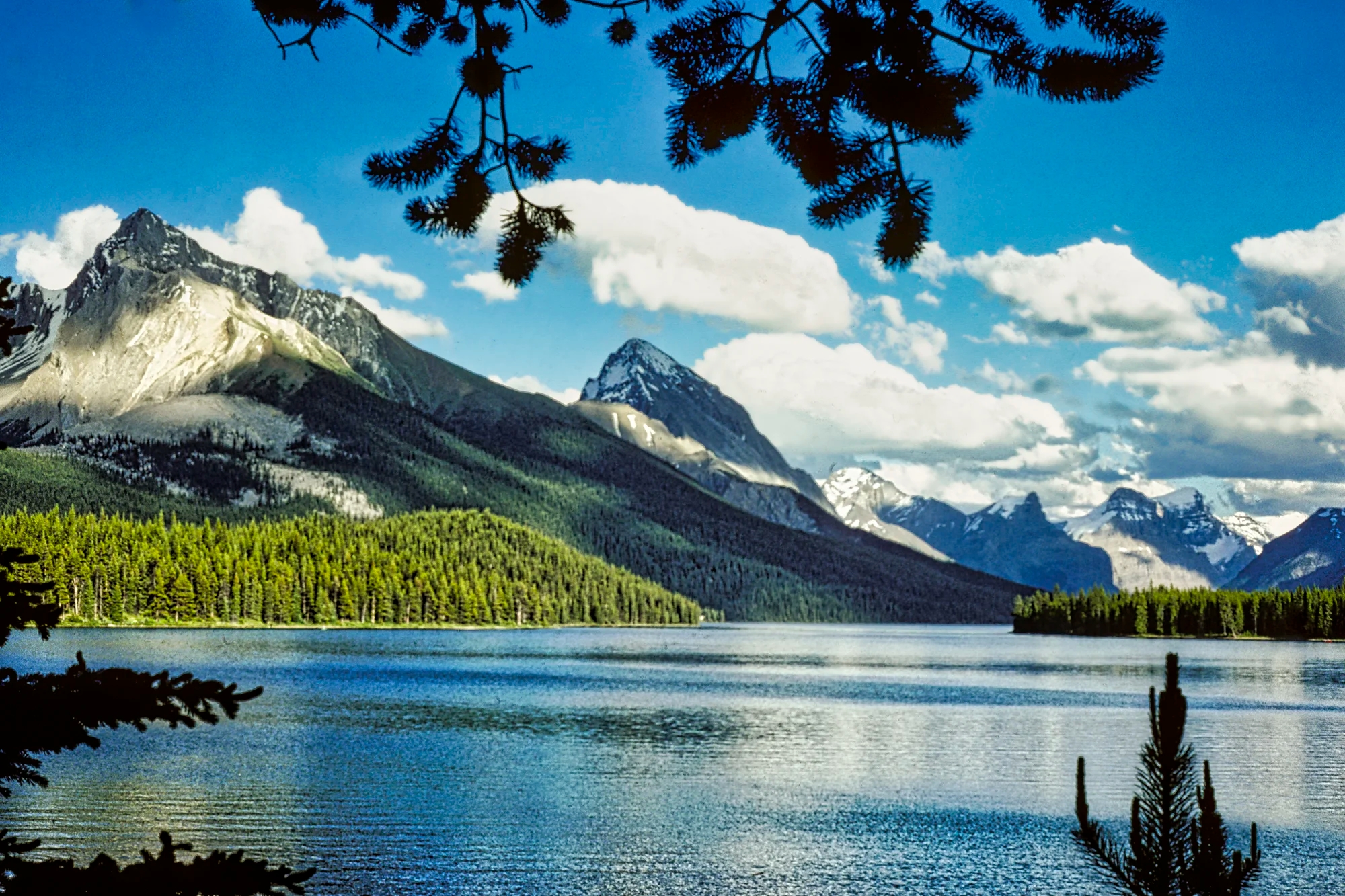
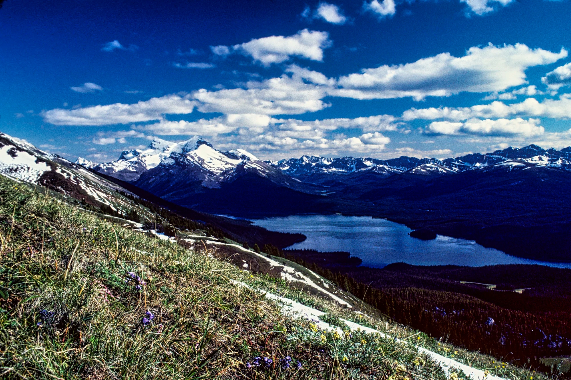
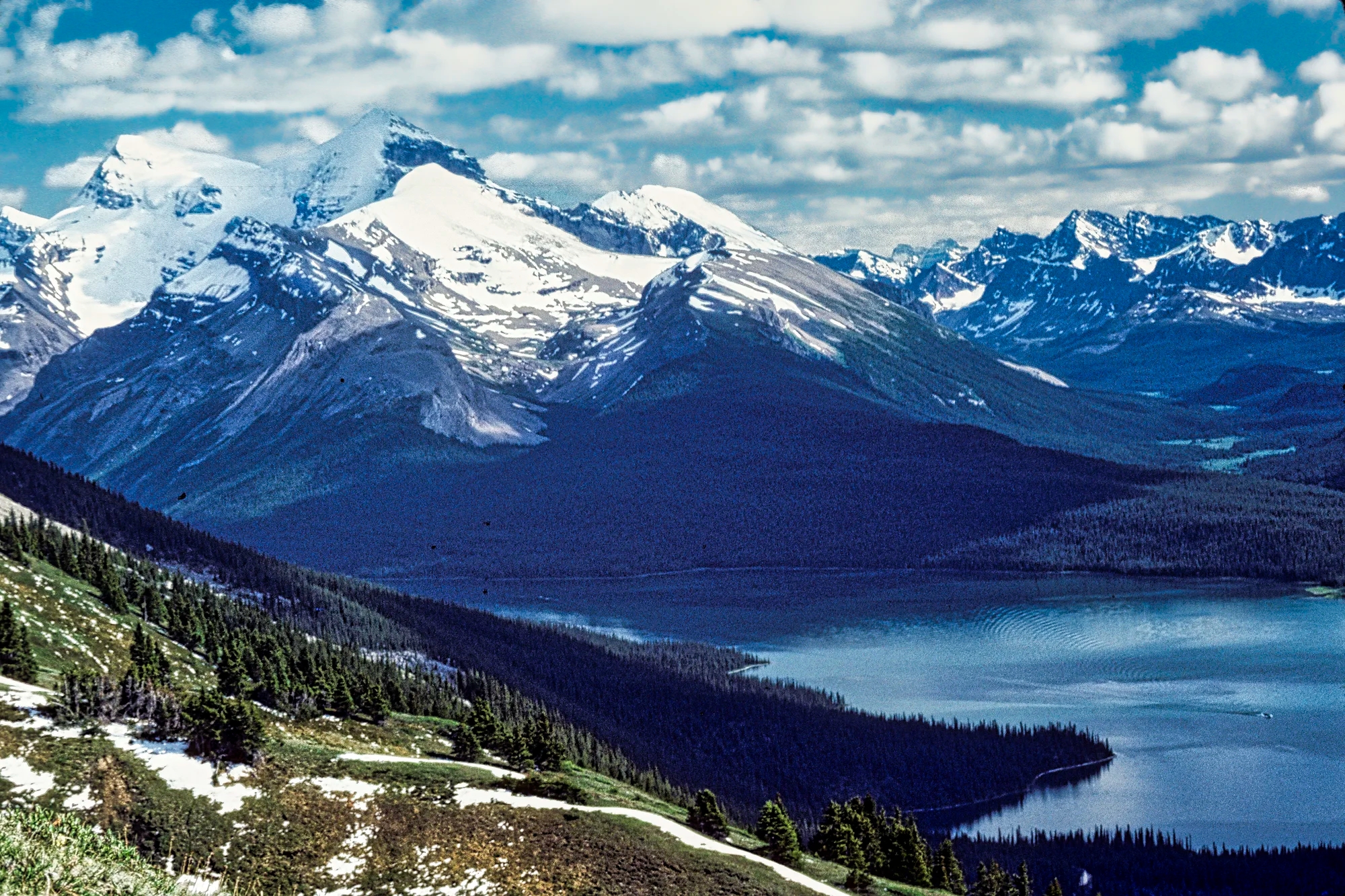
The scenery along the rest of the highway to Stewart was sensational with waterfalls and tall mountains capped with snow and 20 glaciers. 

Waterfalls near Stewart, , British Columbia
Waterfalls near Stewart

However, I wish that Destination BC would install pull-offs near the best views.  You will have to park and walk to take photos.  Be careful as this is a very busy road with no shoulders. 

Glaciers near Stewart, British Columbia
Glaciers near Stewart

The markers for these waterfalls and glaciers on the Mt Robson to Furs and Jade Map are just an approximation but you cannot miss them.

Stewart

Ripley Inn Café, Stewart, British Columbia
Ripley Inn Café, Stewart

At first glance there is nothing much to see in the village of Stewart.  Only about 500 people live here.  So tourist trade workers are imported from BC universities. We stopped for coffee at the Ripley Creek Inn.  The café had a huge collection of memorabilia.  Rooms start at $150. Then I took a photo and noticed that the Kate Ryan building dates from 1920.  So who is Kate Ryan?

Klondike Kate

Kate Ryan Building 1920, Stewart, British Columbia
Kate Ryan Building 1920, Stewart

Katherine Ryan was born in a poor family in Johnville, New Brunswick.  She had been courting Simon Gallagher of the local gentry.  His mother opposed any marriage. Kate not only left but moved to the west coast in 1893.  Then the Klondike Gold Rush began in 1896. Two years later, the 28-year-old Kate decided to become a Klondiker, the first woman to do so.  To earn money, Kate opened up Kate’s Café in Whitehorse.

She was also the first woman special constable hired by the Northwest Mounted Police (now known and still operating as the RCMP). They wanted her to take care of women who broke the law, including prostitutes in Dawson City. She became famous by the nickname Klondike Kate in honour of her legendary exploits.  Kitty Rockwell was a singer, a dancer and a thief.  She was also one of her prisoners.  To get revenge on Kate Kitty took on the moniker Klondike Kate and associated it with all the immoral things Kitty did to damage Kate’s reputation.

In 1903 Kate became the first female gold commissioner.  She retired in Stewart, renting out this store-front to businesses.

Salmon Glacier

Salmon Glacier is one of our regrets as we had not heard about it until some Americans mentioned it during our trip.  The majestic Salmon Glacier can be viewed from the Summit Viewpoint via a 37.4 km (23 mile) gravel road only from early July to late September.  The road travels from Stewart BC into the USA and back into Canada.  The fifth largest glacier in Canada is 14,000 years old. Download the self-guided sightseeing tour, Salmon Glacier Auto Brochure.

Mount Edziza

Mount Edziza is an example of a dormant volcano covered by a glacier.  Because it’s in an unpopulated region, it is not as well monitored.  Mount Edziza Provincial Park was created to preserve the volcanic and culture treasures unique to the northern British Columbia area.

After seeing photos and reading about the incredible hiking, we were getting really excited to go there.  We saw pictures of the Spectrum Range hike.  Who knew such a spectacular site existed in Canada?

Quebrada de Humahuaca (Rainbow Mountains) near Purmamarca, Argentina
Quebrada de Humahuaca, Purmamarca, Argentina

We had seen a similar colourful landscape in our son’s pictures above of Quebrada de Humahuaca (Rainbow Mountains) near Purmamarca, Argentina.   Daniele Mitchell was one of the top ten birders in British Columbia and has just started to blog about his birding trips.

Then we found out that there is no vehicle access to the park.  You had to go on a group tour by seaplane then trek 9 days at a cost of over $3000 per person.  Major disappointment!  Message to Destination BC, if you build a road ending about a day hike away from the Spectrum Range or at least to a high up viewpoint of it, they will come.  This would increase tourism to Northern BC.

Volcanoes of BC

Who knew that there are hundreds of volcanoes in BC?  Well, BC is part of the Pacific Ring of Fire In fact, many famous mountains are actually dormant volcanoes; such as, Stawamus Chief (Squamish), Mt Garibaldi and Black Tusk (Garibaldi PP).  But the biggest danger of eruption is a volcano only 72 km by air and 100 km by road from Vancouver.  It is called Mt Baker (Washington).  Borders are no barrier to the force of nature.

The majority of the eruptions happened in the Miocene Era (6–10 million years ago), the Pliocene Era (2–3 million years ago), and most recently in the Pleistocene Era (10,000 years ago).  Deep layers of ash and microscopic glass shards have been found as far away as Newfoundland, Ireland and Northern Europe!

The stone obsidian is highly valued for its cutting qualities and was used by local First Nations to make tools and weapons.  It was traded for other goods as far away as Alaska and northern Alberta.

Mount Edziza is the main source of this naturally occurring glass since it requires the heat and high pressure of a volcanic area. Obsidian ranks 5.0 on the Mohs scale of hardness with a high of ten (diamond).  Steel rates a 4.0 score!

Dease Lake

Cassiar Mountains, BC
Cassiar Mountains

As a result of our Stewart side trip we did not get as far as planned.  So instead of camping at Boya Lake Prov. Park, we stayed at a hotel in Dease Lake.  Northway Motor Inn was highly rated by Google (#4.3) and was very nice with lots of tourist info in the shared kitchen, which provides a microwave and coffee maker.   NB: you need wifi in your hotel as there is no cell service along the Stewart Cassiar Hwy.  The next part of the highway we saw the Cassiar Mountains above.  Do they look like volcanoes?

Cassiar

Cassiar Mountain Jade Store, BC
Cassiar Mountain Jade Store

It takes 60 million years of high heat and pressure to form jade. So it is found in volcanic subduction zones where two geological plates collide. BC jade can be found in rock deposits or alluvial boulders that have been moved by glaciers over time.  Jade comes in many colours.  Deese Lake to Cassiar BC is the world’s largest producer of nephrite jade.

Multi-coloured Jade table, Cassiar Mountain Jade Store, BC
Multi-coloured Jade, Cassiar Mountain Jade Store

The BC jade market is booming as the demand for “emperor green” color nephrite is highly sought after in the Chinese market.  The deposits of green nephrite are found only in three locations in the world: China, Siberia and British Columbia.  Jade was initially prized for its hardness and resilience.  Canadian jade has a Mohs hardness of 6.5 to 7.0. However, it became more prized due to its beauty and use for ornaments and jewellery. Thanks to Chinese demand, rare imperial green jade is the most expensive gem in the world, worth more than diamonds. So don’t expect to be able to buy artefacts at the Cassiar store.  This is the green gold rush.

Boya Lake

Boya Lake Provincial Park, BC

The Boya Lake Provincial Park (PP) has a very nice campground along a pretty green lake. However, there are only low level mountains as a backdrop. So it was disappointing. It would have been a great stopover as the last stop before entering the Yukon, the subject of our next post.

We met a couple from Quebec City that came to Yukon a couple of years ago. They fell in love with Yukon and found out that it was easy to move there. Lawyers were in high demand so it was easy to find a job. You never know how travelling can affect your life!

Here are the posts describing our road trip from Northern BC to the Yukon, as well as two of our customized itineraries (Google Maps) with all of the points of interest pinned for you. Heading south do not miss Fort St. James:

Heading north do not miss Miles Canyon, Whitehorse, Dawson City and the Klondike Highway:

Mt Robson to Furs and Jade Map

Yukon Itinerary Map

Jasper & Mt Robson — 7 Best Places to Enjoy

Our recommendations are not influenced by affiliate links – we have none. Our content and advice is derived from our personal expertise, experience, and knowledge based on living in Alberta for ten years. All the places recommended in this post are pinned on our Rocky Mountain Itinerary Map.  The place names are appended with the Google Maps Rating (G0 to G5).

Mt. Edith Cavell and Cavell Lake

For snowy sierras, gorgeous glaciers, exciting hiking trails, and spectacular turquoise lakes — it is hard to beat the Jasper to Mt Robson itinerary. Jasper National Park (NP) and Mt Robson Provincial Park (PP) are a lot quieter than Banff NP. Even the town of Jasper is much more laid back than Banff.

One recurrent question is “should I Visit Banff or Jasper NP?” Unfortunately, there are too many tourists thinking that Banff the town and Lake Louise are the ultimate destinations of the Rockies — they are not! They have been spoiled by over-tourism, bus-only roads, expensive parking, and long waits for shuttle buses. Banff NP has more than 4.5 million visitors per year, about the same as overcrowded Yosemite NP, but everyone is going to the same three places in Banff NP.

By contrast, Jasper NP has approximately 2.5 million visitors per year, a bit less than Yellowstone NP. Jasper NP gives you a chance to enjoy equally spectacular mountains and views as Banff without the hordes of tourists.

Athabasca Falls

The special aspects of the Canadian Rockies are the glittering glaciers, vibrant turquoise lakes, wicked waterfalls, and superb hiking trails. These are the key features of the Quintessential Canadian Rockies.

Our advice is not based on a single tourist trip. Our recommendations are based on our extensive experience living in Alberta for ten years. We are avid hikers, nature lovers and photographers (all photos are my own). The Rocky Mountains were our weekend playground as well as vacation destination.

Since most tourists are on a short visit, we are highlighting only our favourite hikes and viewpoints. We have pinned additional places on our custom Rocky Mountain Itinerary Map should you have more time. More advice on itinerary planning can be found at the end of this post.

This section is a direct continuation of the Icefield Parkway Itinerary and the best add-on to that itinerary if you have more time. The first stop is located at the junction of the Icefield Parkway (Highway 93) and Highway 93A, 32 km before of the town of Jasper.

Athabasca Falls

Athabasca Falls

The Athabasca Falls are a spectacular and popular place. Due to tourist deaths in the past, all the pathways are railed or fenced. The downside is that there are narrow congestion points.

As with any popular tourist destination, you should avoid visiting between ca. 10:30 to 15:30 hours during peak season. The parking lot can also be very busy. Spring and early summer days are very long in Alberta. Sunset is as late as 22:00 hrs! One year, when my in-laws came to visit us in the Rockies, we did a morning and afternoon hike. Then we said do want you to do an evening hike? They said yes.

Athabasca Falls Closeup

Athabasca Falls is one of the more dramatic waterfalls in the Rockies – you can feel the power of the water being forced through a narrow gap. 

Athabasca Falls Closeup

Many millennium ago, the then much longer Athabasca Glacier carved through layers of softer limestone. Now a very wide river has to squeeze through a narrow gap.

Athabasca Falls

The roaring water comes from meltwater of the Columbia Icefields. The 1231 km Athabasca River heads north through the Fort McMurray tar sands (heavy oil), joining the Peace and Mackenzie Rivers to eventually reach the Arctic Ocean.

Athabasca Falls Canyon

There is a path to the right that leads along the exit canyon carved through the limestone strata. The silt in the glacial green river carved potholes creating the curvilinear walls of the canyon.

One year we brought my father-in-law on this walk. He was so concerned by the erosion around the decaying Highway 93A bridge over the canyon that he wrote a letter right away to draw attention to the problem. He was a chief engineer. I don’t know if the letter had any effect, but within two years the bridge was completely rebuilt.

Mt. Edith Cavell

Mt. Edith Cavell and Cavell Lake

This panorama of Mt Edith Cavell is one of my favourite views not just of this mountain but in all of the national parks. It also comes with a gorgeous glacial green Cavell Lake. Most people do not see this lake as you have to hike part of the Tonquin Valley Trail.

N.B.: Cavell Road is a 14 km (8.7 mile) narrow road that does not allow trailers or motor hies. It is only open seasonally – typically mid-June to the end of October. This depends on snow so in 2023 the road opened on June 23. Check with Parks Canada web site given in the Reading Section below.

Mt. Edith Cavell and Angel Glacier

This is the view most tourists get of the mountain. What’s more intriguing is its name. The Indigenous people called it “White Ghost”. The fur trade voyageurs called it Montagne de la Grande Traverse, a landmark to the Athabasca Pass. Now the mountain is named Edith Cavell, a 49-year old English nurse who worked in German-occupied Belgium and gave assistance to soldiers of all nations during World War I. She was executed by the Germans during World War I (1916) for “treason” (even though she is not German). She admitted that she helped Allied soldiers escape from occupied Belgium to the Netherlands. Edith Cavell became the best known casualty of World War I due to a British propaganda campaign. There was such a furor that many monuments and remembrances were made around the world. Canada named a mountain after her.

Angel Glacier Hikes

Mt Edith Cavell also comes with its own guardian angel, Angel Glacier.   

Cavell Glacier and Tarn

The Path of the Glacier Trail goes to a mint green glacial pond at the foot of Cavell Glacier, with Angel Glacier high above looking down upon us.

Angel Glacier, Cavell Glacier and Tarn

Cavell Glacier is a remnant of an ancient glacier at the bottom of the mountain. The rock-strewn ice is melting into the glacial tarn. I spent an inordinate amount of time taking photos of the icebergs floating in the tarn. Note that glacial ice reflects various shades of blue, especially in the shade areas. The ice fall above Cavell Glacier is the separate Angel Glacier. But it will no longer look like this as it has since melted back.

Cavell Glacier and Tarn

Cavell Pond has a mint-green colour but don’t expect it to look this big! A rock and ice fall roared down the valley flooding and damaging the valley including the lower return trail. Due to the danger of falling rock and ice, Parks Canada still advises you to stay away from the cliffs and glaciers.

Cavell Meadows Trail Junction

Cavell Meadows Trail and The Path of the Glacier are the same trail until this point. A left hand turn climbs steeply to Cavell Meadows where there are alpine flowers from mid-July to mid-August.

As this is an alpine area, there are unimpeded views of the glaciers and mountains.

You do not have to hike the whole trail to get the best view of Angel Glacier right at your level. In fact, we often took friends and family just to get to this point.

This is a great place for a picnic. It comes with stone seats and great views.

Franchère Peak from Cavell Meadows, Jasper NP, AB
Franchère Peak from Cavell Meadows

One can see the the whole valley from here but note that Cavell Lake is hidden. Look for pikas and marmots in this area.

Icefield Parkway (Hwy 93)

The last part of the Icefield Parkway from Athabasca Falls to the town of Jasper is a good area to see wildlife, especially wapiti and mule deer. Bears used to be common before the bear-proof garbage bins, and bans on humans feeding the wildlife or leaving coolers on picnic tables. Highway 93A, including the campgrounds, are also good places for wildlife.

Athabasca River Bridge

One sight we never gave much notice before is the bridge over the Athabasca River. When you visit a place at mid-day the lighting is harsh. Evening lighting made the views look special. Park on the shoulder before (not on) the bridge and walk part way across for spectacular views at sunset or late evening lighting.

View South of Athabasca River and Mt. Kerkeslin

The view south shows Mt. Kerkeslin, with the same syncline (upturned strata) literally as the Big Bend on the Icefield Parkway.

View North of Athabasca River and Pyramid Mountain

The view northeast is dominated by the appropriately named Pyramid Mountain. In reality, it won’t appear this close as a moderate zoom lens was used for this photo.

Icefield Parkway in Autumn

Icefield Parkway Autumn Views

We ended our October trip with these views along the Parkway. The roads were lined with golden-leaved trees.

Icefield Parkway in Autumn

The mountain looked like a cake with sugar icing highlighting every strata.

There is one unusual thing to see along Highway 93A, which veers right 7.4 km (4.6 mi) south of the town of Jasper. Drive on Highway 93A for 14 km (8.8 mi) to the Valley of the Crooked Trees. It can also be reached via the Athabasca Falls junction with the Icefield Parkway and continuing on for 10.3 km (6.4 mi).

Lodgepole Pines, Valley of the Crooked Trees

Lodgepole pines are slender, tall, vertical pines. This forest was felled by a forest fire. But lodgepole pine cones are fire resistant. So new trees grew up and had to twist and turn to work their way up past the fallen spars. It’s a great place for family photos framed by the twisted trees.

Calypso Orchids

We once saw calypso orchids, also called Fairy Slipper or Venus Slipper. That was exciting as we never associated the Rockies with orchids! They grow amongst the Lodgepole pine needles at high elevations from May to July. Because the mountains are so high, you may not realize that the elevation of the town of Jasper is 1825m (5988 ft).

Life is Short for Rocky Mountain Flowers

In the spring it is amazing to see wildflowers bloom as soon as the snow starts melting. Hiking trails such as Cavell Meadows and Opal Hills are the best places to see wildflowers during the summer – generally mid-July to August. Additional flowers you can see are described in 15 Things you Must Do in Banff and Lake Louise.

Juvenile Bighorn Sheep

This last stretch of the Icefield Parkway provides a good chance of seeing wildlife. Hiking, side roads, camping, dusk and dawn increase the probability of seeing wildlife. You can see Rocky Mountain sheep, goats, marmots, wapiti, deer, pika, and bears if you are (un)lucky!

Wapiti near Wapiti Campground

Elk in Alberta are called Wapiti by the locals and Parks Canada. Wapiti is the Shawnee name meaning “white rump”.

Many tourists used to get mauled by bears and even wapiti. The cardinal rule is never get too close to foraging wildlife. My technique is to move slowly and keep some distance. If they keep eating you are safe; if not you have gone too close. When we visited Yellowstone NP, we saw tourists rushing towards bears and buffalo to get a selfie. I never saw such aggressive actions in the Rockies, but it does happen and people get hurt.

Middle Class Marmot

The animals we saw more in Jasper NP than Banff were bears — we even saw one suntanning on its back on a picnic table one time! Marmots and pika are common in rock pile areas like Mt. Edith Cavell. This fat specimen must be a middle class marmot.

One plus in Jasper NP is that the town of Jasper is centrally located. One can easily drop in for a coffee or other treats as you transverse from one area to another. Jasper is a less commercialized small town that happens to be surrounded by a national park rather than a town built for tourism. BTW, the landlord of all three towns in the Rockies is Parks Canada. The towns cannot be expanded and require approval for all changes desired.

Lake Annette

There are five cute, small lakes very close to the town of Jasper. Some of them have a backdrop of Rocky Mountains. Lake Beaufort is home to the famous Jasper Park Lodge. This is not a must-see but it is a pleasant drive or hike if you have extra time.

Pyramid Mountain and Athabasca Valley, Jasper NP, AB
Pyramid Mountain and Athabasca Valley,

This photo was taken from Whistler Mountain. We were rewarded with 360’ views of the Athabasca Valley. Pyramid Mountain stands out in this sweeping panorama of green forest.

From Jasper, drive 7 km, 9 minutes east on the Yellowhead Highway (16) to the junction with the Maligne Lake Road. There are three interesting sights along the drive on Maligne Lake Road 44.6 km (22.7 mi) south to the lake.

Maligne Canyon

This is a very easy and busy walk only 12 km (7.5 mi) east of Jasper town. It is definitely worth doing to see how water can carve a canyon, albeit a very narrow one. Cascades cast swirling (glacial) green water into potholes carved into the canyon walls. The railings were erected because many tourists went too close to the edge and fell to their death up to 50 m (165 ft) below. Before the guard rails, we remember seeing tourists walking at the canyon edge vying for the Darwin Award.

Suspended Rock, Maligne Canyon, Jasper NP, AB
Suspended Rock, Maligne Canyon

Why is this rock eroded by water? The canyon is very soluble limestone formed from the skeletal remains of marine organisms. Cephalopod, brachiopod and crinoid fossils as well as ripple marks are embedded in the rocks on the way to the first bridge. This 365 million year old layer used to be the bed of a tropical sea before the Rockies were uplifted. It’s hard to believe that Canada was once tropical. OK, there was no Canada then, just one super continent, Pangaea.

This self-guided interpretative trail comes with signs describing the natural and geological history of the area. Look for oily-feathered American dippers and rare black swifts along the canyon.

The main parking is near the First Bridge. Before the First Bridge, the river travels 32 km underground from Medicine Lake! The hike to the Sixth Bridge is 3.7 km OW. Allow 1 to 2 hrs OW. But most tourists do the shorter walk to the Fourth Bridge, as this is the most dramatic and scenic part. The walk is not difficult except perhaps in the winter when there are guided ice walks.

Medicine Lake

Medicine Lake, Jasper NP, AB
Medicine Lake

This is a less touristy area and we were lucky to see moose in the shallow part of the lake a couple of times. There is a viewpoint at the very beginning. On the northeast shore look for a “sawtooth” mountain range. Giant slabs of once level limestone were tilted near vertically during the uplift of the Rocky Mountains ca. 70 million years ago.

By winter this becomes mud flats of the “disappeared lake”. The water is from glacial meltwater during the spring and summer. The water stops flowing in the winter and the lake keeps draining but there is no visible river outlet. The lake drains underground through a limestone cave system, one of the largest in the world. It reappears at Maligne Canyon!

Maligne Lake

Leah & Sampson Peaks from Maligne Lake in Spring, Jasper NP, AB
Leah & Sampson Peaks from Maligne Lake in Spring

Maligne Lake is one of the famous places to visit in the Jasper area. Perhaps it is because of the iconic Maligne Lake cruise ($84) to Spirit Island and the Narrows. That view is the one most used for postcards.

Leah & Sampson Peaks from Maligne Lake in Summer, Jasper NP, AB
Leah & Sampson Peaks from Maligne Lake in Summer

Actually it is very peaceful, scenic area — especially compared to Lake Louise. We always had a tradition of walking to the end the path south of the parking lot to get a view. You can not see the full scope of this 22.5 km (14 mi) lake due to the Narrows, an alluvial fan. The gravel you are walking on is the terminal moraine of a once massive 22.5 km glacier.

Maligne Lake in Spring

Maligne Lake Hikes

There are two beautiful hikes that start at the parking lot.

Bald Hills Trail

Bald Hills Trail starts at the parking lot near the warden’s station. It is a steep climb up a fire road. At 3.4 km you reach wide open alpine meadows and a spectacular view of Maligne Lake.

  • Bald Hills Lookout Trail
    Distance: 5.2 km (3.2 mi), 2 hrs OW;
    Elevation: 2165 m (7100 ft); gain 490 m (1600 ft)
Queen Elizabeth Ranges, Jasper NP, AB
Queen Elizabeth Ranges from Opal Hills

Opal Hills Trail

The Opal Hills Trail starts at the upper parking lot above the boat dock. We really enjoyed this trail in spite of the immediate, steep climb with no switchbacks. After 1.6 km you reach the trail junction of the loop part of the trail. Turn right to see the views earlier.

Queen Elizabeth Ranges, Jasper NP, AB
Queen Elizabeth Ranges from Opal Hills Zoom

At 2.6 km you reach the alpine meadows with lots of wildflowers. There were extensive views of Maligne Lake resting 307 m (1010 ft) below you. The group of mountains behind the lake was named in 1953 to celebrate the coronation of Queen Elizabeth II. The tall peaks like snowy Mount Charlton have an elevation of 3,217m (10,554 ft).

Spring Snow on Opal Hills

We did not have perfect weather but the views were still spectacular. The trail continues along a tilted mountain meadow dusted with snow.

Spring Snow on Opal Hills
  • Opal Hills Trail:
    Distance: 8.2 km (5.1 mi), 4 hrs RT; start at lake 1673 m (5490 ft) asl
    Elevation: 2200 m (7218 ft); gain 517 m (1696 ft)
Mt Robson from the Visitor Centre

Take the Yellowhead Highway west from Jasper. It is a pleasant and very short trip to Mt Robson Provincial Park (PP). There is a very nice campground and there was space in high season. We got the last campsite at ca. 17:30 hrs.

Mt Robson from the Meadow behind the Visitor Centre

Wow, Mt Robson is a must-see. The Canadian Rockies’ tallest mountain has an elevation of 3,954 m (12,972 ft). One Indigenous name, Cloud Cap Mountain, would be more appropriate. Apparently, mist or cloud always shrouds the mountain.

Mt Robson Zoom

So imagine the OMG reaction to seeing this magnificent view two days in a row in spite of the massive forest fires just to the west of us in central British Columbia. It was the best views we had in all of the Rockies, which were affected by smoke from forest fires.

  • Berg Lake Trail
    17.4 km 8-10 hrs OW; gain 790 m (2600 ft);

The two books below should be available in a bookstore in Alberta and are on Amazon.

Jasper has supermarkets, cafés, and restaurants and is an excellent base for the places described in this post. Hotels are expensive and hard to come by in the peak season.

Jasper has excellent campgrounds: Wabasso (tent site $21.50) is our favourite as it is smaller and quieter.  There is also Whistlers (tent site $27.40) and Wapiti (tent site $27.40, winter serviced $21.40), which is open all year-long.  The problem in the summer is that they are reservable and it can be hard to get in at the last minute.  Avoid weekends and statutory holidays.  There is an overflow area, but it is better suited to vans and trailers.  We used to drive in on Thursday night and stay in the overflow area then get a tent site the next day when people left.

Robson Meadows Campground (tent site $28) is open circa May 18 to Sept 16. It is right across Hwy 16 from the visitor centre so it a very good location with those glorious views of Mt. Robson. It is not convenient for Jasper NP but we used it as our jumping off point for Northern British Columbia (BC).

Mt Robson Ultra Zoom

To save you time we have designed a Rocky Mountain Itinerary Map with estimated distances and driving times. There are so many places to see that we have divided this road trip into separate itineraries (layers in the Google map). Some layers such as Accommodation, Food and other driving routes are initially hidden to keep the focus on the sights. We have included additional points of interest not described in these posts in case you have time

The short distances of this itinerary imply that you only need two days to see it all. If you plan to hike, take tours, and visit interpretive centres and programs, then you will need far more days. This itinerary is ideal as an extension of the Icefield Parkway road trip. With an extra two days you can at least see Maligne Canyon, Athabasca Falls and Mt. Edith Cavell plus hike the Angel Glacier and/or Cavell Meadows trails.

Parks Canada Passes

Since the Yellowhead Highway 16 travels through Jasper NP, you can transit through the park without any fees. But the minute you park, hike, drive the Icefield Parkway, or do some other activity — you must have a NP pass. The day pass is $10.50 per person. The annual Discovery Pass is $72.25 for all 80 Parks Canada sites. There are no multi-day passes. There are discounts for children and seniors.

You can see the best parts of Banff and Jasper NPs by driving the Icefield Parkway. The road from the town of Jasper to Lake Louise village is THE Quintessential Road Trip of Canada, if not North America.

Here are additional road trips you can do south or west of the town of Jasper.

We earlier said that Mt. Robson is the jumping off point for exploration of Northern BC. Here are additional road trips that are really worth doing:

Do you want to escape mass tourism? Here is the itinerary for you!

Is the Canon EOS R5 Camera Worth it?

Canon EOS R5 front view

Our recommendations are not influenced by affiliate links – we have none. Our photography and advice is derived from our personal expertise, experience, and knowledge based on travelling and living 23 years around the world.

Canon EOS R5 Synopsis

It’s fun to be using a full frame camera again, a mirrorless Canon EOS R5. The R5 provides customizable settings and buttons; an LCD touch screen with flexible swivel; and sharp images right out of the 45 MP sensor. The R5 also records up to 8K video.

I did a scientific analysis of Canon, Nikon and Sony cameras and lenses, using multiple research organizations like Digital Photography Review. Only the Nikon Z9 scored higher (3%) than the Canon R5 but the Z9 costs over $2500 more. The runners-up were the Nikon Z7, Sony A7 IV and Canon R6. They scored a couple of points lower but were also less expensive. The new Sony A7 V has similar capabilities and the same price as the Canon EOS R5 but with a 60 MP sensor and better battery life. Really, 45MP is more than enough. Unfortunately, there are no ratings for the Sony A7 V yet.

A few other factors were behind my switching from Nikon to Canon. One was that my son had already switched from Nikon to Canon and his bird photos were incredibly sharp as shown in the post One Caribbean Island You Must See #3.

The second factor was how far Nikon had fallen in market share. The figures below (with % annual change in brackets) from Nikon Rumours were based on the previous year, 2021. This means that no Nikon Z9 sales were included. But the Z9 has not been generally available and, in any event, how many people are going to buy the most expensive camera.

  1. Canon: 45.8% (-2.1%)
  2. Sony: 27% (+4.9%)
  3. Nikon: 11.3% (-2.4%)
  4. Fujifilm: 5.9% (+0.3%)
  5. Panasonic: 4.4% (unchanged)

Third, my Nikon D7100 (and one lens) had failed on day one of our Saint Lucia trip so I had to decide if the cost of repair was worth it. It wasn’t because I wanted to go mirrorless and full frame. Since Saint Lucia, I have been using my iPhone 12 Pro to take all my photos, such as post One Caribbean Island You Must See #1.

Finally I viewed a video by professional photographer Nick Page. He spoke about the physical flaws in the Sony A7 IV camera. All the buttons were sticky. Sand got in behind the buttons. The shutter malfunctioned after only two years. The rear LCD screen no longer stays all the way into the back of the camera. He had to replace the camera but he decided to switch to Canon instead. He feels the build quality, weather sealing, and ergonomics of the Canon R5 are far superior.

So, is the R5 worth it? Read on…

Low Light, High ISO and Noise Handling

The Canon R5 camera marks a dramatic departure from the Nikon cameras I have been using since age 10. I was not happy with my last two Nikon DLSRs, which were crop frame (APS) 24 MP sensors. They did not do well in low light, including using a polarizing filter on bright sunny days. Dark blue polarized skies were full of light-colored artefacts. Photographer Aaron Reed summed it up well stating that the images are not clean and have lots of noise, especially in the shadows. My slides on our three-year Round-The-World trip using my Nikon F3 film camera were far superior.

The Canon EOS R5 is better for low light thanks to built-in image stabilization and low noise, enabling you to shoot at higher ISO and even handhold the camera in low light for as much as two seconds! This is fantastic for low light and travel photography. In fact, the low noise and very sharp images hardly need any post photo editing.

Swivel Touch Screen

Canon EOS R5 back view & LCD panel

One of my favourite features in the R5 is the high-resolution OLED screen that accurately depicts the final picture. It is tiltable and flippable and I actually use it in the flipped position shown in the photo above. The touch screen allows the easiest way to change settings. It can be used for live view or to see the images already taken. The camera switches to the excellent viewfinder if you put your eye close to it. Watch where you hover your fingers when selecting menu options, or it will switch to the viewfinder as well.

Customizable Buttons and Wheels

Canon EOS R5 top view

I am still learning how to use all the Canon buttons and wheels. Nearly every button on the R5 can have its function changed. However, I would recommend that you only change buttons that are not important to you. Minimizing change allows you to use the Canon R5 User Manual or on-line help without getting confused. One particular good use of a button is to toggle between still and video recording. I use the M-Fn button on the camera top for that.

Autofocus By Face or Eyes

Autofocus (AF) provides multiple methods such as spot, single point and expanded single point AF. The Canon R5 has 5940 focus areas, i.e. the whole screen. Even better, one can click on the touch screen and that will be the focus point. Instead, I have customized the multi-controller button (joystick) on the camera back to allow me to scroll to the desired focal point.

Squirrel using Canon R5 Autofocus by Eye

But the most impressive feature is tracking by subject, face or eyes! The subject choices are vehicles, animals or birds. A button could be set to eye focus, but I use customized mode C3 to provide a set of settings needed for action and animal photography.

However, focus by face or eyes is not easy for moving small animals or birds that do not fill the frame. You first have to acquire the small animal and then the focus by eyes will lock on. In other words, you may have to take multiple images and hopefully get a few excellent shots.

Chickadee using Canon R5 Autofocus by Eye

I would love to try it with my birder son’s Canon EF 100-400mm lens. BTW, both of the above images were taken with a 24-240mm zoom lenses and substantially cropped.

Canon R5 Shooting Modes

Most cameras have the typical aperture, shutter, and auto modes. In auto mode, the camera selects aperture, shutter speed, and ISO values for you. The EOS R5 has an additional mode known as Flexible value mode or “Fv”. The Fv mode allows you to modify any one of three factors and the camera selects the other two factors, For me, Fv essentially supersedes manual and auto modes. The one trick to know is that if you change a second factor, it does not change the previous one to AUTO. A simple hack is to select that factor then press the Trash Can icon to reset it to AUTO.

Modes for Saving Settings

Blanket Flowers taken with Canon EOS R5
Blanket Flowers taken with Canon EOS R5 24-240mm

The R5 camera is very sophisticated and customizable. It would be impractical to make manual changes via the six menus and 31 sub-menus before taking each picture. As a result, it is highly recommended that you customize and save the desired settings for your style(s) of photography in order to work seamlessly with the camera in the field. The R5 provides three memory banks for stills photography and another set for videography. The mode button and wheel on the camera top allow you to switch between settings. For instance, I use the still photography modes for the following purposes:

  • C1 — for autofocus photography geared to landscapes, scenery…
  • C2 — for manual photography geared to landscapes, scenery…
  • C3 — for high speed and continuous focus for action, bird, and wildlife photography

Let me know if you are interested in my recommendations and I can blog about my setup in another post. In general, these settings apply to any of the Canon mirrorless cameras Canon R3, R5, R6, and R7.

Canon R5 Downsides

The R5 captures much larger RAW files that are around 44 to 50 MB in size. My previous camera created ca. 32 MB files. This means you need lots of memory cards and lots of disk space on your computer. Since I specialize in travel photography, one rule of thumb is to bring enough memory cards to last the whole trip. I am currently only using my existing SD cards.

The R5 has two card slots — one for an SD card and one for the new, higher speed CFexpress, which costs $200 or more depending on the storage size. The higher quality 4k and 8k video settings will only work with CFexpress cards. Heat buildup is an issue if you want to continually record video.

Another drawback is that all the great features described in the Is the Canon EOS R5 Camera Worth it? post, use up a lot of battery power. The EOS R5 is rated for 490 shots on a fully charged battery if you use the LCD display, which gives more shots than using the viewfinder. Since my main passion is travel photography, I always bring a second battery in case there is no time to charge one while on the road. I just bought a two-battery pack from a third-party vendor for $55 at Amazon whereas the Canon battery costs $115 at Henry’s.

The biggest downside is the cost of the Canon R5. The cost of professional cameras has increased beyond the cost of inflation. I bought my professional Nikon F3 in during our three-month Japan trip. It would cost ca. $2200 in today’s dollars, significantly less than the R5. But even semi-professional cameras today cost ca. $3000. These enthusiast cameras are usually made of mainly plastic. The professionally sealed Canon R5 chassis is made of magnesium alloy and polycarbonate. Polycarbonate is the material used for bullet-proof “glass” as well as many auto body parts.

Canon R5 Conclusions

The Canon EOS R5 is one of the best cameras on the market for image quality, autofocus, performance, and comprehensive feature set… but it will cost ca. $1800 or more than a serious enthusiast camera. You will have to decide what you want to spend.

Photo Editing

While I have always shot in RAW, my ancient Photoshop CS 6 cannot handle the Canon CR3 RAW format. Canon provides a free editor, Digital Photo Professional (DPP). On the plus side it shows the exact focus point. However, it provides very few actions and tools and is exceedingly slow. I am trying out Luminar Neo, a less expensive software than the annual subscription of Adobe Photoshop Creative Cloud. A future post Luminating with Luminar Neo will provide my comments.

Canon R3, R5, R6, R7 References